In geodesy, surveying, hydrography and navigation, vertical datum or altimetric datumis a reference coordinate surface used for vertical positions, such as the elevations of Earth-bound features (terrain, bathymetry, water level, and built structures) and altitudes of satellite orbits and in aviation.
In planetary science, vertical datums are also known as zero-elevation surface[1] or zero-level reference.[2]
Commonly adopted criteria for a vertical datum include the following approaches:
Tides, based on sea level when specific conditions occur, such as NOAA's National Geodetic Survey-produced tidal datums;
Gravimetric, based on a geoid; or geometric, based on the same Earth ellipsoids that are used in computing a horizontal datum, such as NOAA's planned gravimetric and Global Navigation Satellite Systems (GNSS)-based Datum of 2022 set to be released that year by the National Geodetic Survey.
Prominent vertical datums in use by professionals include the National Geodetic Vertical Datum of 1929 and the North American Vertical Datum of 1988.
^Smith, David E.; Zuber, Maria T.; Solomon, Sean C.; Phillips, Roger J.; Head, James W.; Garvin, James B.; Banerdt, W. Bruce; Muhleman, Duane O.; Pettengill, Gordon H.; Neumann, Gregory A.; Lemoine, Frank G.; Abshire, James B.; Aharonson, Oded; David, C.; Hauck, Steven A.; Ivanov, Anton B.; McGovern, Patrick J.; Zwally, H. Jay; Duxbury, Thomas C. (1999-05-28). "The Global Topography of Mars and Implications for Surface Evolution". Science. 284 (5419). American Association for the Advancement of Science (AAAS): 1495–1503. Bibcode:1999Sci...284.1495S. doi:10.1126/science.284.5419.1495. ISSN 0036-8075. PMID 10348732.
^Smith, David E.; Zuber, Maria T. (1998-12-15). "The relationship between MOLA northern hemisphere topography and the 6.1-Mbar atmospheric pressure surface of Mars". Geophysical Research Letters. 25 (24). American Geophysical Union (AGU): 4397–4400. Bibcode:1998GeoRL..25.4397S. doi:10.1029/1998gl900085. ISSN 0094-8276. S2CID 28320895.
surveying, hydrography and navigation, verticaldatum or altimetric datumis a reference coordinate surface used for vertical positions, such as the elevations...
The North American VerticalDatum of 1988 (NAVD 88) is the verticaldatum for orthometric heights established for vertical control surveying in the United...
The National Geodetic VerticalDatum of 1929 is the official name since 1973 of the verticaldatum established for vertical control surveying in the United...
horizontal datum is used to measure a location across the Earth's surface, in latitude and longitude or another coordinate system; a verticaldatum is used...
measurements. Vertical measurements, based on distances above or below Mean High Water (MHW), are calculated using the North American VerticalDatum of 1988...
sea level (MSL) is used. A chart datum is a type of verticaldatum and must not be confused with the horizontal datum for the chart. The following tidal...
An ordnance datum (OD) is a verticaldatum used by an ordnance survey as the basis for deriving altitudes on maps. A spot height may be expressed as above...
Vertical position or vertical location is a position along a vertical direction (the plumb line direction) above or below a given verticaldatum (a reference...
The global MSL is a type of verticaldatum – a standardised geodetic datum – that is used, for example, as a chart datum in cartography and marine navigation...
NAP markers in Amsterdam Amsterdam Ordnance Datum or Normaal Amsterdams Peil (NAP) is a verticaldatum in use in large parts of Western Europe. Originally...
The Australian Height Datum was introduced in 1971 as the official verticaldatum for Australia, and thereby serves as the benchmark to which all height...
with reference to a common assumed verticaldatum. It is a vertical distance between survey point and adopted datum surface. Thus, it is considered as...
standards, also includes a choice of geodetic datum (including an Earth ellipsoid), as different datums will yield different latitude and longitude values...
surface of a sea, stream, lake or reservoir relative to a specified verticaldatum. Water level (device), device utilizing the surface of liquid water...
sea level as an equipotential gravitational surface (see Geodetic datum § Verticaldatum). The term elevation is mainly used when referring to points on...
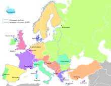
ED50 ("European Datum 1950", EPSG:4230) is a geodetic datum which was defined after World War II for the international connection of geodetic networks...
used as a vertical direction as a reference line, or plumb-line. It is a precursor to the spirit level and used to establish a verticaldatum. It is typically...
American Datum of 1983 (NAD 83) and the North American VerticalDatum of 1988 (NAVD 88) with a new geometric reference frame and geopotential datum. In association...
direction of the plumbline (vertical). These regional geodetic datums, such as ED 50 (European Datum 1950) or NAD 27 (North American Datum 1927), have ellipsoids...
points relative to a datum. It is widely used in geodesy and cartography to measure vertical position with respect to a verticaldatum, and in construction...
deflection of the vertical and geoid height data were used to determine local-to-geocentric datum shifts, datum rotation parameters, a datum scale parameter...
number of harmonics generated with better data. Deflection of the vertical Geodetic datum Geopotential International Terrestrial Reference Frame Physical...
reckoned from the surface of a reference ellipsoid, see Geodetic system, verticaldatum. In aviation terminology, the terms height, altitude, and elevation...
piezometric head is a specific measurement of liquid pressure above a verticaldatum. It is usually measured as a liquid surface elevation, expressed in...
The South American Datum (SAD) is a regional historical geodetic datum for South America. The most common version was established in 1969 (SAD69), as...
position reported in a modern datum usually cannot be misunderstood as using an old datum, and vice versa – provided the datums use different MGRS lettering...
square to the north of 49 is N40, etc. The grid is based on the OSGB36 datum (Ordnance Survey Great Britain 1936, based on the Airy 1830 ellipsoid),...
level is a measure of a location's vertical distance (height, elevation or altitude) in reference to a verticaldatum based on a historic mean sea level...
 Global Information