Geographical reference point from which various heights are measured
For other uses, see Sea level (disambiguation).
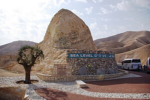
This marker indicating sea level is situated between Jerusalem and the Dead Sea.
Mean sea level (MSL, often shortened to sea level) is an average surface level of one or more among Earth's coastal bodies of water from which heights such as elevation may be measured. The global MSL is a type of vertical datum – a standardised geodetic datum – that is used, for example, as a chart datum in cartography and marine navigation, or, in aviation, as the standard sea level at which atmospheric pressure is measured to calibrate altitude and, consequently, aircraft flight levels. A common and relatively straightforward mean sea-level standard is instead a long-term average of tide gauge readings at a particular reference location.[1]
Sea levels can be affected by many factors and are known to have varied greatly over geological time scales. Current sea level rise is mainly caused by human-induced climate change.[2] When temperatures rise, mountain glaciers and polar ice sheets melt, increasing the amount of water in the oceans, while the existing seawater also expands with heat. Because most of human settlement and infrastructure was built in response to a more-normalized sea level with limited expected change, populations affected by sea level rise will need to invest in climate adaptation to mitigate the worst effects or, when populations are at extreme risk, a process of managed retreat.[3]
The term above sea level generally refers to above mean sea level (AMSL). The term APSL means above present sea level, comparing sea levels in the past with the level today.
Earth's radius at sea level is 6,378.137 km (3,963.191 mi) at the equator. It is 6,356.752 km (3,949.903 mi) at the poles and 6,371.001 km (3,958.756 mi) on average.[4] This flattened spheroid, combined with local gravity anomalies, defines the geoid of the Earth, which approximates the local mean sea level for locations in the open ocean. The geoid includes a significant depression in the Indian Ocean, whose surface dips as much as 106 m (348 ft) below the global mean sea level (excluding minor effects such as tides and currents).[5]
^What is "Mean Sea Level"? Liverpool, UK: National Oceanography Centre. Retrieved 29 January 2024.
^USGCRP (2017). "Climate Science Special Report. Chapter 12: Sea Level Rise. Key finding 1". science2017.globalchange.gov: 1–470. Archived from the original on 8 December 2019. Retrieved 27 December 2018.
^Nicholls, Robert J.; Marinova, Natasha; Lowe, Jason A.; Brown, Sally; Vellinga, Pier; Gusmão, Diogo de; Hinkel, Jochen; Tol, Richard S. J. (2011). "Sea-level rise and its possible impacts given a 'beyond 4°C (39.2°F)world' in the twenty-first century". Philosophical Transactions of the Royal Society of London A: Mathematical, Physical and Engineering Sciences. 369 (1934): 161–181. Bibcode:2011RSPTA.369..161N. doi:10.1098/rsta.2010.0291. ISSN 1364-503X. PMID 21115518. S2CID 8238425.
^"Earth Radius by Latitude Calculator". Archived from the original on 15 August 2021. Retrieved 22 August 2021.
^Sreejith, K.M.; Rajesh, S.; Majumdar, T.J.; Rao, G. Srinivasa; Radhakrishna, M.; Krishna, K.S.; Rajawat, A.S. (January 2013). "High-resolution residual geoid and gravity anomaly data of the northern Indian Ocean – An input to geological understanding". Journal of Asian Earth Sciences. 62: 616–626. Bibcode:2013JAESc..62..616S. doi:10.1016/j.jseaes.2012.11.010.
Mean sealevel (MSL, often shortened to sealevel) is an average surface level of one or more among Earth's coastal bodies of water from which heights...
Between 1901 and 2018, average global sealevel rose by 15–25 cm (6–10 in), an average of 1–2 mm (0.039–0.079 in) per year. This rate accelerated to 4...
roughly equivalent to the mean sea-level atmospheric pressure on Earth; that is, the Earth's atmospheric pressure at sealevel is approximately 1 atm. In...
Global or eustatic sealevel has fluctuated significantly over Earth's history. The main factors affecting sealevel are the amount and volume of available...
Sealevel drop refers to the phenomenon in which the shrinking weights of melting glaciers cause the surrounding land to rise and the relative sea level...
dictionary. The eustatic sealevel is the distance from the center of the Earth to the sea surface. An increase of the eustatic sealevel can be generated by...
This is a list of places on land below mean sealevel. Places artificially created such as tunnels, mines, basements, and dug holes, or places under water...
sealevel (RSL) is defined as the sealevel that is observed with respect to a land-based reference frame. It is often contrasted with eustatic sea level...
River. As of 2019, the lake's surface is 430.5 metres (1,412 ft) below sealevel, making its shores the lowest land-based elevation on Earth. It is 304 m...
A sea is a large body of salty water. There are particular seas and the sea. The sea commonly refers to the ocean, the wider body of seawater. Particular...
by sealevel rise. By 2050, 80% of the country could become uninhabitable due to global warming. According to the World Bank, with "future sealevels projected...
386,400 km2 (149,200 sq mi) and the surface is about 27 m (89 ft) below sealevel. Its main freshwater inflow, Europe's longest river, the Volga, enters...
The Mediterranean Sea (/ˌmɛdɪtəˈreɪniən/ MED-ih-tə-RAY-nee-ən) is a sea connected to the Atlantic Ocean, surrounded by the Mediterranean Basin and almost...
sealevel, and therefore is not necessarily the same as the aircraft's actual altitude, either above sealevel or above ground level. Flight levels are...
lake in the world (after the Dead Sea, a salt lake), at levels between 215 and 209 metres (705 and 686 ft) below sealevel. It is approximately 53 km (33 mi)...
Look up level, Level, leveled, levelled, or levels in Wiktionary, the free dictionary. Level or levels may refer to: Level (optical instrument), a device...
irrigation, the sea's water level above sealevel held steady at 53 m. By 2010 the large Aral was 27 m and the small Aral 43 m above sealevel. The disappearance...
But sea-level falls are very probably the result of other events, such as sustained global cooling or the sinking of the mid-ocean ridges. Sea-level falls...
The early Holocene sealevel rise (EHSLR) was a significant jump in sealevel by about 60 m (197 ft) during the early Holocene, between about 12,000 and...
of sealevel rise of 1.6–1.8 mm/yr over the twentieth century. The Intergovernmental Panel on Climate Change (IPCC) (1997) suggested that sealevel rise...
tourism. Marine coastal ecosystems can also provide protection against sealevel rise and tsunamis. In many countries, mangroves are the primary source...
 Global Information