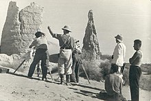
Example of a surveying expedition in the 20th Century similar to those undertaken to complete the Australian Height Datum.
General information
Unit system
metric
Unit of
height
Date Established
July 1971
Reference Network
The Australian National Levelling Network
The Australian Height Datum was introduced in 1971 as the official vertical datum for Australia, and thereby serves as the benchmark to which all height measurements are referred. The Australian Height Datum is an amalgamation of decades of spirit levelling work conducted by numerous state and territory authorities across the country, and was corrected to align with the mean sea level observations of thirty tide gauges positioned around the entire coastline.[1][2] While it remains the published vertical datum for all surveying and engineering operations performed throughout Australia, newer technologies have uncovered numerous deficiencies, offsets and distortions within the Australian Height Datum, leading to discussions about defining a new Australian vertical datum.[2][3]
An old tide gauge positioned at Fort Denison, Sydney, Australia
^Geoscience Australia (2014). "Australian Height Datum". www.ga.gov.au. Retrieved 21 September 2020.
^ abFilmer, M. S.; Featherstone, W. E. (2012). "Three viable options for a new Australian vertical datum". Journal of Spatial Science. 57 (1): 19–36. Bibcode:2012JSpSc..57...19F. doi:10.1080/14498596.2012.679248. hdl:20.500.11937/20186. ISSN 1449-8596. S2CID 56168131.
^Featherstone, W. E. (2006). "Yet more evidence for a North-South slope in the Australian Height Datum". Journal of Spatial Science. 51 (2): 1–6. Bibcode:2006JSpSc..51....1F. doi:10.1080/14498596.2006.9635076. hdl:20.500.11937/39721. ISSN 1449-8596. S2CID 53571234.
and 23 Related for: Australian Height Datum information
AustralianHeightDatum was introduced in 1971 as the official vertical datum for Australia, and thereby serves as the benchmark to which all height measurements...
The choice of which layer to use for defining height is arbitrary. Australia: AustralianHeightDatum Austria, Albania and former Yugoslavian republics:...
Hydrographic Office and the Australian Hydrographic Service, use the LAT to define chart datums. One advantage of using LAT for chart datums is that all predicted...
geodetic datum or geodetic system (also: geodetic reference datum, geodetic reference system, or geodetic reference frame) is a global datum reference...
England, station code Audio High Density, a digital disc format AustralianHeightDatum Analog High Definition, a standard for transmitting high-definition...
The bridge is prone to flooding, being only 257.6 metres on the AustralianHeightDatum and lower than the 1-in-10-year recurrence interval flood level...
indicate where the "zero level" or "reference altitude" – the vertical datum – is located. A pilot flying an aircraft under instrument flight rules (typically...
referenced to the same geodetic datum. A geographic coordinate transformation is a translation among different geodetic datums. Both geographic coordinate...
the large geodetic systems, such as European Datum (ED50), North American Datum (NAD), and Tokyo Datum (TD), to provide a worldwide geo-data basis Need...
knowledge. For example, the entry in a database specifying the height of Mount Everest is a datum that communicates a precisely-measured value. This measurement...
Mercator Grid) and the AustralianHeightDatum 1971(AHD71)for all mapping of Australia and Papua New Guinea. The local datum AGD/AMG66 was used for surveying...
conventional) coordinate values for one or more datum points. In the case of height data, it suffices to choose one datum point — the reference benchmark, typically...
the IUGG held in Moscow. It is used in Australia for the Australian Geodetic Datum and in the South American Datum 1969. The GRS-80 (Geodetic Reference...
at the Albert River Heads. This level is about 8 metres above AustralianHeightDatum. Seven people of the population of 138 died in the cyclone. Burketown...
three-dimensional space. It is frequently used in geodesy to produce datum transformations between datums. The Helmert transformation is also called a seven-parameter...
Displacement is a result of varying topographic relief within a covered area. A datum plane, which refers to the average sea level, is essential in the displacement...
periods shorter than minutes. These data are compared to the reference (or datum) level usually called mean sea level. While tides are usually the largest...
changing the datum from the wing leading edge to the engine firewall. CASA indicated that the amended weight and balance limits and new datum adequately...
dehydrogenase, an enzyme Royal Darwin Hospital, Northern Territory, Australia Reference datumheight, an aviation metric Radiotron Designer's Handbook, a famous...
Seamount is often cited as an example of limitations in the vertical geodetic datum accuracy of some offshore areas as represented on nautical charts, especially...
that the Earth is flat and measure from an arbitrary point, known as a 'datum' (singular form of data). The coordinate system allows easy calculation...
datum TVDKB – true vertical depth (referenced to) top kelly bushing zero datum TVDSS – true vertical depth (referenced to) mean sea level zero datum TVELD...
 Global Information