American Earth-observing satellite launched in 1984 as part of the Landsat program
Landsat 5
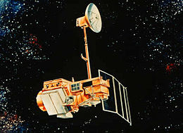
Artist's rendering of Landsat 5.
Mission type
Earth imaging
Operator
NASA / NOAA
COSPAR ID
1984-021A
SATCAT no.
14780
Mission duration
29 years, 3 months and 4 days
Spacecraft properties
Bus
Multimission Modular Spacecraft
Manufacturer
Fairchild Industries
Launch mass
1,938 kilograms (4,273 lb)
Dry mass
1,407 kilograms (3,102 lb)
Start of mission
Launch date
1 March 1984 (1984-03)
Rocket
Delta 3920
Launch site
Vandenberg SLC-2W
End of mission
Disposal
Placed in graveyard orbit
Deactivated
5 June 2013 (2013-06-06)
Orbital parameters
Reference system
Geocentric
Regime
Sun-synchronous
Perigee altitude
694 kilometers (431 mi)
Apogee altitude
701 kilometers (436 mi)
Inclination
98.2 degrees
Period
98.72 minutes
Repeat interval
16 days
Epoch
1 April 1984[1]
Landsat 5 was a low Earth orbit satellite launched on March 1, 1984, to collect imagery of the surface of Earth. A continuation of the Landsat Program, Landsat 5 was jointly managed by the U.S. Geological Survey (USGS) and the National Aeronautics and Space Administration (NASA). Data from Landsat 5 was collected and distributed from the USGS's Center for Earth Resources Observation and Science (EROS).
After 29 years in space, Landsat 5 was officially decommissioned on June 5, 2013.[2] Near the end of its mission, Landsat 5's use was hampered by equipment failures, and it was largely superseded by Landsat 7 and Landsat 8.[2] Mission scientists anticipated the satellite will re-enter Earth's atmosphere and disintegrate around 2034.[2]
Recognized by Guinness World Records as the longest-operating Earth-observing satellite mission in history, Landsat 5 orbited the planet more than 150,000 times while transmitting more than 2.5 million images of land surface conditions around the world, greatly outliving its original three-year design life.[3]
^McDowell, Jonathan. "Satellite Catalog". Jonathan's Space Page. Retrieved 16 June 2013.
^ abcHistoric Landsat 5 Mission Ends
^"Historic Landsat 5 Mission Ends". NASA. June 24, 2013. Retrieved March 8, 2018.
Landsat5 was a low Earth orbit satellite launched on March 1, 1984, to collect imagery of the surface of Earth. A continuation of the Landsat Program...
eventually renamed to Landsat 1 in 1975. The most recent, Landsat 9, was launched on 27 September 2021. The instruments on the Landsat satellites have acquired...
Landsat 7 is the seventh satellite of the Landsat program. Launched on 15 April 1999, Landsat 7's primary goal is to refresh the global archive of satellite...
officially renamed to Landsat 8. With Landsat5 retiring in early 2013, leaving Landsat 7 as the only on-orbit Landsat program satellite, Landsat 8 ensures the...
Landsat 6, equipped with upgraded versions of the instruments on Landsat5, was designed to carry forward the Landsat program. It was launched on October...
Landsat 9 is an Earth observation satellite launched on 27 September 2021 from Space Launch Complex-3E at Vandenberg Space Force Base on an Atlas V 401...
NASA during the Landsat program. Landsat 4 was the first Landsat to be operated by NOAA. The second generation of Landsat, Landsat 4 and 5, flew in lower...
Landsat 3 is the third satellite of the Landsat program. It was launched on March 5, 1978, with the primary goal of providing a global archive of satellite...
evaporating the ephemeral lake. The pair of images (seen at right) from NASA's Landsat5 satellite documents the short history of Death Valley's Lake Badwater:...
Landsat 1 (LS-1), formerly named ERTS-A and ERTS-1, was the first satellite of the United States' Landsat program. It was a modified version of the Nimbus...
Landsat5, thermal infrared imagery was also collected (at coarser spatial resolution than the optical data). The Landsat 7, Landsat 8, and Landsat 9...
during the 1993 Perseid meteor shower. A similar event occurred with the Landsat5 spacecraft during the 2009 Perseid meteor shower. Spacecraft electrostatic...
with a below-neutral pH of less than 6.5. A lake is considered to be highly acidic if its pH drops below 5.5, leading to biological consequences. Such...
этноконфессиональный аспект. Граница. ISBN 978-5-94691-100-9. Archived from the original on 17 October 2020. Retrieved 5 February 2019. Sharifov, Azad. "Legend...
had a square citadel built around the 5th to 3rd centuries BC, some 8 km (5.0 mi) south of the Syr Darya River. By the 7th century AD, Chach had more...
launching a series of Landsat satellites in the decade. Some of the first included passive microwave imaging in 1972 through the Nimbus 5 satellite. Following...
Land Cover Dynamics in the Yellow River Delta from 1995 to 2010 based on Landsat5 TM". Applied Geography. 44: 53–68. doi:10.1016/j.apgeog.2013.07.003. The...
12 June 1998. By comparing images collected on those dates from NASA's Landsat-5 satellite, the desert area where Marree Man was found goes from undisturbed...
Lake Tharthar Landsat5 (1990) Lake Tharthar Location of Tharthar lake Location Al Anbar Province Coordinates 33°58′N 43°11′E / 33.967°N 43.183°E /...
The Thematic Mapper (TM) sensor on Landsat 4 and Landsat5 included a thermal (6th) band. Landsat 8 and Landsat-9 also acquires thermal data in two 10...
the loss of water due to evaporation, the groundwater, never deeper than 1.5 m, flows seawards and is recharged by continental waters, rainstorms, and...
trips from Dalian to Shenyang can be completed in 1.5 hours, to Changchun 2.5 hours and to Harbin 3.5 hours. The city has two major railway stations, namely...
1991 Landsat5 for NASA/USGS- launched in 1984 (the satellite holds Guinness World Record for longest operating earth observing satellite) Landsat 4 for...
Landsat 2 is the second satellite of the Landsat program. The spacecraft originally carried a designation of ERTS-B (Earth Resource Technology Satellite...
 Global Information