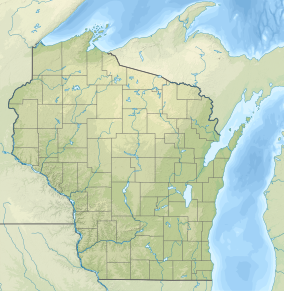
Wind Pudding Lake State Natural Area is a Wisconsin Department of Natural Resources-designated State Natural Area featuring the 180-acre Wind Pudding Lake, its associated wetlands, and some of its surrounding uplands. The lake is noteworthy for its separate basins, each having distinctive characteristics. The eastern basin is the deepest, at 35 feet (11 m), and has a primarily sand/gravel bottom. This basin contains a well-developed population of sterile-rosette aquatic vegetation, with several species considered either rare, or with a restricted range within the State of Wisconsin, such as the plantain shoreweed (Littorella uniflora). The central and western basins are much shallower and muck-bottomed, with extensive areas covered by a mat of floating peat, which supports a dense growth of aquatic vegetation, including sundew (Drosera intermedia), purple bladderwort (Utricularia purpurea), yellow-eyed grass (Xyris montana), and the rare Robbin's spike-rush (Eleocharis robbinsii). \The western basin does have some development, with several houses, while the rest of the lake is undeveloped.[1][2][3]
^Wisconsin Department of Natural Resources. "Biotic Inventory and Analysis of the Northern-Highland American Legion State Forest" (PDF).
^Wisconsin Department of Natural Resources. "Wind Pudding Lake State Natural Area". Retrieved 2013-11-30.
^Wisconsin Department of Natural Resources. "Wind Pudding Lake". Retrieved 2013-11-30.
and 24 Related for: Wind Pudding Lake State Natural Area information
Adjacent to the Cylon Wildlife area, the Cylon StateNaturalArea is a 207 acres (84 ha) collection of four separate areas featuring woodlands and sedge...
Durst Rockshelter StateNaturalArea is a privately owned statenaturalarea located roughly 1 mile (1.6 km) north of Leland, Wisconsin. The property encompasses...
Wisconsin state park is an area of land in the U.S. state of Wisconsin preserved by the state for its natural, historic, or other resources. The state park...
the wind, the water of Mirror Lake is usually calm and often as glassy-smooth as a mirror, hence the name. Situated in a major tourist area, the state park...
Wildlife Area is a 1,968-acre (7.96 km2) tract of protected land located in Washburn County, Wisconsin, managed by the Wisconsin Department of Natural Resources...
and peat accumulated in the former lake's basin, the Horicon Marsh was formed. The Horicon Marsh State Wildlife Area is one of nine units of the Ice Age...
County, Wisconsin, Gibraltar Rock StateNaturalArea is 68 acres (28 ha) in size. The Wisconsin River Valley and Lake Wisconsin are located within view...
Blomberg Lake and Woods StateNaturalArea is a Wisconsin Department of Natural Resources-designated StateNaturalArea made up of 966 acres (391 ha) of...
Chippewa Moraine Lakes is a Wisconsin Department of Natural Resources-designated StateNaturalArea that comprises nine separate sites, spread out over...
turtles, salamanders, and snakes. Whitefish Dunes StateNaturalArea, a 230-acre (93 ha) area within the state park, protects rare species of plants such as...
Kangaroo LakeStateNaturalArea is a nature sanctuary in Door County, Wisconsin, United States, located on and around Kangaroo Lake. The land was designated...
south, Lake Michigan to the east, Michigan to the northeast, and Lake Superior to the north. Wisconsin is the 25th-largest state by land area and the...
related to Kettle Moraine State Forest. Wisconsin Department of Natural Resources Northern Unit Southern Unit Pike Lake Unit Loew Lake Unit Lapham Peak Unit...
Spread Eagle Barrens StateNaturalArea is a 7,155-acre (2,896 ha) protected area just off of U.S. 2 in Florence County, Wisconsin, USA. The nearest unincorporated...
including Dartmoor, the Lake District, the Pennines, and the Shropshire Hills. The country's capital is London, the metropolitan area of which has a population...
Grandma Lake Wetlands StateNaturalArea is a Wisconsin Department of Natural Resources-designated StateNaturalArea featuring the undeveloped, pristine...
Lithuanian cuisine, introducing pork and potato dishes, such as potato pudding (kugelis or kugel) and potato sausages (vėdarai), as well as the baroque...
River is owned by the Wisconsin Department of Natural Resources. It was established as a StateNaturalArea in 1994. The Dells was formed during the Last...
is a Wisconsin Department of Natural Resources-designated StateNaturalArea located within Horicon State Wildlife Area. It features a narrow, forested...
Wildlife Area is a tract of protected land located on the border of Illinois in Rock County, Wisconsin, managed by the Wisconsin Department of Natural Resources...
 Global Information