Global Information Lookup Global Information

Spread Eagle Barrens State Natural Area information


Spread Eagle Barrens State Natural Area
Map showing the location of Spread Eagle Barrens State Natural Area
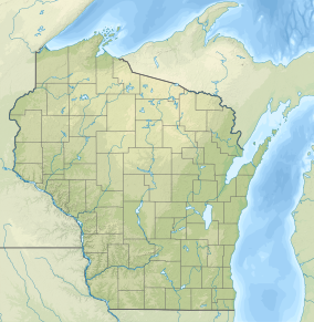
Location of Spread Eagle Barrens State Natural Area in Wisconsin
Map showing the location of Spread Eagle Barrens State Natural Area
Spread Eagle Barrens State Natural Area (the United States)
LocationFlorence, Wisconsin, United States
Coordinates45°51′49″N 88°59′38″W / 45.86361°N 88.99389°W / 45.86361; -88.99389
Area7,155 acres (28.96 km2)
Elevation1,122 ft (342 m)[1]
Established1995
Governing bodyWisconsin Department of Natural Resources

Spread Eagle Barrens State Natural Area is a 7,155-acre (2,896 ha) protected area just off of U.S. 2 in Florence County, Wisconsin, USA. The nearest unincorporated community is Spread Eagle, Wisconsin, but the closest large city is Iron Mountain, Michigan; 6 miles (10 km) away. The Spread Eagle Barrens is owned by the Wisconsin Department of Natural Resources and the Wisconsin Energy Corporation, and was designated a State Natural Area in 1995.[2]

In February 1993, the Natural Resources Board approved the creation of an 8,500-acre (3,400 ha) Spread Eagle Barrens State Natural Area. In August 1995, the Board approved the first purchase of land for the new natural area: 3,900 acres (1,600 ha) acres from Florence County at a cost of $1,400,000. Governor Tommy Thompson authorized the purchase in September 1995.[3]

Despite the barrens name, many plants and animals call Spread Eagle home. The large grasslands and barrens are dominated by scattered jack pine, red pine, scrub oak,[4] and quaking aspen trees. The open landscape is maintained by timber harvesting and controlled burns. Some of the birds that live in the area are: northern harrier, upland sandpiper, northern raven, winter wren, eastern bluebird, warbling vireo, Nashville, chestnut-sided, pine, and mourning warblers, clay-colored sparrow, common nighthawk, eastern towhee, and Brewer's blackbird. Black bears, fishers, badgers, coyotes, red foxes, and white-tailed deer are some of the animals that roam the area. There are two rivers that run through the barrens: the Pine River and the Menominee River.[2]

  1. ^ "Spread Eagle Barrens State Natural Area". Geographic Names Information System. United States Geological Survey. 1999-09-30. Retrieved 2011-03-18.
  2. ^ a b Wisconsin Department of Natural Resources (2010-10-19). "Spread Eagle Barrens State Natural Area".
  3. ^ Crehore, Dave (April 1997). "A sense of space: Spread Eagle Barrens preserves a place with a long view over rolling, open country". Wisconsin Natural Resources Magazine. Madison, Wis.: Wisconsin Department of Natural Resources.
  4. ^ Scrub oaks may be Quercus dumosa, dwarf Chinkapin oak (Quercus prinoides), or simply undernourished black oak (Quercus velutina), white oak (Quercus alba), northern pin oak (Quercus ellipsoidalis), or bur oak (Quercus macrocarpa). Less common but possible is bear oak (Quercus ilicifolia).

and 21 Related for: Spread Eagle Barrens State Natural Area information

Request time (Page generated in 1.1587 seconds.)

Spread Eagle Barrens State Natural Area

Last Update:

Spread Eagle Barrens State Natural Area is a 7,155-acre (2,896 ha) protected area just off of U.S. 2 in Florence County, Wisconsin, USA. The nearest unincorporated...

Word Count : 366

Dunnville Barrens State Natural Area

Last Update:

Dunnville Barrens is a Wisconsin Department of Natural Resources-designated State Natural Area featuring a jack pine barrens plant community on a wide...

Word Count : 254

List of pine barrens

Last Update:

Barrens Moquah Barrens Research Natural Area Northwest Wisconsin Pine Barrens Gotham Jack Pine Barrens Spread Eagle Barrens Virginia Zuni Pine Barrens...

Word Count : 111

Moquah Barrens Research Natural Area

Last Update:

northwest corner of the natural area. "Moquah Barrens Research Natural Area". National Park Service. Retrieved 2012-01-19. "Moquah Barrens (No. 83)". Wisconsin...

Word Count : 90

Cylon Wildlife Area

Last Update:

Adjacent to the Cylon Wildlife area, the Cylon State Natural Area is a 207 acres (84 ha) collection of four separate areas featuring woodlands and sedge...

Word Count : 285

Beaver Brook Wildlife Area

Last Update:

Wildlife Area is a 1,968-acre (7.96 km2) tract of protected land located in Washburn County, Wisconsin, managed by the Wisconsin Department of Natural Resources...

Word Count : 519

Kettle Moraine State Forest

Last Update:

State Forest is a state forest in southeastern Wisconsin. The chief feature of the reserve is the Kettle Moraine, a highly glaciated area. The area contains...

Word Count : 598

Durst Rockshelter State Natural Area

Last Update:

Durst Rockshelter State Natural Area is a privately owned state natural area located roughly 1 mile (1.6 km) north of Leland, Wisconsin. The property encompasses...

Word Count : 160

List of Wisconsin state parks

Last Update:

Wisconsin state park is an area of land in the U.S. state of Wisconsin preserved by the state for its natural, historic, or other resources. The state park...

Word Count : 1668

Buckhorn State Park

Last Update:

Yellow Rivers. Sign Sandy area Buckhorn Barrens, a State Natural Area Office Adi (January 23, 2023). "Exploring Buckhorn State Park: A 2023 Guide (Hiking...

Word Count : 85

Pinelands National Reserve

Last Update:

Jersey Pine Barrens. The Pinelands is a unique location of historic villages and berry farms amid the vast oak-pine forests (pine barrens), extensive...

Word Count : 2040

Twin Lakes Bog State Natural Area

Last Update:

Twin Lakes Bog State Natural Area is a Wisconsin Department of Natural Resources-designated State Natural Area featuring an intact tamarack (Larix laricina)...

Word Count : 299

South Jersey

Last Update:

the Pine Barrens, which remains largely undisturbed despite its location within the Northeastern megalopolis. The South Jersey Pine Barrens are the largest...

Word Count : 4684

Tuscarora State Forest

Last Update:

Forest Picnic Area Colonel Denning State Park Fowlers Hollow State Park Little Buffalo State Park Bald Eagle State Forest (north) Weiser State Forest (east)...

Word Count : 833

Brule Glacial Spillway State Natural Area

Last Update:

Brule Glacial Spillway is a Wisconsin Department of Natural Resources-designated State Natural Area that encompasses the valley of the upper reaches of...

Word Count : 567

Bayshore Blufflands State Natural Area

Last Update:

Bayshore Blufflands State Natural Area is a Wisconsin Department of Natural Resources-designated State Natural Area of significant note for its grand...

Word Count : 475

Dells of the Wisconsin River

Last Update:

River is owned by the Wisconsin Department of Natural Resources. It was established as a State Natural Area in 1994. The Dells was formed during the Last...

Word Count : 800

Two Creeks Buried Forest State Natural Area

Last Update:

Two Creeks Buried Forest State Natural Area is a site in the Wisconsin State Natural Areas Program and a unit of the Ice Age National Scientific Reserve...

Word Count : 678

Great Smoky Mountains National Park

Last Update:

Gatlinburg. Their children and grandchildren spread out southward into the Sugarlands and Roaring Fork areas. Cades Cove was settled largely by families...

Word Count : 13547

Wind Pudding Lake State Natural Area

Last Update:

Wind Pudding Lake State Natural Area is a Wisconsin Department of Natural Resources-designated State Natural Area featuring the 180-acre Wind Pudding...

Word Count : 355

Pawnee National Grassland

Last Update:

species use rhizomes to spread, often following small fractures in the clays. Other plants associated with the clay barrens are; phlox, Indian rice grass...

Word Count : 1609

PDF Search Engine © AllGlobal.net