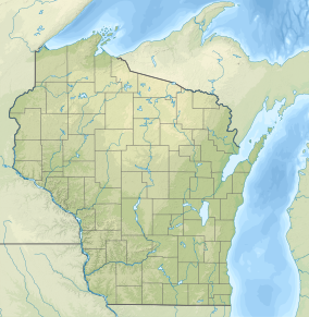
Durst Rockshelter State Natural Area is a privately owned state natural area located roughly 1 mile (1.6 km) north of Leland, Wisconsin. The property encompasses a rock shelter inhabited by pre-Columbian Native Americans. Archaeological excavations at the rock shelter have uncovered projectile points and ceramic artifacts. The oldest artifacts date to the Archaic period from roughly 4000 to 3500 B.C., though the site was inhabited by multiple cultural groups across several periods of development. The rockshelter is surrounded by a mesic forest split by a sandstone ridge.[2]
The property is listed on the National Register of Historic Places as the Durst-Bloedau Site. It is owned by The Nature Conservancy and public access is restricted without permission.[2]
^"National Register Information System". National Register of Historic Places. National Park Service. November 2, 2013.
^ ab"Durst Rockshelter (No. 44". Wisconsin Department of Natural Resources. Retrieved April 27, 2023.
and 23 Related for: Durst Rockshelter State Natural Area information
DurstRockshelterStateNaturalArea is a privately owned statenaturalarea located roughly 1 mile (1.6 km) north of Leland, Wisconsin. The property encompasses...
Adjacent to the Cylon Wildlife area, the Cylon StateNaturalArea is a 207 acres (84 ha) collection of four separate areas featuring woodlands and sedge...
Wildlife Area is a 1,968-acre (7.96 km2) tract of protected land located in Washburn County, Wisconsin, managed by the Wisconsin Department of Natural Resources...
Mounds at High Cliff State Park, the Seth Peterson Cottage in Mirror Lake State Park, the Raddatz Rockshelter at Natural Bridge State Park, Stonefield partially...
Gibraltar Rock StateNaturalArea is a naturalarea in southern Wisconsin, United States, which is 68 acres (28 ha) in size, and is located along the 1...
Two Creeks Buried Forest StateNaturalArea is a site in the Wisconsin StateNaturalAreas Program and a unit of the Ice Age National Scientific Reserve...
Richard Bong State Recreation Area is a 4,515-acre (1,827 ha) unit of the state park system of the U.S. state of Wisconsin. It is located in the town of...
Spread Eagle Barrens StateNaturalArea is a 7,155-acre (2,896 ha) protected area just off of U.S. 2 in Florence County, Wisconsin, USA. The nearest unincorporated...
Wildlife Area is a tract of protected land located on the border of Illinois in Rock County, Wisconsin, managed by the Wisconsin Department of Natural Resources...
Brule Glacial Spillway is a Wisconsin Department of Natural Resources-designated StateNaturalArea that encompasses the valley of the upper reaches of...
Kangaroo Lake StateNaturalArea is a nature sanctuary in Door County, Wisconsin, United States, located on and around Kangaroo Lake. The land was designated...
Rice Creek is a Wisconsin Department of Natural Resources-designated StateNaturalArea that features a large, high-quality wetland complex of conifer...
of Natural Resources-designated StateNaturalArea featuring a jack pine barrens plant community on a wide, sandy Chippewa River terrace. Open areas in...
Grandma Lake Wetlands StateNaturalArea is a Wisconsin Department of Natural Resources-designated StateNaturalArea featuring the undeveloped, pristine...
Twin Lakes Bog StateNaturalArea is a Wisconsin Department of Natural Resources-designated StateNaturalArea featuring an intact tamarack (Larix laricina)...
Black Tern Bog StateNaturalArea is a Wisconsin Department of Natural Resources-designated StateNaturalArea featuring 20 acres (8 ha) of quaking sphagnum...
Natural Resources-designated StateNaturalArea featuring one of the few remaining dry-mesic prairies in Wisconsin, situated on a low Driftless Area knob...
picnic area with natural history exhibits. Naturalists offer programs in the summer. The Military Ridge State Trail, which follows the natural east-west...
Chippewa Moraine Lakes is a Wisconsin Department of Natural Resources-designated StateNaturalArea that comprises nine separate sites, spread out over...
 Global Information