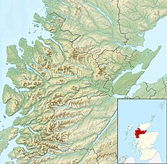
The River Meig (Scottish Gaelic: Mìg) is a river in Easter Ross. It draws its source from the meeting of several allts in the forested hills north of Loch Monar, before flowing northeast through Loch Beannacharain and Loch Meig, before joining the River Conon at the small settlement of Little Scatwell, 2 km south of Loch Luichart.[1]
The name of the river derives from an Old Gaelic root, minc, with cognates in Latin, Old Welsh, and Old English. It roughly translates to "pouring forth".[2]
Meig Dam was constructed on the River Meig in the 1957 as part of a series of post-war infrastructure projects led by the North of Scotland Hydro-Electric Board (NoSHEB). This led to the formation of a reservoir named after the river, Loch Meig.[3]
North of the river near the settlement of Scardroy is a memorial cairn from the late-20th century dedicated to a 'Colin Grant Sangster, 1930–1994'.[4]
Downstream of Loch Meig is Meig Gorge (Am Mòr-Ghil Mhìg), a popular location for local kayakers. The gorge is best kayaked in dry weather thanks to compensation flow from the nearby dam; it is potentially too dangerous after heavy rainfall. The main drop in the gorge is colloquially known as "Tea Cup Falls".[5]
^"River Meig from The Gazetteer for Scotland". www.scottish-places.info. Retrieved 14 January 2024.
^"Contin Parish Place Names ⋆ Ross and Cromarty Heritage". Ross and Cromarty Heritage. Retrieved 14 January 2024.
^"Conon Fishing | Loch Meig". www.cononfishing.com. Retrieved 14 January 2024.
^"River Meig | Canmore". canmore.org.uk. Retrieved 14 January 2024.
^kayakscotland.ruralaccent.com http://kayakscotland.ruralaccent.com/2010/09/the-meig-gorge/. Retrieved 14 January 2024. {{cite web}}: Missing or empty |title= (help)
The RiverMeig (Scottish Gaelic: Mìg) is a river in Easter Ross. It draws its source from the meeting of several allts in the forested hills north of Loch...
Loch Meig (Scottish Gaelic: Loch Mìg) is a freshwater loch in Easter Ross, Scotland, 8.1 kilometres (5.0 mi) west of Contin. Situated on the RiverMeig, the...
joined by the RiverMeig at Scatwell before passing through Loch Achonachie. It is joined by the Black Water at Moy Bridge, and the River Orrin at Urray...
Conon catchment River Conon River Orrin (R) Allt Goibhre (R) Black Water (L) RiverMeig (R) Simple coastal catchments River Peffery River Sgitheach Allt...
of Loch Beannacharain, near where the Allt Gleann Chorainn joins the RiverMeig. Inverchoran is 40 km west of the city of Inverness. The village of Achnasheen...
Meigs Creek may refer to the following streams in the United States: Meigs Creek (Muskingum River tributary), in Ohio Meigs Creek, Meigs Mountain Trail...
Fort Meigs was a United States fortification along the Maumee River in what is now Perrysburg, Ohio during the War of 1812. The British Army, supported...
Tennessee River a few miles west of what is now State Route 58 in Meigs County, Tennessee. The river is about 147 miles (237 km) long. The river is dammed...
The River Maigue (/ˈmeɪɡ/ Irish: An Mháigh, meaning 'river of the plain') rises in the Milford area of north County Cork, Ireland. The River Maigue is...
The siege of Fort Meigs took place in late April to early May 1813 during the War of 1812 in northwestern Ohio, present-day Perrysburg. A small British...
river and downstream of Defiance, in the 1807 Treaty of Detroit. They ceded the remainder of the Maumee River valley in the 1817 Treaty of Fort Meigs...
Cornelia Lynde Meigs (1884–1973) was an American writer of fiction and biography for children, teacher of English and writing, historian and critic of...
R. Meade Democratic 5th March 4, 1875 – March 3, 1877 Manhattan ? Henry Meigs Democratic-Republican 2nd March 4, 1819 – March 3, 1821 Manhattan ? Gregory...
(758 km) making the lake 58.9 miles (94.8 km) long. It borders Rhea County, Meigs County, and Hamilton County with 810 miles (1,303 km) of shoreline and two...
east branch shortly thereafter: The West Branch Shade River rises in Scipio Township in Meigs County, at an elevation of 853 feet (260 m), and flows...
the St. Georges Creek Skirmish, was an American Civil War engagement in Meigs County, Ohio, and Jackson County, West Virginia, on July 19, 1863, during...
(secondary coordinates) Watts Bar Lake is a reservoir on the Tennessee River created by Watts Bar Dam as part of the Tennessee Valley Authority system...
on the Tennessee River in Meigs and Rhea counties in Tennessee, United States. The dam is one of nine dams on the main Tennessee River channel operated...
 Global Information