 Global Information
Maryland information
Maryland | |
|---|---|
State | |
| State of Maryland | |
 Flag  Seal | |
| Nicknames: "Old Line State", "Free State", "Little America",[1] "America in Miniature"[2] | |
Mottoes:
| |
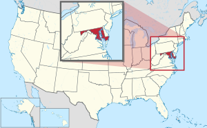 Map of the United States with Maryland highlighted | |
| Country | United States |
| Before statehood | Province of Maryland |
| Admitted to the Union | April 28, 1788 (7th) |
| Capital | Annapolis |
| Largest city | Baltimore |
| Largest county or equivalent | Montgomery |
| Largest metro and urban areas |
|
| Government | |
| • Governor | Wes Moore (D) |
| • Lieutenant Governor | Aruna Miller (D) |
| Legislature | General Assembly |
| • Upper house | Senate |
| • Lower house | House of Delegates |
| Judiciary | Supreme Court of Maryland |
| U.S. senators |
|
| U.S. House delegation |
|
| Area | |
| • Total | 12,407 sq mi (32,133 km2) |
| • Land | 9,776 sq mi (25,314 km2) |
| • Water | 2,633 sq mi (6,819 km2) 21% |
| • Rank | 42nd |
| Dimensions | |
| • Length | 250 mi (400 km) |
| • Width | 100 mi (200 km) |
| Elevation | 350 ft (110 m) |
| Highest elevation (Hoye-Crest[5][a]) | 3,360 ft (1,024 m) |
| Lowest elevation (Atlantic Ocean[5]) | 0 ft (0 m) |
| Population (2020[6]) | |
| • Total | 6,177,224 |
| • Rank | 18th |
| • Density | 632/sq mi (244/km2) |
| • Rank | 5th |
| • Median household income | $87,063 |
| • Income rank | 1st |
| Demonym | Marylander |
| Language | |
| • Official language | None (English, de facto) |
| Time zone | UTC−05:00 (Eastern) |
| • Summer (DST) | UTC−04:00 (EDT) |
| USPS abbreviation | MD |
| ISO 3166 code | US-MD |
| Traditional abbreviation | Md. |
| Latitude | 37° 53′ N to 39° 43′ N |
| Longitude | 75° 03′ W to 79° 29′ W |
| Website | maryland |
| List of state symbols | |
|---|---|
 Flag of Maryland | |
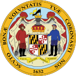 Seal of Maryland | |
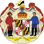 Coat of arms of Maryland | |
| Song | None. Formerly: "Maryland, My Maryland" by James Ryder Randall (1861), (adopted 1939, repealed 2021) |
| Living insignia | |
| Bird | Baltimore oriole |
| Cat breed | Calico cat |
| Crustacean | Blue crab |
| Dog breed | Chesapeake Bay Retriever |
| Fish | Rock fish |
| Flower | Black-eyed Susan |
| Horse breed | Thoroughbred |
| Insect | Baltimore checkerspot butterfly |
| Reptile | Diamondback terrapin |
| Tree | White oak |
| Inanimate insignia | |
| Beverage | Milk |
| Dance | Square dance |
| Dinosaur | Astrodon johnstoni |
| Food | Smith Island cake |
| Fossil | Ecphora gardnerae gardnerae |
| Gemstone | Patuxent River stone |
| Ship | Skipjack |
| Sport |
|
| State route marker | |
 | |
| State quarter | |
 Released in 2000 | |
| Lists of United States state symbols | |
Maryland (US: /ˈmɛrɪlənd/ ⓘ MERR-il-ənd)[b] is a state in the Mid-Atlantic region of the United States.[8][9] The state borders Virginia to its south, West Virginia to its west, Pennsylvania to its north, Delaware to its east, the Atlantic Ocean, and the national capital of Washington, D.C. With a total area of 12,407 square miles (32,130 km2), Maryland is the ninth-smallest state by land area,[10] and its population of 6,177,224 ranks it the 18th-most populous state and the fifth-most densely populated. Maryland's capital is Annapolis, and the most populous city is Baltimore.[11] Occasional nicknames include Old Line State, the Free State, and the Chesapeake Bay State. It is named after Henrietta Maria, the French-born queen of England, Scotland, and Ireland during the 17th century.[12][13]
The western portion of the state contains numerous stretches of the Appalachian Mountains, the central portion is primarily composed of the Piedmont, and the eastern side of the state makes up a significant portion of Chesapeake Bay.
Maryland's coastline was first explored by Europeans in the 16th century. Prior to that, it was inhabited by several Native American tribes, mostly the Algonquian peoples and, to a lesser degree, Iroquoians and Siouans.[14] As one of the original Thirteen Colonies of England, Maryland was founded by George Calvert, 1st Baron Baltimore, a Catholic convert[15][16] who sought to provide a religious haven for Catholics persecuted in England.[17] In 1632, Charles I of England granted Lord Baltimore a colonial charter, naming the colony after his wife, Henrietta Maria.[18] Unlike the Pilgrims and Puritans, who rejected Catholicism in their settlements, Lord Baltimore envisioned a colony where people of different religious sects would coexist under the principle of toleration.[17]
In 1649, the Maryland General Assembly passed an Act Concerning Religion, which enshrined this principle by penalizing anyone who "reproached" a fellow Marylander based on religious affiliation.[19] Nevertheless, religious strife was common in the early years, and Catholics remained a minority, albeit in greater numbers than in any other English colony.
Maryland's early settlements and population centers clustered around rivers and other waterways that empty into the Chesapeake Bay. Its economy was heavily plantation-based and centered mostly on the cultivation of tobacco. Demand for cheap labor from Maryland colonists led to the importation of numerous indentured servants and enslaved Africans. In 1760, Maryland's current boundaries took form following the settlement of a long-running border dispute with Pennsylvania. Maryland was an active participant in the events leading up to the American Revolution, and by 1776, its delegates signed the Declaration of Independence. Many of its citizens subsequently played key political and military roles in the war. In 1790, the state ceded land for the establishment of the U.S. capital of Washington, D.C.
Although then a slave state, Maryland remained in the Union during the American Civil War, its strategic location giving it a significant role in the conflict. After the Civil War, Maryland took part in the Industrial Revolution, driven by its seaports, railroad networks, and mass immigration from Europe. Since the 1940s, the state's population has grown rapidly, to approximately six million residents, and it is among the most densely populated U.S. states. As of 2015[update], Maryland had the highest median household income of any state, owing in large part to its proximity to Washington, D.C., and a highly diversified economy spanning manufacturing, retail services, public administration, real estate, higher education, information technology, defense contracting, health care, and biotechnology.[20] Maryland is one of the most multicultural states in the country; it is one of the six states where non-Whites compose a majority of the population, with the fifth-highest percentage of African Americans, and high numbers of residents born in Africa, Asia, Central America, and the Caribbean. The state's central role in U.S. history is reflected by its hosting of some of the highest numbers of historic landmarks per capita.
Sixteen of Maryland's twenty-three counties, as well as the city of Baltimore, border the tidal waters of the Chesapeake Bay estuary and its many tributaries,[21][11] which combined total more than 4,000 miles of shoreline. Although one of the smallest states in the U.S., it features a variety of climates and topographical features that have earned it the moniker of America in Miniature.[22] In a similar vein, Maryland's geography, culture, and history combine elements of the Mid-Atlantic, Northeastern, and Southern regions of the country.
- ^ "Maryland's quality of life ranks high compared to other states". The Daily Record. July 1, 2021. Retrieved September 30, 2023.
- ^ "Maryland Facts". Maryland Office of Tourism. Archived from the original on June 13, 2010. Retrieved June 2, 2009.
- ^ "Senate Bill 88" (PDF). Archived from the original (PDF) on September 29, 2017.
- ^ "Great Seal of Maryland (reverse)". Maryland State Archives. Archived from the original on January 4, 2013. Retrieved March 4, 2014.
- ^ a b "Elevations and Distances in the United States". United States Geological Survey. 2001. Archived from the original on October 15, 2011. Retrieved October 21, 2011.
- ^ "QuickFacts: Maryland". United States Census Bureau. Retrieved April 3, 2022.
- ^ Wells, John C. (2008). Longman Pronunciation Dictionary (3rd ed.). Longman. ISBN 978-1-4058-8118-0.
- ^ "Mid-Atlantic Home : Mid–Atlantic Information Office". U.S. Bureau of Labor Statistics. Archived from the original on April 8, 2019. Retrieved July 27, 2017.
- ^ "United States Regions". National Geographic Society. January 3, 2012. Archived from the original on November 28, 2021. Retrieved November 19, 2021.
- ^ "Maryland - 2023 - III.B. Overview of the State". mchb.tvisdata.hrsa.gov. Retrieved January 3, 2024.
- ^ a b "Baltimore". Encyclopædia Britannica. June 18, 2023.
- ^ "Maryland's Name". Catholic History of Maryland. Simon & Schuster. Archived from the original on March 8, 2006. Retrieved July 20, 2012.
- ^ "Why Is It Named Maryland?". Ghosts of Baltimore. May 19, 2015. Archived from the original on February 20, 2018. Retrieved February 19, 2018.
- ^ "People, Tribes and Bands". Maryland Manual On-line: A Guide to Maryland and its Government. Maryland State Archives. Archived from the original on July 17, 2019. Retrieved August 25, 2019.
- ^ "George Calvert and Cecilius Calvert, Barons Baltimore" William Hand Browne, Nabu Press (August 1, 2010), ISBN 117662539X ISBN 978-1176625396
- ^ Krugler, John D. (2004). English and Catholic : the Lords Baltimore in the seventeenth century. Baltimore: Johns Hopkins University Press. ISBN 978-0801879630. OCLC 53967315.
- ^ a b Andrews, Matthew Page (1929). History of Maryland: Province and State. Garden City, New York: Doubleday, Doran & Company, Inc. pp. 3–5.
- ^ "The Charter of Maryland : 1632". avalon.law.yale.edu. December 18, 1998. Archived from the original on March 25, 2015. Retrieved May 2, 2018.
- ^ "Avalon Project—Maryland Toleration Act; September 21, 1649". avalon.law.yale.edu. Archived from the original on November 25, 2009. Retrieved May 3, 2018.
- ^ "State Median Household Income Patterns: 1990–2010". U.S. Census Bureau. Archived from the original on October 26, 2011. Retrieved August 6, 2012.
- ^ Tom Horton; William Chesapeake Bay Foundation (2013). Turning the Tide: Saving the Chesapeake Bay. Island Press. p. 221. ISBN 9781610911160.
- ^ "Maryland Facts". Visit Maryland. Archived from the original on April 25, 2019. Retrieved April 25, 2019.
Cite error: There are <ref group=lower-alpha> tags or {{efn}} templates on this page, but the references will not show without a {{reflist|group=lower-alpha}} template or {{notelist}} template (see the help page).