Upstream of the confluence with Tanqwa in Barashuwa[1]
• maximum
551 m3/s (19,500 cu ft/s)
Basin features
River system
Permanent river
Tributaries
• left
Ilala, May Gabat
• right
Inda Sillasie River, Tanqwa
Waterbodies
Future Lake Giba, Gereb Segen and many small reservoirs
Bridges
Qarano, Old bridge (Debre Nazret), Abergele
Topography
Mountains and deep gorges
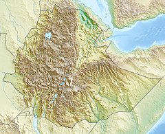
The Giba is a river of northern Ethiopia. It starts at the confluence of Genfel and Sulluh (which rises in the mountains of Mugulat) (3,298 metres above sea level) and flows westward to the Tekezé River.[2] Future Lake Giba will occupy the plain where the Sulluh, Genfel and Agula'i Rivers meet, and hence be the future source of Giba River.
Giba drainage network
^ abAmanuel Zenebe, and colleagues (2013). "Spatial and temporal variability of river flows in the degraded semi-arid tropical mountains of northern Ethiopia". Zeitschrift für Geomorphologie. 57 (2): 143–169. Bibcode:2013ZGm....57..143Z. doi:10.1127/0372-8854/2012/0080.
^Jacob, M. and colleagues (2019). Geo-trekking map of Dogu'a Tembien (1:50,000). In: Geo-trekking in Ethiopia's Tropical Mountains - The Dogu'a Tembien District. SpringerNature. ISBN 978-3-030-04954-6.
The Giba is a river of northern Ethiopia. It starts at the confluence of Genfel and Sulluh (which rises in the mountains of Mugulat) (3,298 metres above...
Ab'aro Azef River Amblo Korowya Ferrey River Kidane Mihret River May Meqa Graliwdo GibaRiver Tanqwa Tsech'i River May Qoqah Arwadito Adawro River May Selelo...
Pellic Vertisol) (12) brown loamy sands developed on alluvium along GibaRiver (Fluvisol) (30) Inclusion: stony, dark cracking clays with good natural...
Ilala is a river of northern Ethiopia. Rising in the mountains of Dergajen (2,676 metres above sea level), it flows westward to GibaRiver which empties...
Regosol and Cambisol) (21) brown loamy sands developed on alluvium along GibaRiver (Fluvisol) Associated soil types shallow, stony, dark, loamy soils on...
Sulluh is a river of northern Ethiopia. Rising in the mountains of Mugulat (3,298 metres above sea level), it flows southward to GibaRiver which empties...
the foot of the Tsatsen ridge to GibaRiver, over a long ledge between the Inda Sillasie and Gra Agiam/Bitchoqo rivers. The highest peak is a hill at May...
Moens, T.; Lanckriet, S.; Jacob, M. (2019). "Boswellia Incense in the GibaRiver Gorge". Geo-trekking in Ethiopia's Tropical Mountains. GeoGuide. Springer...
southbound over an elongated ridge between Inda Sillasie River and Addi Keshofo River towards GibaRiver. The highest place is a hill east of Gudeli (2230 m...
Tanqwa is a river of northern Ethiopia. Rising in the mountains of Dogu’a Tembien (2510 metres above sea level), it flows westward to GibaRiver which empties...
Genfel is a river of northern Ethiopia. Rising on the foot of the Atsbi horst at 2,253 metres above sea level, it flows southwestward to GibaRiver which empties...
Gabat is a river of northern Ethiopia. Rising in the mountains of Inderta (2,233 metres above sea level), it flows westward to GibaRiver which empties...
southward to GibaRiver which empties finally in the Tekezé River. Along its couse, it first takes the name Rubaksa River, then Dabba Hadera River, and finally...
is a river of the Nile basin. Rising in the mountains of Dogu’a Tembien in Northern Ethiopia, it flows southwards to empty directly in the Giba and further...
A bedrock river is a river that has little to no alluvium mantling the bedrock over which it flows. However, most bedrock rivers are not pure forms; they...
Togogwa May Bilbil in GibaRiver (the strong spring is inside the river bed) May Kebakebo and May Togogwa directly feed Inda Anbesa River In this area with...
Lake Giba is a reservoir under construction at the border of the Inderta; Kilte Awula'ilo and Dogu’a Tembien woredas of the Tigray Region in Ethiopia....
River, is a river of the Nile basin. Rising in the mountains of Dogu’a Tembien in northern Ethiopia, it flows southward to empty finally in the Giba and...
the Gibariver. The highest peak is at the northern end of the tabia (2710 m a.s.l.) and the lowest place at the confluence of Zikuli and Gibarivers (1395 m...
 Global Information