 Global Information
Sulluh information
| Sulluh | |
|---|---|
 Shugu'a Shugu'i confluence: Sulluh (from the back) and Genfel (from right) together form Giba River, flowing towards the photographer | |
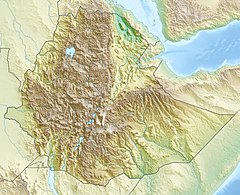 Sulluh River in Tigray Region | |
| Location | |
| Country | Ethiopia |
| Region | Tigray Region |
| Districts (woreda) | Dogu’a Tembien, Kilte Awula’ilo, Hawzen |
| Physical characteristics | |
| Source | |
| • location | Slopes of Mugulat mountains |
| • elevation | 2,746 m (9,009 ft) |
| Mouth | Giba River |
• location | Shugu'a Shugu'i |
• coordinates | 13°38′53″N 39°24′54″E / 13.648°N 39.415°E |
• elevation | 1,770 m (5,810 ft) |
| Length | 87 km (54 mi) |
| Basin size | 969 km2 (374 sq mi) |
| Width | |
| • average | 35 m (115 ft) |
| Discharge | |
| • location | Near the confluence at Shugu'a Shugu'i[1] |
| • maximum | 338 m3/s (11,900 cu ft/s) |
| Basin features | |
| River system | Permanent river |
| Waterbodies | Addi Abagiè and many other reservoirs |
| Bridges | Road Hawzien-Senkata |
| Topography | Mountains and deep gorges |
The Sulluh is a river of northern Ethiopia. Rising in the mountains of Mugulat (3,298 metres above sea level), it flows southward to Giba River which empties finally in the Tekezé River.[2][3] Future Lake Giba will occupy the plain where Sulluh, Genfel and Agula'i Rivers meet.

- ^ Amanuel Zenebe, and colleagues (2013). "Spatial and temporal variability of river flows in the degraded semi-arid tropical mountains of northern Ethiopia" (PDF). Zeitschrift für Geomorphologie. 57 (2): 143–169. Bibcode:2013ZGm....57..143Z. doi:10.1127/0372-8854/2012/0080.
- ^ Jacob, M. and colleagues (2019). Geo-trekking map of Dogu'a Tembien (1:50,000). In: Geo-trekking in Ethiopia's Tropical Mountains - The Dogu'a Tembien District. SpringerNature. ISBN 978-3-030-04954-6.
- ^ Solomon Hishe, Woldeamlak Bewket, Nyssen, J., Lyimo, J., 2020. Analyzing past land use land cover change and CA-Markov based future modeling in the Middle Suluh Valley, Northern Ethiopia. GeoCarto International, 35(3): 225-255.