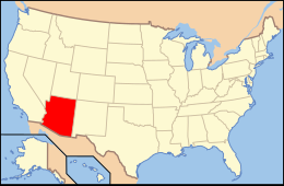
Arizona is a landlocked state situated in the southwestern region of the United States of America. It has a vast and diverse geography famous for its deep canyons, high- and low-elevation deserts, numerous natural rock formations, and volcanic mountain ranges. Arizona shares land borders with Utah to the north, the Mexican state of Sonora to the south, New Mexico to the east, and Nevada to the northwest, as well as water borders with California and the Mexican state of Baja California to the southwest along the Colorado River. Arizona is also one of the Four Corners states and is diagonally adjacent to Colorado.
Arizona has a total area of 113,998 square miles (295,253 km2), making it the sixth largest U.S. state.[1] Of this area, just 0.3% consists of water, which makes Arizona the state with the second lowest percentage of water area (New Mexico is the lowest at 0.2%).[1] Arizona spans about 335 miles (539 km) at its widest and 390 miles (628 km) at its longest, and has an average elevation of about 4,000 feet (1,200 m).[2] The geographic center of Arizona is located in Yavapai County, approximately 55 miles (89 km) east-southeast of the city of Prescott.
^ abSummary of 2000 Census Table 17
^Weir, Bill. The Land, arizonahandbook.com.
and 24 Related for: Geography of Arizona information
Arizona is a landlocked state situated in the southwestern region of the United States of America. It has a vast and diverse geography famous for its deep...
not part of the Navajo Nation but is geographically surrounded by it, also does not observe DST. For this reason, driving the length ofArizona State Route...
Yavapai counties, the region is geographically dominated by the Colorado Plateau, the southern border of which in Arizona is called the Mogollon Rim.[citation...
ˈʂɔnak]) is a landlocked state in the Southwestern region of the United States. Arizona is part of the Four Corners region with Utah to the north, Colorado...
The Arizona Strip is the part ofArizona lying north of the Colorado River. Despite being larger in area than several U.S. states, the entire region has...
The Arizona Sun Corridor, shortened Sun Corridor, is a megaregion, or megapolitan area, in the southern area of the U.S. state ofArizona. The Sun Corridor...
In Arizona, copper mining has been a major industry since the 19th century. In 2007, Arizona was the leading copper-producing state in the country, producing...
under the Arizona banner until the war ended. The political geographyof the two Arizona Territories differed in that the Confederate Arizona was approximately...
provided as an overview of and topical guide to geography: Geography – study of Earth and its people. an academic discipline – a body of knowledge given to...
North Central Arizona is a geographical region ofArizona. It is in the Transition Zone between the Basin and Range Province and the Colorado Plateau...
1912) Adjectival: Arizona Demonyms Arizonan Arizonian GeographyofArizonaArizona is: a U.S. state, a federal state of the United States of America Location...
Southern Arizona is a region of the United States comprising the southernmost portion of the State ofArizona. It sometimes goes by the name Gadsden or...
The ArizonaGeographic Information Council (AGIC) was established by executive order as Arizona's primary forum and oversight group for coordination efforts...
University ofArizona (Arizona, U of A, UArizona, or UA) is a public land-grant research university in Tucson, Arizona. Founded in 1885 by the 13th Arizona Territorial...
Plateau in Northeast Arizona and the Basin and Range region of lower-elevation deserts in the southwest and south. Northwest Arizona transitions to the...
used in the geographical sense, refers to the contiguous United States (sometimes referred to as the Lower 48, including the District of Columbia), Alaska...
The Apache Trail in Arizona was a stagecoach trail that ran through the Superstition Mountains. It was named the Apache Trail after the Apache Indians...
the U.S. state ofArizona. Four counties (Mohave, Pima, Yavapai and Yuma) were created in 1864 following the organization of the Arizona Territory in 1862...
USS Arizona Memorial, at Pearl Harbor in Honolulu, Hawaii, marks the resting place of 1,102 of the 1,177 sailors and Marines killed on USS Arizona during...
The Arizona Coyotes are an inactive professional ice hockey team based in the Phoenix metropolitan area, which competed in the National Hockey League...
The geographyof Mexico describes the geographic features of Mexico, a country in the Americas. Mexico is located at about 23° N and 102° W in the southern...
according to the 2020 US Census. Geography portal United States portal Arizona portal GeographyofArizona Demographics ofArizona The OMB defines a core as...
on the western coast of North America. Covering an area of 163,696 sq mi (423,970 km2), California is among the most geographically diverse states. The...
 Global Information