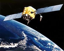
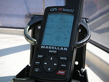
Artist's conception of GPS Block II-F satellite in Earth orbitCivilian GPS receiver ("GPS navigation device") in a marine application
GPS signals are broadcast by Global Positioning System satellites to enable satellite navigation. Receivers on or near the Earth's surface can determine location, time, and velocity using this information. The GPS satellite constellation is operated by the 2nd Space Operations Squadron (2SOPS) of Space Delta 8, United States Space Force.
GPS signals include ranging signals, which are used to measure the distance to the satellite, and navigation messages. The navigation messages include ephemeris data which are used both in trilateration to calculate the position of each satellite in orbit and also to provide information about the time and status of the entire satellite constellation, called the almanac.
There are four GPS signal specifications designed for civilian use. In order of date of introduction, these are: L1 C/A, L2C, L5 and L1C.[1] L1 C/A is also called the legacy signal and is broadcast by all currently operational satellites. L2C, L5 and L1C are modernized signals and are only broadcast by newer satellites (or not yet at all). Furthermore, as of January 2021[update], none of these three signals are yet considered to be fully operational for civilian use. In addition to the four aforementioned signals, there are restricted signals with published frequencies and chip rates, but the signals use encrypted coding, restricting use to authorized parties. Some limited use of restricted signals can still be made by civilians without decryption; this is called codeless and semi-codeless access, and this is officially supported.[2][3]
The interface to the User Segment (GPS receivers) is described in the Interface Control Documents (ICD). The format of civilian signals is described in the Interface Specification (IS) which is a subset of the ICD.
^"New Civil Signals". Retrieved 2021-01-18.
^"Codeless/Semi-Codeless GPS Access Commitments".
^Civilian GPS Receivers Actually do Have Access to the L2 Frequency
GPSsignals are broadcast by Global Positioning System satellites to enable satellite navigation. Receivers on or near the Earth's surface can determine...
the weak GPS signal. GPS's vulnerability to jamming is a threat that continues to grow as jamming equipment and experience grows. GPSsignals have been reported...
position. Since GPSsignals at terrestrial receivers tend to be relatively weak, natural radio signals or scattering of the GPSsignals can desensitize...
inside the spot beam, the GPS satellite will appear as two GPSsignals occupying the same position. While the full-Earth M-code signal is available on the Block...
When GPS was first being put into service, the US military was concerned about the possibility of enemy forces using the globally available GPSsignals to...
impression of a GPS Block III satellite in orbit GPS Block III is the first series of third-generation GPS satellites, incorporating new signals and broadcasting...
implemented in sensors. Use more GNSS signal types. Modernized civil GPSsignals are more robust than the L1 signal and should be leveraged for increased...
agree with the signals broadcast by GPS or other GNSS satellites. GPSDOs work well as a source of timing because the satellite time signals must be accurate...
has the security hardware necessary to decode the encrypted P(Y)-code GPSsignals. Manufactured by Rockwell Collins, the DAGR entered production in March...
navigation signals to improve the system's accuracy — including new CDMA signals in the L3 and L5 bands, which will use modulation similar to modernized GPS, Galileo...
contain an L1 & L5 GPS payload. This means they will potentially be usable with the L5 modernized GPSsignals when the new signals and receivers become...
satellite signals. Dedicated GPS timing receivers are accurate to better than 1 microsecond; however, general-purpose or consumer grade GPS may have an...
individual signals collected and integrated by the receiver units employed in a Global Navigation Satellite System (GNSS). The integrity of received signals and...
Structure of the time-encoding components of GPSsignals, NAV and CNAV versions "Advisory for the August 1999 GPS Week Rollover". www.navcen.uscg.gov. Retrieved...
exceptionally poor signal conditions, for example in urban areas, satellite signals may exhibit multipath propagation where signals skip off structures...
encrypted military M-code GPSsignaling to ensure that the JDAM only accepts signals with correct encryption and rejects all other signals. However, according...
the Earth of navigation signals from Global Navigation Satellite Systems such as GPS. The idea of using reflected GNSS signal for earth observation became...
developments allow for the production of IMU-enabled GPS devices. An IMU allows a GPS receiver to work when GPS-signals are unavailable, such as in tunnels, inside...
using GPS tracking software and devices with GPS capability. A GPS "track me" essentially contains a GPS module that receives the GPSsignal and calculates...
GPS Block IIIF, or GPS III Follow On (GPS IIIF), is the second set of GPS Block III satellites, consisting of up to 22 space vehicles. The United States...
controllers integrated with low-noise radio receivers to decode GPSsignals at very low signal levels (typically -160dBm). SiRF chips also support SBAS to...
A distress signal, also known as a distress call, is an internationally recognized means for obtaining help. Distress signals are communicated by transmitting...
P(Y)-code GPSsignal. Introduced in January 1990, and extensively fielded until 2004 when it was replaced by its successor, the Defense Advanced GPS Receiver...
 Global Information