East Cape is the easternmost point of the main islands of New Zealand. It is at the northern end of the Gisborne District of the North Island.[1] East Cape was originally named "Cape East" by British explorer James Cook during his 1769–1779 voyage. It is one of four New Zealand cardinal capes he named, along with North Cape, West Cape and South Cape.[2]
The name "East Cape" is also used for the part of the Gisborne District north of the Poverty Bay area, and even sometimes the whole Gisborne District.[3]
Maritime New Zealand operates the East Cape Lighthouse, located at the cape's easternmost point.[4] The small East Island / Whangaokeno, also known as Motu o Kaiawa, is directly offshore.[5][6] The NZ Transport Agency upgraded the Horoera Bridge in 2017,[7] giving campervans and other heavy vehicles full access to the lighthouse.[8] It replaced a temporary Bailey bridge installed in 2015.[9]
Te Araroa and ranges towards East Cape
Looking from East Cape towards East Island / Whangaokeno
^Soutar, Monty (1 March 2015). "East Coast region – Overview". Te Ara – the Encyclopedia of New Zealand. Ministry for Culture and Heritage. Retrieved 28 August 2023.
^East Cape Lighthouse Archived 14 May 2010 at the Wayback Machine, Maritime New Zealand. Retrieved 1 December 2009.
^Also known as Motu o Kaiawa, see Kate MacIntyre, Te Whanau a Apanui and the East Coast Inquiry District Archived 23 April 2019 at the Wayback Machine, Waitangi Tribunal Scoping Report, Wai 900 #A9, p. 37.
^East Island / Whangaokeno, Rodent Invasion Project, Department of Statistics, University of Auckland. Retrieved 1 December 2009.
^"Dropout delays bridge rebuild". Gisborne Herald. 24 July 2017. Archived from the original on 18 May 2019. Retrieved 18 May 2019.
^"Bridging the gap to East Cape Lighthouse". Gisborne Herald. 17 August 2017. Archived from the original on 18 May 2019. Retrieved 18 May 2019.
^Ashton, Andrew (3 December 2015). "East Coast Lighthouse opens up for freedom campers". Gisborne Herald. Archived from the original on 1 February 2016. Retrieved 18 May 2019.
EastCape is the easternmost point of the main islands of New Zealand. It is at the northern end of the Gisborne District of the North Island. East Cape...
The EastCape War, sometimes also called the East Coast War, was a series of conflicts fought in the North Island of New Zealand from April 1865 to October...
South EastCape is a cape located at the southernmost point of the main island of Tasmania, the southernmost state in Australia. The cape is situated...
books: Raymond Salisbury's "Cape to Cape – 80 Day Traverse of the North Island" and A.H. Reed's "From EastCape to Cape Egmont On Foot at Eighty-six"...
Cape Dezhnyov or Cape Dezhnev (Russian: мыс Дежнёва; Eskimo–Aleut: Tugnehalha); (Inupiaq: Nuuġaq), formerly known as EastCape or Cape Vostochny, is a...
There are three prominent points on the cape, each of which hosts a designated backcountry campsite: EastCape, which is the actual southernmost point...
prominence during New Zealand's EastCape War and Te Kooti's War. Born in 1820 in the Waiapu Valley on the EastCape, he was enslaved as a boy and became...
fluctuates between Cape Agulhas and Cape Point (about 1.2 kilometres (0.75 mi) east of the Cape of Good Hope). 75km 50miles Cape Agulhas Cape of Good Hope ...
Bowl area of Cape Town is the oldest urban area in the Western Cape, with a significant cultural heritage. It was founded by the Dutch East India Company...
Cape Matapan (Greek: Κάβο Ματαπάς, Maniot dialect: Ματαπά), also called Cape Tainaron or Taenarum (Greek: Ακρωτήριον Ταίναρον), or Cape Tenaro, is situated...
The Cape Flats (Afrikaans: Die Kaapse Vlakte) is an expansive, low-lying, flat area situated to the southeast of the central business district of Cape Town...
the same name, which was established in 1652 by the Dutch East India Company (VOC). The Cape was under VOC rule from 1652 to 1795 and under rule of the...
Nek Qacha's Nek District – east of Quthing Domestically, it borders the following provinces: Western Cape – west Northern Cape – northwest Free State –...
great capes are three major capes of the continents in the Southern Ocean—Africa's Cape of Good Hope, Australia's Cape Leeuwin, and South America's Cape Horn...
died during celebrations at the Enyobeni Tavern, a shebeen in East London, Eastern Cape, South Africa. Four more people were injured. No official causes...
to the east of Cape Cod, and to the southwest of the Cape is Buzzards Bay. The Cape Cod Canal, completed in 1916, connects Buzzards Bay to Cape Cod Bay;...
East Land – the parallel of lat. 80° N. From Cape Leigh Smith to Cape Kohlsaat – the Northern limit of Barentsz Sea [sic]. From Cape Kohlsaat to Cape...
Cape Breton East (formerly Sydney River-Mira-Louisbourg) is a provincial electoral district in Nova Scotia, Canada, that elects one member of the Nova...
System, it has also been known historically as: North East River Northeast Fork Northeast Cape Fear River rises about 1 mile southeast of Mount Olive...
include all lion populations in Southern and East Africa. Genetic analysis published in 2023 suggests that Cape lions were not particularly distinctive from...
Wales Cape Egmont Cape Foulwind Cape Reinga EastCape North Cape Young Nick's Head Diamond Head, Hawaii Koko Head, Hawaii Cape Froward, Chile Cape Horn...
and EastCape were created in this manner. Around 25–22 Ma, Northland and EastCape were adjacent, with EastCape near Whangarei. Northland–EastCape was...
The Cape Fear River is a 191.08-mile-long (307.51 km) blackwater river in east-central North Carolina. It flows into the Atlantic Ocean near Cape Fear...
 Global Information

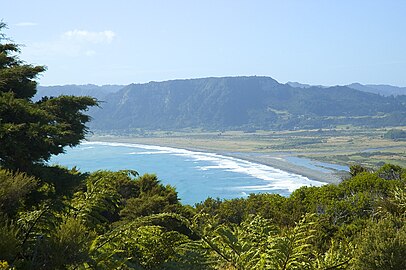 Te Araroa and ranges towards East Cape
 Looking from East Cape towards East Island / Whangaokeno
