 Global Information
Cape Fear River information
| Cape Fear River Tributary to Atlantic Ocean | |
|---|---|
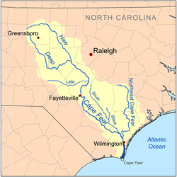 Map of the Cape Fear River drainage basin | |
| Location | |
| Country | United States |
| State | North Carolina |
| County | Bladen Brunswick Chatham Columbus Cumberland Harnett Lee New Hanover Pender |
| City | Lillington Erwin Fayetteville Elizabethtown Wilmington Southport |
| Physical characteristics | |
| Source | confluence of Deep River and Haw River |
| • location | about 1 mile southeast of Moncure, North Carolina |
| • coordinates | 35°35′48″N 079°03′07″W / 35.59667°N 79.05194°W[1] |
| • elevation | 154 ft (47 m)[2] |
| Mouth | Atlantic Ocean |
• location | between Oak Island and Bald Head Island |
• coordinates | 33°53′08″N 078°00′46″W / 33.88556°N 78.01278°W[1] |
• elevation | 0 ft (0 m)[2] |
| Length | 191.08 mi (307.51 km)[3] |
| Basin size | 9,120.61 square miles (23,622.3 km2)[4] |
| Discharge | |
| • location | Atlantic Ocean |
| • average | 9,959.87 cu ft/s (282.032 m3/s) at mouth with Atlantic Ocean[4] |
| Basin features | |
| Progression | generally southeast |
| River system | Cape Fear River |
| Tributaries | |
| • left | Gulf Creek, Buckhorn Creek, Parkers Creek, Avents Creek, Hector Creek, Neills Creek, Dry Creek, Buies Creek, Thorntons Creek, Juniper Creek, Cedar Creek, Phillips Creek, Harrison Creek, Ellis Creek, Turnbull Creek, Mulford Creek, Bandeau Creek, Frenchs Creek, Black River, Northeast Cape Fear River, Barnards Creek, Mott Creek, Telfairs Creek |
| • right | Wombles Creek, Little Shaddox Creek, Lick Creek, Bush Creek, Fall Creek, Daniels Creek, Cedar Creek, Camels Creek, Little Creek, Fish Creek, Poorhouse Creek, Upper Little River, Little River, Carvers Creek, Cross Creek, Rockfish Creek, Grays Creek, Willis Creek, Georgia Branch, Hucklebrry Swamp, Black Swamp, Bakers Creek, Browns Creek, Pemberton Creek, Hammonds Creek, Drunken Run, Donoho Creek, Carvers Creek, Plummers Run, Steep Run, Weyman Creek, Double Branch, Livingston Creek, Bryant Mill Creek, Grist Mill Branch, Bay Branch, Indian Creek, Cartwheel Branch, Alligator Creek, Brunswick River, Mallory Creek, Little Mallory Creek, Town Creek, Sand Hill Creek, Liliput Creek, Orton Creek, Walden Creek, Price Creek |
| Bridges | Avents Ferry Road, US 401-NC 210, NC 217, I-295, I-95, NC 24-210, I-95, Tarheel Ferry Road, US 701, General Howe Highway (NC 11), US 17-74, US 17 |
The Cape Fear River is a 191.08-mile-long (307.51 km)[5] blackwater river in east-central North Carolina. It flows into the Atlantic Ocean near Cape Fear, from which it takes its name. The river is formed at the confluence of the Haw River and the Deep River (North Carolina) in the town of Moncure, North Carolina. Its river basin is the largest in the state: 9,149 sq mi.[6]
The river is the most industrialized river in North Carolina, lined with power plants, manufacturing plants, wastewater treatment plants, landfills, paper mills, and industrial agriculture.[7] Relatedly, the river is polluted by various substances, including suspended solids and manmade chemicals. These chemicals include per- and polyfluoroalkyl substances (PFAS), GenX, perfluorooctanesulfonic acid, perfluorooctanoic acid, byproducts of production of the fluoropolymer Nafion; and intermediates used to make other fluoropolymers (e.g. PPVE, PEVE and PMVE perfluoroether). Industrial chemicals such as 1,4-Dioxane and other pollutants have been found in its tributary, the Haw River.
In 2020, a national study of tap water found the highest concentration of PFAS in Brunswick County, which gets its drinking water from the Cape Fear River.[8]
- ^ a b U.S. Geological Survey Geographic Names Information System: Cape Fear River
- ^ a b "Cape Fear River Topo Map, Brunswick County NC (Southport Area)". TopoZone. Locality, LLC. Retrieved 24 November 2019.
- ^ "ArcGIS Web Application". epa.maps.arcgis.com. US EPA. Retrieved 24 November 2019.
- ^ a b "Cape Fear River Watershed Report". Waters Geoviewer. US EPA. Retrieved 24 November 2019.
- ^ Cape Fear River Archived April 1, 2005, at the Wayback Machine, The Columbia Gazetteer of North America: Note that despite the gazetteer's claim of the river being the longest entirely within North Carolina, the Neuse River Archived 2009-06-09 at the Wayback Machine is longer
- ^ "Basin wide Assessment Report Cape Fear River Basin" (PDF). August 2004 – via NCDENR.
{{cite journal}}: Cite journal requires|journal=(help) - ^ Online, Coastal Review (2022-06-08). "Climate change, pollution imperil Cape Fear, advocates say". North Carolina Health News. Retrieved 2022-10-28.
- ^ Barnes, Greg (2020-02-03). "New DEQ data show 'staggering' levels of PFAS in Cape Fear River basin". North Carolina Health News. Retrieved 2022-10-28.