 Global Information
2011 Mississippi River floods information
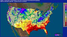
 100 populated locations were experiencing major or moderate flooding on May 8, 2011. Source: National Weather Service | |
| Date | May 4, 2011 to June 20, 2011 |
|---|---|
| Location | Mississippi River Valley, United States |
| Deaths | About 20 direct 348 indirect from preceding storms[1][2][3] |
| Property damage | US$2 to 4 billion[4][5] |
Major floods along the Mississippi River in April and May 2011 were among the largest and most damaging recorded along the U.S. waterway in the past century, comparable in extent to the Great Mississippi Flood of 1927 and Great Flood of 1993. In April 2011, two large storm systems deposited record levels of rainfall on the Mississippi River drainage basin. When that additional water combined with the springtime snowmelt, the river and many of its tributaries began to swell to record levels by the beginning of May. Flooding occurred in Illinois, Missouri, Kentucky, Tennessee, Arkansas, Mississippi, and Louisiana.
U.S. President Barack Obama declared the western counties of Kentucky, Tennessee, and Mississippi federal disaster areas.[6] For the first time in 37 years, the Morganza Spillway was opened on May 14, deliberately flooding 4,600 square miles (12,000 km2) of rural Louisiana to save most of Baton Rouge and New Orleans.[7]
Fourteen people were killed in Arkansas,[8] with 348 killed across seven states in the preceding storms.[1][2][3] Thousands of homes were ordered evacuated, including over 1,300 in Memphis,[9] and more than 24,500 in Louisiana and Mississippi,[10][11] though some people disregarded mandatory evacuation orders.[12] The flood crested in Memphis on May 10 and artificially crested in southern Louisiana on May 15, a week earlier than it would have if spillways had not been opened.[13] The United States Army Corps of Engineers stated that an area in Louisiana between Simmesport and Baton Rouge was expected to be inundated with 20–30 feet (6.1–9.1 m) of water.[14] Baton Rouge, New Orleans, and many other river towns were threatened,[15][16] but officials stressed that they should be able to avoid catastrophic flooding.[17]

From April 14–16, the storm system responsible for one of the largest tornado outbreaks in U.S. history also produced large amounts of rainfall across the southern and midwestern United States. Two more storm systems, each with heavy rain and tornadoes, hit in the third week of April. In the fourth week of April, from April 25–28, another, even more extensive and deadly storm system passed through the Mississippi Valley dumping more rainfall resulting in deadly flash floods.[18] The unprecedented extensive rainfall from these four storms, combined with springtime snow melt from the Upper Midwest, created the perfect situation for a 500-year flood along the Mississippi.
- ^ a b "Tornado victims seek comfort in Sunday services". CBS News. May 1, 2011. Retrieved May 1, 2011.
- ^ a b "Heavy Rain/Severe Weather on April 23–27, 2011". National Weather Service in Little Rock, Arkansas. National Oceanic and Atmospheric Administration. April 27, 2011. Retrieved April 28, 2011.
- ^ a b "Top federal officials tour, promise help to tornado-ravaged South". CNN. May 1, 2011. Retrieved May 1, 2011.
- ^ Masters, Jeffrey. "Mississippi River flood of 2011 already a $2 billion disaster". Weather Underground. Jeff Masters' WunderBlog. Retrieved 12 May 2011.
- ^ Strauss, Gary; Marisol Bello (May 11, 2011). "Mississippi flood damages could reach billions". Tucson Citizen. Retrieved 12 May 2011.[dead link]
- ^ "Obama Signs Tennessee Disaster Declaration". Blog.memphisdailynews.com. 2011-05-09. Archived from the original on 15 June 2011. Retrieved 2011-05-16.
- ^ "Rural Louisiana flooded to save New Orleans" (CBS News/Associated Press) May 14, 2011
- ^ "River floods 100 homes; state's death toll at 14". Arkansasonline.com. 2011-04-30. Retrieved 2011-05-16.
- ^ "BBC News - Mississippi flood: Southern states brace for crest". Bbc.co.uk. 2011-05-11. Archived from the original on 13 May 2011. Retrieved 2011-05-16.
- ^ "Gov Jindal: Morganza Spillway opening by Saturday". Times Union. 2011-05-12. Archived from the original on 2012-09-13. Retrieved 2011-05-16.
- ^ "Flooding begins to 'wrap arms' around Memphis" May 7, 2011 (Toronto Sun)
- ^ Paul Rioux (May 16, 2011) "Many in way of diverted Mississippi River floodwaters ignore evacuation order" The Times-Picayune
- ^ "Memphis and Baton Rouge brace for record-breaking Mississippi flood". Christian Science Monitor. 2011-05-08. Archived from the original on 24 May 2011. Retrieved 2011-05-16.
- ^ Estimated Inundation (US Army Corps of Engineers) Archived May 11, 2011, at the Wayback Machine
- ^ "Mississippi River rise has River Parishes residents worried" NOLA.com May 12, 2011
- ^ "'Sacrificial' towns prepare for deliberate flooding" MSNBC May 12, 2011
- ^ "Officials try to calm fears of New Orleans flooding from Mississippi River" Archived May 15, 2011, at the Wayback Machine WWL TV May 12, 2011
- ^ This latter storm produced over 250 tornadoes, the deadliest tornado outbreak since 1936, causing an estimated $11 billion dollars in damage.