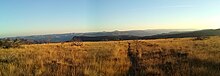
Map of BLM Wilderness Study Areas.Slinkard BLM Wilderness Study Area, CaliforniaSutton Mountain BLM Wilderness Study Area, Oregon
A wilderness study area (WSA) contains undeveloped United States federal land retaining its primeval character and influence, without permanent improvements or human habitation, and managed to preserve its natural conditions. In spite of this, WSAs are not included in the National Wilderness Preservation System.
On Bureau of Land Management lands, a WSA is a roadless area that has been inventoried (but not designated by Congress) and found to have wilderness characteristics as described in Section 603 of the Federal Land Policy and Management Act of 1976 and Section 2(c) of the Wilderness Act of 1964. Wilderness Study Area characteristics:
Size – roadless areas of at least 5,000 acres (2,000 ha) of public lands or of a manageable size;
Naturalness – generally appears to have been affected primarily by the forces of nature rather than human activity;
Opportunities – provides outstanding opportunities for solitude or primitive and unconfined types of recreation.[1]
BLM manages wilderness study areas under the National Landscape Conservation System to protect their value as wilderness until Congress decides whether to designate them as wilderness. Wilderness bills often include so-called "release language" that eliminates WSAs not selected for wilderness designation.
Some WSAs are managed in exactly the same manner as wilderness areas, a specific government designation and not synonymous with the natural state of wilderness. Some areas permit activities that are generally excluded from wildernesses, such as mountain biking and off-roading.
As of 2023, there are 487 BLM wilderness study areas with a total area of 11,118,496 acres (4,499,496 ha).[2]
^"Wilderness and Wilderness Study Areas". Bureau of Land Management. Retrieved 11 December 2023.
^"Wilderness Areas and Wilderness Study Areas Summary Table". Bureau of Land Management. December 2023. Retrieved 10 December 2023.
and 24 Related for: Wilderness study area information
A wildernessstudyarea (WSA) contains undeveloped United States federal land retaining its primeval character and influence, without permanent improvements...
less wilderness remains in the ocean, with only 13.2% free from intense human activity. Some governments establish protection for wildernessareas by law...
The National Wilderness Preservation System (NWPS) of the United States protects federally managed wildernessareas designated for preservation in their...
Sleeping Giant WildernessStudyArea is a non-motorized recreation area located on the west side of the Missouri River and Holter Lake located about 30...
Canyon WildernessStudyArea may refer to wildernessstudyareas managed by the U.S. Bureau of Land Management: Black Canyon WildernessStudyArea (Gooding...
This is a list of some of the wildernessstudyareas (WSA) in the United States as of December 2009. Wildernessstudyareas are designated lands that meet...
The Indian Creek WildernessStudyArea is a wildernessstudyarea managed by the United States Bureau of Land Management in southern Utah. It encompasses...
The Shale Butte WildernessStudyArea is a Bureau of Land Management wildernessstudyarea (WSA) in Lincoln County, Idaho. It covers 15,560 acres (6,300 ha)...
The Boundary Waters Canoe AreaWilderness (BWCAW or BWCA) comprises 1,090,000 acres (440,000 ha) of pristine forests, glacial lakes, and streams in the...
The Terry Badlands WSA (also Terry Badlands) is a designated WildernessStudyArea by the Bureau of Land Management. It is located three miles north of...
The Little City of Rocks WildernessStudyArea is a Bureau of Land Management wildernessstudyarea in Gooding County, Idaho between the towns of Gooding...
The Lynn Camp Creek WildernessStudyArea, a 3226-acre site in the Eastern Divide Ranger District of the George Washington and Jefferson National Forests...
Conservation Lands: National Monument National Conservation AreaWildernessAreaWildernessStudyArea National Wild and Scenic River National Scenic Trail National...
Big Joe Basin, and Irish Canyon. In 1980, the West Cold Spring WildernessStudyArea was established by the Bureau of Land Management (BLM). It includes...
of Parker, and 3 miles (4.8 km) north of Bouse. The wildernessstudyarea is an immense open area of stabilized and semi-stabilized sand dunes, unique...
The Gooding City of Rocks East WildernessStudyArea is a Bureau of Land Management wildernessstudyarea that covers 14,743 acres (5,966 ha) in Gooding...
Prior to its 2019 designation, it was known as the Aden Lava Flow WildernessStudyArea. It lies within the Potrillo volcanic field southwest of Las Cruces...
The Oregon Badlands Wilderness is a 29,301-acre (11,858 ha) wildernessarea located east of Bend in Deschutes and Crook counties in the U.S. state of...
com. Retrieved 23 August 2014. "Disaster Peak WildernessStudyArea" (PDF). Nevada WildernessStudyArea Notebook. Bureau of Land Management. April 2001...
Mountain WildernessStudyArea to protect land within the Augusta Mountains. With some local advocacy from the Friends of Nevada Wilderness, some of the...
Retrieved 7 May 2017. "National Landscape Conservation System - WildernessStudyAreas" (PDF). BLM. December 2009. pp. 21, 23. Archived from the original...
 Global Information