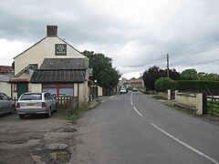
Westhay is a village in Somerset, England. It is situated in the parish of Meare, 4 miles (6.4 km) north-west of Glastonbury on the Somerset Levels.
The name means 'The west field that is enclosed by hedges' from the Old English west and haga. The 'g' in haga is silent.[1]
Westhay is a marshland village on the River Brue in typical Somerset rhyne country, standing on the site of pre-historic lake dwellings. The site of the lake-village is marked by groups of mounds. The nearby Avalon Marshes Centre, where the RSPB, Natural England, Somerset Wildlife Trust and The Hawk and Owl Trust have offices and work bases to manage the local wildlife reserves, has replaced the old Peat Moors Centre which closed down in the autumn of 2009. It also includes a craft centre, cafe, several historic reconstructions and information about the local archeology. The prehistoric Sweet Track and Post Track run from the village southwards towards Shapwick.
The village is close to Westhay Moor, Westhay Heath, RSPB Ham Wall and Shapwick Heath, all of which have been designated as Sites of Special Scientific Interest, and Honeygar, a rewilding project.
Peat gatherers at Westhay, somerset levelsPeat stacks and cutting at Westhay, somerset levelsHarvesting the peat at Westhay, somerset levels
Westhay is well known as the site of the Starling Roost featured on many TV wildlife programmes. The roost is in National wildlife reserves such as Westhay Moor, Ham Wall and Shapwick Heath. The area also contains one third of the UK breeding population of Bitterns and the first known UK breeding populations of Great White Egret, Little Bittern, and Night Heron.[2]
^Robinson, Stephen (1992). Somerset Place Names. Wimborne, Dorset: Dovecote Press. ISBN 1-874336-03-2.
^"'Incredible': night herons breed for first time in UK".
Westhay is a village in Somerset, England. It is situated in the parish of Meare, 4 miles (6.4 km) north-west of Glastonbury on the Somerset Levels. The...
Westhay Moor (sometimes, historically, referred to as West Hay Moor) is a 513.7-hectare (1,269-acre) biological Site of Special Scientific Interest 2...
Westhay Heath (grid reference ST415422) is a 25.9 hectare (64.0 acre) biological Site of Special Scientific Interest 2km west of Westhay village in Somerset...
across the now largely drained marsh between what was then an island at Westhay and a ridge of high ground at Shapwick, a distance close to 1,800 metres...
valley includes several Sites of Special Scientific Interest including Westhay Moor, Shapwick Heath and Shapwick Moor. Much of the area has been at the...
Sticklinch Stoke St Gregory Street Thorney Yatton Yeovil Marsh Weare Wedmore Westhay Weston-super-Mare Westonzoyland Wick St Lawrence Wookey Woolavington Aller...
future generations and manages almost 80 nature reserves. Examples include Westhay Moor, Long Wood and Langford Heathfield. It has over 20,500 members and...
reduced. Peat gatherers, Westhay, September 1905 Peat stacks and cutting, Westhay, September 1905 Harvesting the peat, Westhay, September 1905 As a result...
from an extension to the Somerset Wildlife Trust's existing reserve at Westhay Moor. The area is dissected by drainage channels between plots of land...
Sweet. It extended across the marsh between what was then an island at Westhay, and a ridge of high ground at Shapwick, a distance close to 2,000 metres...
approximately 10 kilometres (6.2 mi) until it joins the River Brue at Westhay. The Witelake was once navigable between Pilton and the confluence with...
Glastonbury on the Somerset Levels. The parish includes the village of Westhay. Meare is a marshland village in typical Somerset "rhyne" country, standing...
The Peat Moors Centre lay on the road between Shapwick and Westhay in Somerset, England. The centre was run by the Somerset Historic Environment Service...
was built in the winter of 3807 BC and connected the Polden Hills with Westhay Mears, a length which ran for over a kilometre. Being agriculturalists...
"Peat extraction rights revoked at Westhay Moor, Glastonbury". Mineral Planning. Retrieved 8 February 2015. "Westhay Moor" (PDF). English Nature. Archived...
Subadult specimen An ichthyosaurid ichthyosaur Ichthyosaurus sp. West of Westhay Water, Stonebarrow Stonebarrow Marls Member NHMUK R15907, partial skeleton...
Wear River and the Decoy Rhine to Westhay Level, where it joins Whites River and then the River Brue near Westhay. The water quality is generally good;...
and interest, remaining in his Majesty, in and upon the haye or walk of Westhay, in the forest of Rockingham, in the county of Northampton, upon a full...
or Honeygar, is a rewilding project of Somerset Wildlife Trust, near Westhay on the Somerset Levels of Somerset, England. The Trust announced in August...
successfully breeding for the first time in Britain. Two birds fledged at the Westhay Moor National Nature Reserve, managed by the Somerset Wildlife Trust. A...
Manor, Parish and Liberties of Fenny Compton, in the County of Warwick. Westhay Moor in Mear (Somerset) Inclosure Act 1778 18 Geo. 3. c. 75 15 April 1778...
 Global Information