This article is about the mountain range. For the national park, see Warrumbungle National Park. For the local government area, see Warrumbungle Shire.
Warrumbungles
Completing a circuit around the jagged Breadknife is a steep hike taking about five hours.
Highest point
Peak
Mount Exmouth
Elevation
1,206 m (3,957 ft)
Geography
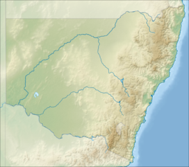
Location of the Warrumbungle Range in New South Wales
The Warrumbungles is a mountain range in the Orana region of New South Wales, Australia. The nearest town is Coonabarabran. The area is easiest accessed from the Newell Highway which is the major road link directly between Melbourne, Victoria and Brisbane, Queensland and cuts across inland New South Wales from the north to the south.
As the range is between the moist eastern coastal zone and the dryer plains to the west, it has provided protection for flora and fauna suited to both habitats. There are over 120 bird species identified on the range, including lories and lorikeets, rosellas and parrots. The centre of the range has served as an area of protection for a healthy and content colony of grey kangaroos. These animals have become fairly tame due to constant visitor attention and are easily approached.
The Siding Spring Observatory is located on Mount Woorut, an eastern peak. The area has little to no light pollution to disturb astronomical viewing. In 2016, the International Dark-Sky Association declared the Warrumbungle National Park as Australia's first International Dark Sky Park.
The Warrumbungles hosted the 2006 World Rogaining Championships.
Dark-Sky Association declared the Warrumbungle National Park as Australia's first International Dark Sky Park. The Warrumbungles hosted the 2006 World Rogaining...
national park is based on the geographical Warrumbungle Mountain Range, sometimes shortened to the Warrumbungles, and thus the park name is often heard in...
further examples, along with Mount Warning and the several peaks in the Warrumbungles in New South Wales. The 11 peaks of the Glasshouse Mountains National...
owned by James Weston in 1848. The area around Coonabarabran and the Warrumbungles has been occupied by the Kamilaroi people for approximately 7,500 years...
Goobergooberyam Mount Moombil Dome Mountain, Kyogle Mountains located within the Warrumbungles Mount Exmouth, at 1206m Siding Spring Mountain, at 1,165 metres (3,822 ft)...
Wales portal List of volcanoes in Australia Warrumbungle National Park Ken Eastwood (9 May 2014). "Warrumbungles: a climber's paradise". Australian Geographic...
September to October 1979 in the Blue Mountains, Barrington Forest and Warrumbungle National Park. It was reported that Holden and Schroder got along while...
"Mayo Dark Sky Park". ballycroynationalpark.ie. Retrieved 2017-05-06. "Warrumbungles Becomes Australia's First 'Dark Sky Park'". Archived from the original...
Gladstone in central Queensland, and south through Gayndah, Dalby, the Warrumbungles, southwest to Condobolin and the vicinity of Balranald and then across...
24–23 million years ago Warrumbungles inc The Breadknife — — 31°18′S 149°00′E / 31.3°S 149.0°E / -31.3; 149.0 (Warrumbungles) 13–17 million years ago...
species occurs on the western slopes of the Great Dividing Range from the Warrumbungles southwards to the Mudgee area of New South Wales. Gray, MR (2010). "A...
de la Société Botanique de France, from specimens collected near the Warrumbungles. The specific epithet (strigosa) means "strigose". This pimelea grows...
January 2013 Tasmanian bushfires Tasmania 20,000 49,000 1 18 January 2013 Warrumbungle bushfire New South Wales 54,000 130,000 0 53 118 Agricultural machinery...
scattered distribution across central eastern New South Wales from the Warrumbungles to the Nowra area, occurring in heath and dry sclerophyll forest on...
Brewarrina Cobar Coonamble Dubbo Gilgandra Narromine Walgett Warren Warrumbungle Far West Broken Hill Central Darling Unincorporated Far West External...
Nandewar Range Nightcap Range Ramshead Range Snowy Mountains Tweed Range Warrumbungles Watagan Mountains Bloods Range Hann Range Kelly Hills MacDonnell Ranges...
Barrier Lewis Peak (297 m or 974 ft) Warrumbungles Exmouth (1,206 m or 3,957 ft) Woorut (1,165 m or 3,822 ft) Needle Other inland mountains Grenfell Gibralter...
(/ˈdʌniduː/ DUN-ee-doo) is a village of 1,021 inhabitants situated within the Warrumbungle Shire of central western New South Wales, Australia. Dunedoo is well...
Brewarrina Cobar Coonamble Dubbo Gilgandra Narromine Walgett Warren Warrumbungle Far West Broken Hill Central Darling Unincorporated Far West External...
 Global Information