 Global Information
Wadi Khabb Shamsi information
| Wadi Khabb Shamsi Wādī Khab ash Shāmsī | |
|---|---|
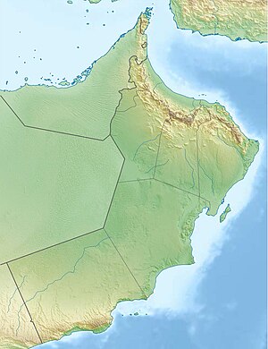
 Wadi Khabb Shamsi. Oman | |
   | |
| Native name | وادي خب الشامسي (Arabic) |
| Location | |
| Country | |
| Governorate | Musandam |
| Physical characteristics | |
| Source | On the eastern slope of Jebel Qihwi (1,735 m (5,692 ft)), [1] at (1,705 m (5,594 ft)) altitude. |
| • elevation | 1,705 m (5,594 ft) |
| Mouth | In the Gulf of Oman, next to the port, beach and residential area of Karsha, [2] in Dibba Al-Baya, Musandam Governorate, Oman |
• location | Karshā, Musandam, Oman |
• coordinates | 25°38′56.0″N 56°16′08.0″E / 25.648889°N 56.268889°E |
• elevation | 0 m (0 ft) |
| Length | 28.6 km (17.8 mi) |
| Basin size | 133 km2 (51 sq mi) |
| Basin features | |
| River system | Karsha / Wadi Khabb Shamsi |
| Tributaries | |
| • left | Wadi Muqi |
| • right | Wadi Wa'ab, Wadi Khabb Naqbi, Wadi as Sabban, Wadi Hiyar |
The Wadi Khabb Shamsi (Arabic: وادي خب الشامسي, romanized: Wādī Khab ash Shāmsī),[3][4][5][6] is a valley or dry river, with ephemeral or intermittent flow, flowing almost exclusively during the rainy season, located west of the Musandam Governorate, in the Sultanate of Oman.
Wadi Khabb Shamsi drains the southeast of Ru'us al-Jibal,[7] and is the main wadi of the drainage basin of Karsha, named after the port, beach and current residential area of the city of Dibba Al-Baya (Oman), into which it flows.[8][9]
The entire drainage basin of Karsha, formed by the Wadi Khabb Shamsi itself and its numerous tributaries and sub-tributaries, covers an approximate area of 133 km2 (51 sq mi). It is bordered to the north by the Al Rawdah drainage basin, also in Oman; to the west with the basins of Wadi Bih, Wadi Naqab and Wadi Tawiyaen / Wādī Ţawīyayn,[10]; to the south with that of Wadi Basseirah;[11] and to the east with a small mountain range of just over 6 km (3.7 mi) in length, whose highest peak is Jabal an Nakhlah (629 m (2,064 ft)),[12] that separates the main channel of the Wadi Khabb Shamsi from the city of Zighi / Zaghi,[13] on the coast of the Gulf of Oman.
The highest point of the Wadi Khabb Shamsi drainage basin is located on the summit of Jebel Qihwi / Jabal Qa'wah (1,735 m (5,692 ft)). [5][8][14]
- ^ Mindat.org - Jabal Qihwi, Musandam, Oman
- ^ Mindat.org - Karshā, Musandam, Oman
- ^ Jāmiʻat al-Imārāt al-ʻArabīyah al-Muttaḥidah. Geoprojects (U.K.) Ltd., The National atlas of the United Arab Emirates, Al Ain: United Arab Emirates University - 1993
- ^ Map FCO 18/1787 - 1972 - Oman and the United Arab Emirates (UAE): Dibba, with handwritten annotations - Scale 1:100 000 - Published by D Survey, Ministry of Defence, United Kingdom (1971) - Edition 3-GSGS - The National Archives, London, England <https://www.agda.ae/en/catalogue/tna/fco/18/1787>
- ^ a b Map FCO 18/1863 - 1971 - Map of Trucial States, Muscat and Oman - Rams - Scale 1 :100 000 - Published by D Survey, Ministry of Defence, United Kingdom (1971) - Edition 3-GSGS - The National Archives, London, England <https://www.agda.ae/en/catalogue/tna/fco/ 18/1863>
- ^ Mindat.org - Wādī Khabb ash Shāmisī, Musandam, Oman
- ^ Tribulus - Volume 19 - 2011 - Journal of the Emirates Natural History Group - The Flora of the Ru'us al-Jibal -the Mountains of the Musandam Peninsula: An Annotated Checklist and Selected Observations - Gary R. Feulner - Abu Dhabi, United Arab Emirates, 2011<https://enhg.org/Portals/1/trib/ V19/TribulusV19.pdf>
- ^ a b Elmahdy, Samy. (2012). Influence of geological structures on groundwater accumulation and groundwater salinity in Musandam Peninsula, UAE and Oman. Geocarto International. 28. 453-472. 10.1080/10106049.2012.724455. <https://www.researchgate.net/publication/261709103_Influence_of_geological_structures_on_groundwater_accumulation_and_groundwater_salinity_in_Musandam_Peninsula_UAE_and_Oman>
- ^ Dibba, with claimed boundaries - Ref. FCO 18/1929 - 1965 - The National Archives, London, England < https://www.agda.ae/en/catalogue/tna/fco/18/1929>
- ^ Mindat.org - Wādī Ţawīyayn, Al Fujayrah, United Arab Emirates
- ^ Application of a hydrological model in a data poor arid region catchment: a case study of Wadi Ham - Mohamed Mustafa Al Mulla PhD Thesis Academic Year 2005-2006 - Supervisor: Dr Ian P. Holman - December 1, 2005 - Cranfield University at Silsoe - Institute of Water and Environment <https://dspace.lib.cranfield.ac.uk/bitstream/handle/1826/ 3061/Mohamed%20Al%20Mulla%20Thesis%202005.pdf?sequence=1&isAllowed=y>
- ^ Mindat.org - Jabal an Nakhlah, Musandam, Oman
- ^ Mindat.org - Zaghī, Musandam, Oman
- ^ www.peakbagger.com - Jebel Qihwi, Oman