 Global Information
Jebel Qihwi information
| Jebel Qihwi | |
|---|---|
| Jabal Qa'wah | |
 View of Jebel Qiwhi / Jabal Qa'wah | |
| Highest point | |
| Elevation | 1,735 m (5,692 ft) |
| Prominence | 1,435 m (4,708 ft)[1] |
| Isolation | 23.36 km (14.52 mi) |
| Coordinates | 25°44′35.7″N 56°12′36.4″E / 25.743250°N 56.210111°E |
| Naming | |
| Native name | جبل قاوي (Arabic) |
| Geography | |
 Jebel Qihwi Location of Jebel Qiwhi 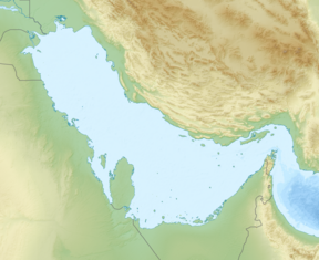 Jebel Qihwi Jebel Qihwi (Persian Gulf)  Jebel Qihwi Jebel Qihwi (West and Central Asia) | |
| Location | Musandam Governorate |
| Country | |
| Parent range | Hajar Mountains |
Jebel Qihwi or Jabal Qa'wah (Arabic: جبل قهوي, romanized: jbl qhwy) (1,735 m (5,692 ft)), along with the Jabal Al Harim (2,087 m (6,847 ft))[2] and Jabal Bil Ays / Jebel Jais (1,911 m (6,270 ft)), [3] are the three highest and most representative mountains of the Musandam Governorate, in Oman.
Jebel Qihwi has a prominence of 1,435 m (4,708 ft) and a topographic isolation of 23.36 km (14.52 mi),[1] and rises in the central area of the western boundary of the drainage divide of Karsha / Wadi Khabb Shamsi.
Its summit lies on the drainage divide, between the basins of the Wadi Khabb Shamsi (which pours into the Gulf of Oman) and the Wadi Bih, which has its main sources of origin on the southern and eastern slopes of the Jabal Al Harim (2,087 m (6,847 ft)), also in the Musandam Governorate, and pours into the Persian Gulf, landing in United Arab Emirates territory.
The steep slope of the mountain, divided into short and high steps,[4] contains two relevant peaks: the northern peak (Jebel Qihwi), and a lesser peak 450 m (1,480 ft) to the south, on which there is a weather station, is named Jabal Khabb in some maps, with an elevation of 1,708 m (5,604 ft).

At 6 km (3.7 mi) north of Jebel Qihwi is the village and mountain pass of Aqabat al Asu / Aqabat Oso,[5][6] situated also on the water divide line, at 940 m (3,080 ft).
Through this mountain pass runs a dirt road of 36 km (22 mi), called Wadi Khabb Shamsi Road, which starts at Dibba Al-Baya, and terminates at the Wadi Bih - Ras Al Khaimah Road (both ends in the Musandam Governorate), and can be used for all-terrain vehicular traffic. The route employs a good deal of the river bed of the Wadi Khabb Shamsi and some of its tributaries, and to cross the mountain range overcomes an accumulated positive slope of 1,750 m (5,740 ft) and a negative slope of 1,500 m (4,900 ft).
- ^ a b www.peakbagger. com - Jebel Qihwi, Oman
- ^ www.peakbagger. com - Jebel al Harim, Oman
- ^ www.peakbagger.com - Jabal Bil Ays, Oman
- ^ "Jebel Qihwi - Western Route - Wadi Niqab - Ben Robbins". www.wikiloc.com. Retrieved 2024-05-20.
- ^ Tribulus - Volume The Flora of the Ru'us al-Jibal -the Mountains of the Musandam Peninsula: An Annotated Checklist and Selected Observations - Gary R. Feulner - Abu Dhabi, United Arab Emirates, 2011 <https://enhg.org/Portals/1/trib/V19/TribulusV19.pdf>
- ^ www.mindat.org - ' Aqabat al 'Āsū, Musandam, Oman