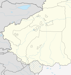
Ulugqat County[2][3][4][5] (also known as Ulughchat County[6][7] and Wuqia County;[6] Chinese: 乌恰县; pinyin: Wūqià Xiàn) is a county in Xinjiang Uygur Autonomous Region, China. It is under the administration of the Kyrgyz autonomous prefecture of Kizilsu. The county has two towns, nine townships and one state-owned farm, eight communities and 34 villages under its jurisdiction in 2017, its county seat is Wuqia Town. It contains an area of 19,118.11 km2 (7,381.54 sq mi) and has a population of 56,633 (as of 2017) with main ethnic groups of Kyrgyz, Han and Uyghur peoples.
Wuqia County is one of the two westernmost counties in China. It borders with Artux City to the east, Kashgar City to the south, Akto County to the southwest and the Kyrgyz Republic to the northwest. There are two national-level ports of Turugart (吐尔尕特口岸) and Arkaxtam (伊尔克什坦口岸), which are the link between Central and Western Asia and the bridgehead of opening up to the outside world. The county has harsh natural conditions, dry climate, earthquakes, floods, snow storms, sandstorms and other frequent natural disasters. From 1905 to the present, there have been 56 recorded earthquakes with a major earthquake of magnitude 6.0 Mw or above, and more than 20,000 earthquakes of magnitude below 6.0 Mw .
There are 11 local ethnic groups in the county, such as Kyrgyz, Han, Uyghur, Hui, Uzbek, Tajik, etc. and the Kyrgyz ethnic group accounts for about 80% of the total population of the county. Its total land area of the county is 19,118 square kilometers with an average elevation of 2,890 meters and its county seat is at 2,200 meters above sea level. Of which, mountains, Gobi and wasteland account for 99.8% of the total area; the total area of desert grassland is more than 10,667 square kilometers, arable land is 23,000 mu (1,533 hectares), per capita arable land is less than 0.5 mu (333 square meters). It is a typical plateau animal husbandry county with traditional animal husbandry as the main county.[8]
^Xinjiang: Prefectures, Cities, Districts and Counties
^Ministry of Housing and Urban-Rural Development (2010). 建筑抗震设计规范 [GB50011-2010: Code for Seismic Design of Buildings] (in English and Simplified Chinese). Beijing: China Architecture & Building Press. p. 203 – via Google Books. Ulugqat County
^Cite error: The named reference earthquake2008 was invoked but never defined (see the help page).
^Xiao-ying Chen; Yusupjan Setiwaldi; Yisilayin Osman (October 2016). "Epidemiological Studies on Echinococcosis in Kizilsu Kirgiz Autonomous Prefecture of Xinjiang". 中国寄生虫学与寄生虫病杂志. 34 (5): 409–13. PMID 30130008. Sixty-two villages were selected as investigation spots from 19 towns in agricultural and pasturing areas of Ulugqat County, Artux City, Akto County, and Akqi County during 2011-2012.{...}The morbidity(1.1%) was highest in Ulugqat County and the antibody positive rate(4.9%) in children was highest in Artux City.
^Mei Xinyu. "Gas Trade for the Better". Beijing Review. Archived from the original on 26 July 2015. Line D of the China-Central Asia gas pipeline network starts from Galkynys Gas Field of Turkmenistan, passes through Uzbekistan, Tajikistan and Kyrgyzstan, and enters China via the Ulugqat County in the south of Xinjiang Uygur Autonomous Region.
^ ab"Full Text: Employment and Labor Rights in Xinjiang". China Daily. 17 September 2020. Archived from the original on 27 September 2020. Retrieved 20 October 2020. from Wuqia (Ulughchat) County, Kizilsu Kirgiz Autonomous Prefecture,{...}from Boritokay Township, Wuqia (Ulughchat) County, Kizilsu Kirgiz Autonomous Prefecture
^"Table 1: List of Government Bids Related to Re-Education Facilities". Jamestown Foundation. Archived from the original on 20 August 2018. Retrieved 22 October 2020. Ulughchat County, Kizilsu Prefecture
Cite error: There are <ref group=lower-alpha> tags or {{efn}} templates on this page, but the references will not show without a {{reflist|group=lower-alpha}} template or {{notelist}} template (see the help page).
UlugqatCounty (also known as Ulughchat County and Wuqia County; Chinese: 乌恰县; pinyin: Wūqià Xiàn) is a county in Xinjiang Uygur Autonomous Region, China...
is a town and the county seat of UlugqatCounty in Xinjiang Uygur Autonomous Region, China. Located in the middle east of the county, the town covers an...
Ulugqat Township (ئۇلۇغچات يېزىسى Chinese: 乌鲁克恰提乡; pinyin: Wūlǔkèqiàtí Xiāng) is a township of UlugqatCounty (Wuqia) in Kizilsu Kyrgyz Autonomous Prefecture...
itself in UlugqatCounty of the Kizilsu Kirghiz Autonomous Prefecture. Distances from the pass to major cities are: 110 km (68 mi) to Ulugqat, 165 km (103 mi)...
933 (Southernmost point of continental China) West: Akto County, Xinjiang south-west of Ulugqat, on the China–Tajikistan border 39°22′48″N 73°30′00″E /...
Yarkant County, also Shache County, also transliterated from Uyghur as Yakan County, is a county in the Xinjiang Uyghur Autonomous Region, China, located...
Hejing County Yuli County Hoxud County Qiemo County Bohu County Luntai County Ruoqiang County Yanqi County Kizilsu Kyrgyz Artush city Akqi CountyUlugqat County...
Barkol Kazakh Autonomous County (sometimes Barkul or Balikul in English) is a part of Hami Prefecture in Xinjiang and has an area of 38,445.3 km2 (14,843...
Xiāng) is considered to be the westernmost township of China located in UlugqatCounty (Wuqia), Kizilsu Kyrgyz Autonomous Prefecture, Xinjiang Uygur Autonomous...
This is a list of all counties (including autonomous counties, autonomous banners, and banners) along with county-level cities (Chinese: 县级市; pinyin:...
are situated along the river Eastern Kyzyl-Suu. Simuhana belongs to UlugqatCounty, under the Kizilsu Kirghiz Autonomous Prefecture of Xinjiang. The Erkeshtam...
part of Yengisar County, became part of Akto County and Bulungkol was transferred to Akto County in Kizilsu from Tashkurgan County in today's Kashgar...
width. It borders Hoboksar Mongol Autonomous County to the northeast, Shawan County to the southeast, Toli County and Wusu to the west and Kuytun to the south...
camps in the prefecture. Turpan directly controls one district and two counties. Turpan is located about 150 km (93 mi) southeast of Ürümqi, Xinjiang's...
parts of Huocheng County after 2010 census. Kunyu CLC was established from parts of Hotan County, Pishan County, Moyu County, & Qira County after 2010 census...
early 2016, the former Hami county-level city merged with Hami Prefecture to form the Hami prefecture-level city with the county-level city becoming Yizhou...
Tashkurgan Tajik Autonomous County (often shortened to Tashkurgan County and officially spelled Taxkorgan) is an autonomous county of Kashgar Prefecture, in...
Russian: Хоргос), officially known as Korgas (from Kazakh: قورعاس), is a county-level city in Ili Kazakh Autonomous Prefecture, Xinjiang, China. It straddles...
administers the directly-administered, county-level city of Yining; 2 other county-level cities; 7 counties; 1 autonomous county; and the two prefectures of Altay...
between various groups of people on the steppes. Now administered as a county-level city, Kashgar is the administrative centre of Kashgar Prefecture,...
Ujme were transferred from Yengisar County to Akto County, as was Bulungkol from Taxkorgan Tajik Autonomous County of Kashgar Prefecture. In April 1990...
density: 2.28 per km2). As of 2020, 53.3% of the 1,509,233 residents of the county were Han Chinese, 36.4% were Uyghur, 5.3% were Hui and 4.0% were Mongol...
Altay or Aletai is a county-level city in Altay Prefecture within Ili Kazakh Autonomous Prefecture, in far Northern Xinjiang, China. The city centre is...
伊宁), also known as Ghulja (Uyghur: غۇلجا) or Kulja (Kazakh: قۇلجا), is a county-level city in Northwestern Xinjiang, China and the seat of Ili Kazakh Autonomous...
 Global Information