The Ukelayat (Russian: Укэлаят; Koryak: Вуквылгаят) is a river in Kamchatka Krai, Russia. The length of the river is 118 kilometres (73 mi) and the area of is drainage basin 6,820 square kilometres (2,630 sq mi).[1]
The name of the river comes from the Koryak "vukvylgayat"(Вуквылгаят), meaning "rock/fall".[2]
^"Река Укэлаят in the State Water Register of Russia". textual.ru (in Russian).
^Leontiev V.V. , Novikova K.A. Toponymic dictionary of the North-East of the USSR / scientific. ed. G. A. Menovshchikov ; FEB AS USSR . North-East complex. Research Institute. Lab. archeology, history and ethnography. - Magadan: Magadan . book. publishing house , 1989. - S. 290. - 456 p. — ISBN 5-7581-0044-7 .
The Ukelayat (Russian: Укэлаят; Koryak: Вуквылгаят) is a river in Kamchatka Krai, Russia. The length of the river is 118 kilometres (73 mi) and the area...
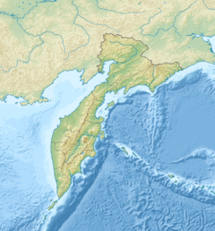
The Ukelayat Range (Russian: хребет Укэлаят) is a range of mountains in Kamchatka Krai, Russian Far East. The range is part of the Koryak Highland system...
Range (about 600 km (370 mi) long), and the Koryak Mountains, with the Ukelayat Range, Vetvey Range, Penzhinsky, Pahachinsky, Pylgin, and Olyutor ranges...
system is the 2,562-metre high (8,406 ft) Mount Ledyanaya, located in the Ukelayat Range, in the central part of the mountains. The Koryak Mountains rise...
Mountains. It is a rocky peak topped by an ice cap, part of the Ukelayat Range, in the Ukelayat river basin. List of mountains and hills of Russia Geonames...
Range Dzhugdzhur Mountains Koryak Mountains Ichigem Range Olyutor Range Ukelayat Range Komeutyuyam Range Rarytkin Range Ukvushvuynen Range The main rivers...
171°10′09″E / 61.88889°N 171.16917°E / 61.88889; 171.16917 (Ledyanaya) Ukelayat Range Koryak Mountains Kamchatka Krai Highest peak of the Koryak Mountains...
their headwaters close to the north-flowing Mayn River, as well as the Ukelayat and the Velikaya River flowing into the Bering Sea. Lantzeff speaks also...
have third quasicrystal The Penzhina-West Kamchatka folded zone and the Ukelayat-Sredinnyi block in the structure of the Koryak Highland and Kamchatka Portal:...
the south. The valley of the Pikasvayam, the largest tributary of the Ukelayat, marks its southern end. The highest point of the range is Mt Volokvyneitkon...
 Global Information