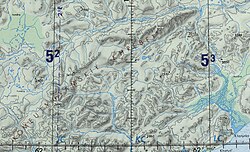
The Iomrautvaam (Russian: Иомраутваам; Chukot: Емрауткенваам) is a river in Chukotka Autonomous Okrug, Russia. The length of the river is 103 kilometres (64 mi) and the area of is drainage basin 1,310 square kilometres (510 sq mi).[1]
The Iomrautvaam is the longest tributary of the Khatyrka river.[2]
^"Река Иомраутваам (Емрауткенваам) in the State Water Register of Russia". textual.ru (in Russian).
^Cite error: The named reference NAR was invoked but never defined (see the help page).
The Iomrautvaam (Russian: Иомраутваам; Chukot: Емрауткенваам) is a river in Chukotka Autonomous Okrug, Russia. The length of the river is 103 kilometres...
метеорит Хатырка) is a meteorite found in 2011 in the valley of the Iomrautvaam, a tributary of the Khatyrka river, Chukotka Autonomous Okrug, Russian...
/ 62.65306°N 174.50056°E / 62.65306; 174.50056 in the area of the Iomrautvaam, a tributary of the Khatyrka river, in the Koryak Mountains, in Anadyrsky...
khatyrkite (CuAl2). Both minerals are thus far restricted to the area of the Iomrautvaam, in the Khatyrka ultramafic (silicon-poor) zone of the Koryak–Kamchatka...
144 metres (3,753 ft) in the Topographic USSR Chart. Rivers Opuka and Iomrautvaam have their sources in the southern slopes of the Komeutyuyam and the...
 Global Information