Global Information Lookup Global Information

UMhlabuyalingana Local Municipality information


uMhlabuyalingana
Local municipality
Official seal of uMhlabuyalingana
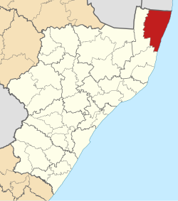
Location of UMhlabuyalingana Local Municipality within KwaZulu-Natal
Coordinates: 27°1′S 32°44′E / 27.017°S 32.733°E / -27.017; 32.733
CountrySouth Africa
ProvinceKwaZulu-Natal
DistrictuMkhanyakude
SeatKwangwanase
Wards17
Government
[1]
 • TypeMunicipal council
 • MayorD. A. Ncube
Area
 • Total3,964 km2 (1,531 sq mi)
Population
 (2011)[2]
 • Total156,736
 • Density40/km2 (100/sq mi)
Racial makeup (2011)
[2]
 • Black African99.3%
 • Coloured0.1%
 • Indian/Asian0.1%
 • White0.3%
First languages (2011)
[3]
 • Zulu95.7%
 • English1.2%
 • Southern Ndebele1.0%
 • Other2.1%
Time zoneUTC+2 (SAST)
Municipal codeKZN271

uMhlabuyalingana Municipality (Zulu: UMasipala wakwa Mhlabuyalingana) is a local municipality within the uMkhanyakude District Municipality, in the northeastern part of the KwaZulu-Natal province of South Africa. The municipality is one of the poorest in the country. It encompasses a World Heritage Site and several areas under environmental protection.[4] Areas of conservation and environmental interest within or adjacent to the uMhlabuyalingana area include the Tembe Elephant Park, iSimangaliso Wetland Park (a World Heritage Site), the Suni-Ridge Sand Forest Park, and the Phongolo Nature Reserve.

The municipality was approximately 98% rural in 2001, with a population of 140,963 inhabitants according to Statistics South Africa. The municipality is made up of at least 99% Black South Africans, most of whom are isiZulu-speaking. The population is very young: 44% were younger than 15, and 77% were younger than 35 years old. Because of its youth, the population is particularly vulnerable to the impact of HIV/AIDS.[4] Towns and major settlement nodes in the area include Emanguzi, Mbazwana, Kwangwanase, Maputa, Mboza, Mseleni and Skhemelele.

  1. ^ "Contact list: Executive Mayors". Government Communication & Information System. Archived from the original on 14 July 2010. Retrieved 22 February 2012.
  2. ^ a b "Statistics by place". Statistics South Africa. Retrieved 27 September 2015.
  3. ^ "Statistics by place". Statistics South Africa. Retrieved 27 September 2015.
  4. ^ a b Integrated Development Plan 2008-2009. uMhlabuyalingana Local Municipality. Retrieved on Oct 12, 2009.

and 14 Related for: UMhlabuyalingana Local Municipality information

Request time (Page generated in 0.8141 seconds.)

UMhlabuyalingana Local Municipality

Last Update:

uMhlabuyalingana Municipality (Zulu: UMasipala wakwa Mhlabuyalingana) is a local municipality within the uMkhanyakude District Municipality, in the northeastern...

Word Count : 479

UMhlabuyalingana Local Municipality elections

Last Update:

The uMhlabuyalingana Local Municipality council consists of thirty-five members elected by mixed-member proportional representation. Eighteen councillors...

Word Count : 299

Mbazwana

Last Update:

Mbazwana is a town in Umhlabuyalingana Local Municipality and is part of Umkhanyakude District Municipality in the KwaZulu-Natal province of South Africa...

Word Count : 80

List of municipalities in South Africa

Last Update:

of the country is divided into district municipalities, each of which consists of several local municipalities. Since the boundary reform at the time of...

Word Count : 229

Umkhanyakude District Municipality

Last Update:

of Eswatini to the north-west The district contains the following local municipalities: The following statistics are from the 2001 census. Election results...

Word Count : 317

Ethnic groups in South Africa by municipality

Last Update:

Ethnic groups in South Africa by municipality details the ethnic composition of South Africa by municipality, according to the 2011 census. Demographics...

Word Count : 39

Kwangwanase

Last Update:

also known as Kosi Bay Town, is a small town in Umkhanyakude District Municipality in the KwaZulu-Natal province of South Africa. It is located some 15 km...

Word Count : 172

Inkatha Freedom Party

Last Update:

(Accessed 3 May 2009.) IFP. "IFP Calls for Forensic Audit into uMhlabuyalingana Municipality". Durban: IFP Press Statement, 9 April 2009. IFP. "IFP National...

Word Count : 3047

Sifiso Mlungwana

Last Update:

Sifiso Mlungwana (born 27 April 1997) is a South African soccer player currently playing as a goalkeeper for Lamontville Golden Arrows. As of 14 July 2021...

Word Count : 39

2021 South African municipal elections

Last Update:

November 2021, to elect councils for all district, metropolitan and local municipalities in each of the country's nine provinces. It is the sixth municipal...

Word Count : 9541

Mseleni

Last Update:

Mseleni is a small settlement in Umhlabuyalingana Maputaland, northern KwaZulu-Natal, South Africa. It is situated not far away from the small town of...

Word Count : 268

2016 South African municipal elections

Last Update:

August 2016, to elect councils for all district, metropolitan and local municipalities in each of the country's nine provinces. It was the fifth municipal...

Word Count : 3390

2011 South African municipal elections

Last Update:

West Local Municipality, and was the largest party in the Cederberg Local Municipality but did not hold a majority there. Five local municipalities were...

Word Count : 1686

List of territorial disputes

Last Update:

KaNgwane, which now forms the northern parts of Jozini and uMhlabuyalingana local municipalities in KwaZulu-Natal, and the southern part of Nkomazi, the...

Word Count : 4415

PDF Search Engine © AllGlobal.net