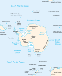
Totten Glacier is a large glacier draining a major portion of the East Antarctic Ice Sheet, through the Budd Coast of Wilkes Land in the Australian Antarctic Territory. The catchment drained by the glacier is estimated at 538,000 km2 (208,000 sq mi),[1] extending approximately 1,100 km (680 mi) into the interior and holds the potential to raise sea level by at least 3.5 m (11 ft).[2] Totten drains northeastward from the continental ice but turns northwestward at the coast where it terminates in a prominent tongue close east of Cape Waldron. It was first delineated from aerial photographs taken by USN Operation Highjump (1946–47), and named by Advisory Committee on Antarctic Names (US-ACAN) for George M. Totten, midshipman on USS Vincennes of the United States Exploring Expedition (1838–42), who assisted Lieutenant Charles Wilkes with correction of the survey data obtained by the expedition.
Totten Ice Shelf is a 6,200 km2 (2,400 sq mi) floating portion of Totten Glacier, laterally bounded by the Aurora Subglacial Basin to the south and Law Dome to the north. The ice shelf exists at the confluence of the two main grounded tributaries of Totten Glacier, its base lies 2,500 m (8,200 ft) below sea level near the grounding line of the western tributary, and the ice shelf surface is characterized by longitudinal channels and transverse fractures.[3][4] Totten Ice Shelf is of glaciological interest because it buttresses the flow of grounded ice while coupling the ice basin to ocean processes such as ocean warming.[5][6]
Totten Glacier Tongue (66°35′S116°5′E / 66.583°S 116.083°E / -66.583; 116.083) is a small glacier tongue extending seaward from Totten Glacier. Delineated from air photos taken by U.S. Navy Operation Highjump (1946–47) and named by US-ACAN in association with Totten Glacier.
^Roberts, Jason; et al. (2011). "Refined broad-scale sub-glacial morphology of Aurora Subglacial Basin and East Antarctica derived by an ice-dynamics-based interpolation scheme". The Cryosphere. 5 (3): 551–560. Bibcode:2011TCry....5..551R. doi:10.5194/tc-5-551-2011. hdl:2152/41173.
^Greenbaum, J. S.; Blankenship, D. D.; Young, D. A.; Richter, T. G.; Roberts, J. L.; Aitken, A. R. A.; Legresy, B.; Schroeder, D. M.; Warner, R. C. (2015). "Ocean access to a cavity beneath Totten Glacier in East Antarctica". Nature Geoscience. 8 (4): 294–298. Bibcode:2015NatGe...8..294G. doi:10.1038/ngeo2388. ISSN 1752-0908.
^Greene, C. A.; Blankenship, D. D. (2018). "A Method of Repeat Photoclinometry for Detecting Kilometer-Scale Ice Sheet Surface Evolution". IEEE Transactions on Geoscience and Remote Sensing. 56 (4): 2074–2082. Bibcode:2018ITGRS..56.2074G. doi:10.1109/TGRS.2017.2773364. ISSN 0196-2892. S2CID 4348022.
^Dow, Christine F.; Lee, Won Sang; Greenbaum, Jamin S.; Greene, Chad A.; Blankenship, Donald D.; Poinar, Kristin; Forrest, Alexander L.; Young, Duncan A.; Zappa, Christopher J. (2018-06-01). "Basal channels drive active surface hydrology and transverse ice shelf fracture". Science Advances. 4 (6): eaao7212. Bibcode:2018SciA....4.7212D. doi:10.1126/sciadv.aao7212. ISSN 2375-2548. PMC 6007161. PMID 29928691.
^Cite error: The named reference :4 was invoked but never defined (see the help page).
^Greene, Chad A.; Young, Duncan A.; Gwyther, David E.; Galton-Fenzi, Benjamin K.; Blankenship, Donald D. (2018-09-06). "Seasonal dynamics of Totten Ice Shelf controlled by sea ice buttressing". The Cryosphere. 12 (9): 2869–2882. Bibcode:2018TCry...12.2869G. doi:10.5194/tc-12-2869-2018. ISSN 1994-0416.
TottenGlacier is a large glacier draining a major portion of the East Antarctic Ice Sheet, through the Budd Coast of Wilkes Land in the Australian Antarctic...
Thwaites Glacier "ice shelf melt rate of 207 m/year in 2014–2017, which is the highest ice shelf melt rate on record in Antarctica." TottenGlacier is a large...
Totten may refer to: Totten (mountain), a mountain in Hemsedal, Norway Fort Totten (disambiguation) TottenGlacier, Antarctica Totten Inlet, Puget Sound...
honor George M. Totten, one of the expedition's midshipmen. TottenGlacier on the Budd Coast of Antarctica is also named for George Totten. "About Taylor...
support from the local sea ice, such as Denman Glacier, and TottenGlacier. TottenGlacier is particularly important because it stabilizes the Aurora Subglacial...
Denman Glacier have contributed to a shift in the perception of change in East Antarctica, along with changes observed at TottenGlacier and glaciers at Vincennes...
of the East Antarctic Ice Sheet would not be affected. TottenGlacier is the largest glacier there which is known to be subject to MISI - yet, its potential...
see sustained losses of ice at its most vulnerable locations such as TottenGlacier and Wilkes Basin. Those areas are sometimes collectively described as...
is bounded by the TottenGlacier to the east and the Vanderford Glacier to the west. The dome itself is host to the Williamson Glacier and several other...
sheet instability. The Aurora Subglacial Basin is drained in part by TottenGlacier, which responds readily to melt induced by upwelling of warm circumpolar...
the significant erosion of the so-called subglacial basins, such as TottenGlacier and Wilkes Basin, which are located in vulnerable locations below the...
533) is an ice-covered point about 42 nautical miles (78 km) east of TottenGlacier, Wilkes Land, Antarctica. It was photographed by U.S. Navy Operation...
per watt than all commercially available GPUs and FPGA." A study of TottenGlacier, East Antarctica's largest outlet of ice, reveals that its melting could...
467; 115.050) is an ice-covered cape midway between Williamson Glacier and TottenGlacier on Budd Coast, Antarctica. It was delineated by G.D. Blodgett...
for the entire ice sheet to be lost. Yet, some of its parts, such as TottenGlacier and Wilkes Basin, are located in vulnerable locations below the sea...
567; 115.550) is an ice-covered cape in Antarctica, just westward of TottenGlacier. It was delineated by G.D. Blodgett (1955) from aerial photographs taken...
unexplored regions of Antarctica, including TottenGlacier and the Aurora Subglacial Basin, Byrd Glacier and the Wilkes Subglacial Basin, and Princess...
(220 km) long, which fringes the Sabrina Coast of Antarctica between TottenGlacier and Paulding Bay. Dalton Iceberg Tongue extends north from the eastern...
glacial and interglacial conditions off the coast of Antarctica near the TottenGlacier, Sabrina Coast, East Antarctica, in 2017. In 2018 Armand joined the...
D.; Siegert, M. J. (April 2015). "Ocean access to a cavity beneath TottenGlacier in East Antarctica". Nature Geoscience. 8 (4): 294–298. Bibcode:2015NatGe...
the nature of this ice coastline. "AVIATION MAP - CAPE PEREMENNYY TO TOTTENGLACIER" (PDF). Australian Antarctic Data Centre. 1 December 2011. Retrieved...
Archived from the original on 26 December 2018. Retrieved 30 November 2015. Totten, Kristy (31 May 2016). "Nevada Is Home To A Micronation—But Don't Tell The...
ice may be contrasted with icebergs, which are chunks of ice shelves or glaciers that calve into the ocean. Depending on location, sea ice expanses may...
Lincoln Square". Phillyvoice. 18 September 2018. Retrieved 2018-12-06. Totten, Steven (18 April 2017). "Investigation finds starving chickens at Sprouts...
 Global Information