This article contains Khmer text. Without proper rendering support, you may see question marks, boxes, or other symbols instead of Khmer script.
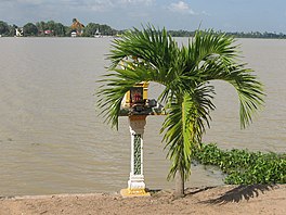
Tonle Bati (Khmer: ទន្លេបាទី) is a small lake about 30 km south of Phnom Penh, the capital of Cambodia. It is a popular weekend destination for the local population. It is also a popular fishing spot for both tourists and people who live locally.
Close to the lake, there is the Ta Prohm of Bati, one of several shelters built in Cambodia and Thailand during the reign of Jayavarman VII to house the Jayabuddhamahanatha statues.[1]: 175–176 It is located off the highway to Takéo Province.
The word Jayabuddhamahanatha means "Victory-Buddha-Great Saviour" and may refer to the defeat of the Chams by the king Jayavarman VII.[2][3] A similar sculpture was found at the Vihar Prampil Lvengo on the Avenue of Victory at Angkor Thom.[4]
20 minutes south of the lake there is another temple called Phnom Chisor (Khmer: ភ្នំជីសូរ). It is situated on a mountain top which requires a visitor to climb 461 steps.
^Coedès, George (1968). Walter F. Vella (ed.). The Indianized States of Southeast Asia. trans.Susan Brown Cowing. University of Hawaii Press. ISBN 978-0-8248-0368-1.
^Huu Phuoc Le (2010). Buddhist Architecture. Grafikol. p. 265. ISBN 9780984404308. OCLC 639315496.
^Southeast Asia: A Historical Encyclopedia, from Angkor Wat to East Timor. Santa Barbara, CA: ABC-CLIO. 2004. p. 696. ISBN 9781576077702. OCLC 1000411290. Retrieved January 1, 2020. Quote: possibly representing the king as Buddha and intended as symbolic of his rule over the locations concerned.
^Exploring the World Heritage sites of Cambodia, Laos and Viet Nam. UNESCO Publishing. May 29, 2017. ISBN 9789230000202 – via archive.is. {{cite book}}: External link in |via= (help)
see question marks, boxes, or other symbols instead of Khmer script. TonleBati (Khmer: ទន្លេបាទី) is a small lake about 30 km south of Phnom Penh, the...
from the great lake of Tonle Sap. He also established the city of Hariharalaya (now known as Roluos) at the northern end of Tonlé Sap. Through a program...
The route has been suggested to span 35 km (22 mi) along a canal towards Tonlé Sap lake, another 35 km (22 mi) crossing the lake, and finally 15 km (9 mi)...
Yasovarman's reign. The other two are Phnom Krom to the south near the Tonle Sap lake, and Phnom Bok, northeast of the East Baray reservoir. Workers...
លិង្គសិវៈ); in the eastern part of the southern gallery, a naval battle on the Tonle Sap (Khmer: ទន្លេសាប) between Khmer and Cham forces, underneath which are...
from the now-defunct quarries on Phnom Krom to Siem Reap. Tonle Sap lake and Phnom Krom hill Tonle Sap lake and Chong Kneas village viewed from Phnom Krom...
capital of the Khmer Empire had changed back to the plains north of the Tonle Sap-lake, more temples were built at the site of Koh Ker. An inscription...
into the Siem Reap River and Puok River, which eventually flows into the Tonlé Sap Lake after passing through the plains and the Angkor temple complex...
area. The ancient city of Angkor during the Khmer Empire extended from Tonle Sap to the Kulen hills covering a vast area of 1,000 square kilometres (390 sq mi)...
 Global Information