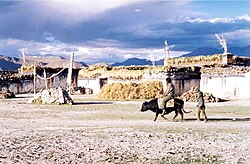
Tingri County (Tibetan: དིང་རི་རྫོང་།; Chinese: 定日县) is a county under the administration of the prefecture-level city of Xigazê in the Tibet Autonomous Region of China.[2]
The county comprises the upper valley of the Bum-chu or Arun River, with the valleys of its tributaries, the valleys of the Rongshar Tsangpo and the Lapchi Gang Tsanpo which flow south into Nepal. It is bordered on the south by the main range of the Himalayas, including Mount Everest (Tib. Chomolungma), Makalu and Cho Oyu. The present county administration is located at Shelkar, about 87 km (54 mi) east of Tingri (town).[3]
Tingri is one of the four counties (the other three being Dinjie, Nyalam, and Kyirong) that comprise the Qomolangma National Nature Preserve,[4] a protected area spanning 3.381 million hectares.
^"日喀则市第七次全国人口普查主要数据公报" (in Chinese). Government of Xigazê. 2021-07-20.
^Croddy, E. (2022). China’s Provinces and Populations: A Chronological and Geographical Survey. Springer International Publishing. p. 698. ISBN 978-3-031-09165-0. Retrieved 2024-03-07.
^Footprint Tibet Handbook with Bhutan, p. 296. 2nd edition (1999). Gyume Dorje. Footprint Handbooks, Bath, England. ISBN 1-900949-33-4.
^Department of Forestry, Government of the Tibet Autonomous Region, People's Republic of China, ‘’Report on Protected Lands in the Tibet Autonomous Region’’ Lhasa: Tibet Autonomous Region Government Publishing House, 2006
TingriCounty (Tibetan: དིང་རི་རྫོང་།; Chinese: 定日县) is a county under the administration of the prefecture-level city of Xigazê in the Tibet Autonomous...
Shigatse Tingri Airport, also called Rikaze Tingri Airport (IATA: DDR, ICAO: ZUDR) is a high-altitude airport in TingriCounty, Shigatse, Tibet Autonomous...
Look up Tingri in Wiktionary, the free dictionary. Tingri may refer to: TingriCounty, county in Tibet Tingri (town), main town in TingriCounty Tingry...
There are two base camps on Mount Everest, on opposite sides of the mountains: South Base Camp is in Nepal at an altitude of 5,364 metres (17,598 ft) (28°0′26″N...
towns in the prefecture are: Gyantse (Gyantse County), Tingri (TingriCounty), and Nyalam (Nyalam County). On 11 July 2014 Shigatse Prefecture was upgraded...
out of the main north-south trending ridge of the Rolwaling Himal, in TingriCounty, Shigatse Prefecture of Tibet. To the southwest, across the Menlung...
first celibate monastery in Solu-Khumbu. Sherpa people also live in TingriCounty, Bhutan, and the Indian states of Sikkim and the northern portion of...
Bhojpur, Tehrathum, Dhankuta, Solukhumbu and Taplejung in Koshi Province. TingriCounty of Shigatse Prefecture in the Tibet Autonomous Region of China borders...
Tibet Autonomous Region of China Nyalam CountyTingriCounty Nepal Kosi Zone Sagarmatha Zone Bihar, India Darbhanga division Kosi division Purnia division...
Show map of Asia Location Solukhumbu District, Koshi Province, Nepal; TingriCounty, Xigazê, Tibet Autonomous Region, China Countries China and Nepal Parent...
the Guandi Temple of Qomolangma (Mount Everest), on Ganggar Mount, in TingriCounty. There are four mosques in the Tibet Autonomous Region with approximately...
ཤེལ་དཀར་, "white crystal") also called New Tingri[citation needed], is the administrative centre for TingriCounty, Shigatse Prefecture in southern Tibet...
Tibetan). The paved road branches from China National Highway 318 at TingriCounty, Tibet Autonomous Region and moves through the Qomolangma National Nature...
Everest, Solukhumbu District, Sagarmatha Zone, Nepal; Mount Everest, TingriCounty, Xigazê, Tibet Autonomous Region, China Parent range Mahalangur Himal...
Tibet Autonomous Region of China Nyalam CountyTingriCounty Nepal Kosi Zone Sagarmatha Zone Bihar, India Darbhanga division Kosi division Purnia division...
and China Districts Solukhumbu District, Sankhuwasabha District and TingriCounty Range coordinates 27°55′N 86°45′E / 27.917°N 86.750°E / 27.917; 86...
Tibet Autonomous Region of China Nyalam CountyTingriCounty Nepal Kosi Zone Sagarmatha Zone Bihar, India Darbhanga division Kosi division Purnia division...
Tibet Autonomous Region of China Nyalam CountyTingriCounty Nepal Kosi Zone Sagarmatha Zone Bihar, India Darbhanga division Kosi division Purnia division...
86.9333 Geography Lhotse Solukhumbu District, Sagarmatha Zone, Nepal TingriCounty, Shigatse Prefecture, Tibet Autonomous Region, China Show map of Koshi...
one of the four counties that comprise the Qomolangma National Nature Preserve (Nyalam, Tingri, Dinggyê, and Kyirong). Nyalam County is divided into 2...
Qiang or Tibetan ethnicity "more than two thousand miles northwest of Shu County". Fu state was pronounced as "bod" or "phyva" in Archaic Chinese. Whether...
Jomda County (Tibetan: འཇོ་མདའ་རྫོང་; Chinese: 江达县) is a county of the Chamdo Prefecture in the Tibet Autonomous Region, China. Jomda is divided in 2...
Tibet Autonomous Region of China Nyalam CountyTingriCounty Nepal Kosi Zone Sagarmatha Zone Bihar, India Darbhanga division Kosi division Purnia division...
 Global Information