Shap Rural is a very large, but sparsely populated, civil parish in the Eden district of Cumbria in England, covering part of the Lake District National Park. It had a population of 119 in 2001,[2] 130 at the 2011 Census,[1] and 110 in 2021.[3]
Within the parish are the hamlets and settlements of Wet Sleddale, Hardendale and Swindale, most of the Shap Fells range and the reservoirs of Haweswater (part) and Wet Sleddale. The village of Mardale Green, which disappeared when Haweswater was converted into a reservoir in the 1930s, was in the parish.
The parish was created in 1904 with the splitting of the former civil parish of Shap into urban and rural parts.[4] Shap Urban, (since 1935 just Shap), was administered by an urban district council from 1905 to 1935.[5] Shap and Shap Rural today have a joint parish council.
Major landowners in the parish are the Lowther Family Estates and United Utilities.
Junction 39 of the M6 motorway lies within the parish.
Shapbeck Limestone quarry owned by Hanson plc is in the northern part of the parish though the Hardendale Corus limestone quarry and works and the famous Cemex (formerly RMC) Shap Granite quarries and works are within both Shap Rural and Shap parishes.
The cottage owned by Uncle Monty in the cult 1986 film Withnail & I is located by the reservoir at Wet Sleddale.[6]
^ abUK Census (2011). "Local Area Report – Shap Rural Parish (E04002569)". Nomis. Office for National Statistics. Retrieved 20 April 2021.
^UK Census (2001). "Local Area Report – Shap Rural Parish (16UF060)". Nomis. Office for National Statistics. Retrieved 20 April 2021.
^"Shap Rural custom area profile". ONS. Retrieved 4 March 2024.
^"West Ward Registration District". UKBMD. Retrieved 12 January 2022.
^"Relationships and changes Shap UD through time". A Vision of Britain through Time. Retrieved 6 November 2022.
^Tyzack, Anna (21 January 2009). "Withnail's 'Horrible little shack' under the hammer". London: Telegraph.co.uk. Archived from the original on 23 January 2009. Retrieved 27 September 2011.
ShapRural is a very large, but sparsely populated, civil parish in the Eden district of Cumbria in England, covering part of the Lake District National...
Shap is a village and civil parish located among fells and isolated dales in Westmorland and Furness, Cumbria, England. The village is in the historic...
of the River Lowther in the civil parish of ShapRural, around 1.5 miles (2.4 km) from the village of Shap, in the Eden District of Cumbria, England. The...
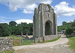
ShapRural is a civil parish in the Eden District, Cumbria, England. It contains eleven listed buildings that are recorded in the National Heritage List...
Hardendale is a hamlet in the parish of ShapRural in the Eden District, in the county of Cumbria, England, near Shap and junction 39 of the M6 motorway....
through Tebay, Orton, Eden, Hoff and Burrells B6261 A685, Gaisgill A6, ShapRural, Shap Passes through Orton, Eden and Oddendale B6262 A6, Eamont Bridge A66...
established elected parish councils in all rural parishes with more than 300 electors; grouped rural parishes into Rural Districts; and aligned parish boundaries...
RDs East Westmorland RD, most of West Ward RD and Shap UD were merged to form North Westmorland Rural District South Westmorland RD absorbed Kirkby Lonsdale...
borders the parishes of Skelsmergh and Scalthwaiterigg, Longsleddale, ShapRural, Orton, Whinfell and Strickland Roger. The population of "Whitwell and...
under a County Review Order it merged with Shap UDC and East Westmorland RDC to become North Westmorland Rural District except for the parish of Patterdale...
1935 by the merger of the East Westmorland Rural District, Shap urban district and most of West Ward Rural District. [1] The district entirely surrounded...
Strickland Roger to the south west, Kentmere and Longsleddale to the west and ShapRural to the north. The main settlement was the village of Selside. In 2001...
Shap Pat Heung Rural Committee Kung Yik She Secondary School is an aided Hong Kong secondary school founded in September 1996. Located at Tin Shing Road...
states of Telangana, and Andhra Pradesh (India), toddy is a popular drink in rural parts that is frequently consumed at the end of the day after work. There...
Rural committees (Chinese: 鄉事委員會) are bodies representing the welfare of indigenous residents in the New Territories of Hong Kong. The chairman of each...
villages represented within the Shap Pat Heung Rural Committee. For electoral purposes, Tong Tau Po Tsuen is part of the Shap Pat Heung East constituency...
bypassing Shap to the east and west, and the Shap summit route finally chosen. After a lengthy Parliamentary inquiry, the longer and steeper route over Shap Fell...
Shap Sze Heung, sometimes transliterated as Shap Sz Heung (Chinese: 十四鄉; lit. 'Fourteen Townships'), is an area in Hong Kong located in the northern part...
2019 Hong Kong Rural Representative election was held in January 2019 to elect 1,540 Rural Representatives in the New Territories of Hong Kong. This is...
Representatives [原居民代表], No. of Resident Representatives [居民代表]) in the Tsing Yi Rural Committee. The villages with no bracketed numbers have no representatives...
Shap Pat Heung is an area in the New Territories of Hong Kong. Located south of Yuen Long and northeast of Tai Tong, the area occupies the plain north...
Science Park Pat Sin Leng Ping Chau Plover Cove Science Park Pak Shek Kok Shap Sze Heung Tai Po Tai Wo Estate Tai Po Industrial Estate Tai Po Kau Ting Kok...
enforce the law firmly. Before the demonstration, the chairperson of Shap Pat Heung Rural Committee threatened that villagers had been overwhelmed and surrounded...
the English county of Cumbria, England. Its closest major settlements are Shap, Appleby-in-Westmorland, and Penrith. Nearby lies the village of Sleagill...
Director Award in 1955. The very same year, he scored music for a Bengali movie Shap Mochan in which he played back four songs for the Bengali actor Uttam Kumar...
 Global Information