Global Information Lookup Global Information

Sassafras River information


Sassafras River
Tributary to Chesapeake Bay
A view of the Sassafras on a windy day with the northern shore in the background
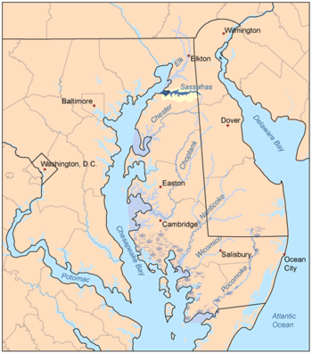
The Sassafras River and its watershed is highlighted in yellow on this map of the rivers of the Eastern Shore of Maryland
Location
CountryUnited States
StateMaryland
Delaware
CountiesCecil (MD)
Kent (MD)
New Castle (DE)
Physical characteristics
Sourcedivide between Sassafras River and Blackbird Creek
 • locationabout 0.5 miles ENE of Vandyke, Delaware[1]
 • coordinates39°21′54″N 075°43′59″W / 39.36500°N 75.73306°W / 39.36500; -75.73306[2]
 • elevation80 ft (24 m)[1]
MouthChesapeake Bay
 • location
Betterton, Maryland[1]
 • coordinates
39°23′14″N 076°03′13″W / 39.38722°N 76.05361°W / 39.38722; -76.05361[2]
 • elevation
0 ft (0 m)[1]
Length18.98 mi (30.55 km)[3]
Basin size91.88 square miles (238.0 km2)[4]
Discharge 
 • locationChesapeake Bay
 • average109.27 cu ft/s (3.094 m3/s) at mouth with Chesapeake Bay[4]
Basin features
ProgressionChesapeake Bay → Atlantic Ocean
River systemChesapeake Bay
Tributaries 
 • leftHerring Branch
Jacobs Creek
Swantown Creek
Mill Creek
Dyer Creek
Woodland Creek
Freeman Creek
Turner Creek
Lloyd Creek
 • rightDuffy Creek
Hen Island Creek
Hall Creek
Back Creek
Foreman Creek
Cox Creek
Money Creek

The Sassafras River is a tributary of the Chesapeake Bay on the Delmarva Peninsula in the United States. It is approximately 22 miles (35 km) long[5] and starts in western New Castle County, Delaware, and along the boundary between Cecil County, Maryland on the north and Kent County, Maryland on the south. It rises southwest of Middletown, Delaware and ends at the Chesapeake Bay in a wide mouth between Howell Point near Betterton, Maryland and Grove Point on Grove Neck.

It is south of the Elk River and north of the Chester River. The Sassafras River is entirely within the coastal plain. Its watershed area (including the water surface) is 97 square miles (250 km2), with 83 square miles (210 km2) of land. Thus, its total watershed area is 14% water.

There are several small creeks on the northern shore of the Sassafras River, including Money Creek, Cox Creek, Foreman Creek, Back Creek, McGill Creek, Dowdel Creek, Hall Creek, and Duffy Creek. On the southern shore small creeks include Lloyd Creek, Turner's Creek, Freeman Creek, Woodland Creek, Dyer Creek, Mill Creek, Swantown Creek, Jacobs Creek, and Herring Branch.

On the 1612 John Smith map of the area, it was called the Tockwogh River.

  1. ^ a b c d "Sassafras River Topo Map, Cecil County MD (Spesutie Area)". TopoZone. Locality, LLC. Retrieved 12 August 2019.
  2. ^ a b "GNIS Detail - Sassafras River". geonames.usgs.gov. US Geological Survey. Retrieved 12 August 2019.
  3. ^ "ArcGIS Web Application". epa.maps.arcgis.com. US EPA. Retrieved 12 August 2019.
  4. ^ a b "Sassafras River Watershed Report". Waters Geoviewer. US EPA. Retrieved 12 August 2019.
  5. ^ U.S. Geological Survey. National Hydrography Dataset high-resolution flowline data. The National Map, accessed April 1, 2011

and 18 Related for: Sassafras River information

Request time (Page generated in 0.7873 seconds.)

Sassafras River

Last Update:

The Sassafras River is a tributary of the Chesapeake Bay on the Delmarva Peninsula in the United States. It is approximately 22 miles (35 km) long and...

Word Count : 737

List of rivers of Maryland

Last Update:

Corsica River Cypress Branch Andover Branch Sewell Branch Sassafras River Elk River Bohemia River Big Elk Creek Little Elk Creek North East River North...

Word Count : 1263

Sassafras Mountain

Last Update:

Sassafras Mountain is the highest point in the state of South Carolina, United States. It is in the Blue Ridge Mountains, part of the Appalachian Mountains...

Word Count : 486

Chester River

Last Update:

located south of the Sassafras River and north of Eastern Bay, and is connected with Eastern Bay through Kent Narrows. The Chester River begins at Millington...

Word Count : 539

Tockwogh

Last Update:

The Tockwogh were an Algonquian tribe living in the region of the Sassafras River in what are now Cecil and Kent counties in Maryland. The name Tockwogh...

Word Count : 195

Oolenoy River

Last Update:

The Oolenoy River is a minor tributary of the Saluda River sourced near Sassafras Mountain in northern Pickens County, South Carolina. Approximately 37...

Word Count : 65

List of War of 1812 battles

Last Update:

conducted by a landing party from HMS Mohawk on two villages on the Sassafras River flowing into the northeast corner of Chesapeake Bay. The landing party...

Word Count : 9805

List of Chesapeake Bay rivers

Last Update:

River Sassafras River Elk River (Maryland) North East River Principio Creek Swan Creek Romney Creek Bush River (Maryland) Gunpowder River Middle River (Maryland)...

Word Count : 865

List of rivers of Delaware

Last Update:

Murderkill River Naamans Creek Nanticoke River Pepper Creek Pocomoke River Red Clay Creek St. Jones River Sassafras River Shellpot Creek Simons River Smyrna...

Word Count : 3089

Maryland Route 292

Last Update:

runs 4.58 miles (7.37 km) from MD 298 near Still Pond north to the Sassafras River in Betterton in northern Kent County. MD 292 was constructed in the...

Word Count : 819

List of islands of Maryland

Last Update:

Chesapeake Bay and its many tributary tidal rivers, creeks and bays; as well as within larger whitewater rivers like the upper Potomac. These Islands are...

Word Count : 127

Harmful algal bloom

Last Update:

organisms.: 246  Harmful algal blooms in freshwater lakes and rivers, or at estuaries, where rivers flow into the ocean, are caused by cyanobacteria, which...

Word Count : 18138

Ellipsoptera puritana

Last Update:

peaked in 1998 with a population size of almost 10,000, while the Sassafras river population dropped to below 500 in the early 2000’s. The Connecticut...

Word Count : 1414

Maryland Route 213

Last Update:

before crossing the Sassafras River on a drawbridge near a marina. MD 213 enters Cecil County upon crossing the Sassafras River, where it continues north...

Word Count : 3626

Maryland Route 282

Last Update:

282 is the primary east–west highway of the Sassafras Neck between the Sassafras River and Bohemia River, connecting Crystal Beach, Earleville, and Warwick...

Word Count : 1522

List of Maryland state parks

Last Update:

Carroll 2,000 acres 809.4 ha 1975 Sassafras Natural Resources Management Area Kent 1,200 acres 485.6 Sassafras River, Chesapeake Bay Hiking, mountain biking...

Word Count : 193

List of Maryland Scenic Byways

Last Update:

where MD 282 heads west to Crystal Beach on the Elk River. The road crosses the Sassafras River and passes through Georgetown, a community that was burned...

Word Count : 7568

List of longest rivers in the United States by state

Last Update:

Marshyhope Creek – 37 miles (60 km) Christina River – 35 miles (56 km) Sassafras River – 22 miles (35 km) Murderkill River – 22 miles (35 km) Brandywine Creek –...

Word Count : 4253

PDF Search Engine © AllGlobal.net