Northern Adelaide, Barossa Light and Lower North[2]
Major suburbs / towns
Angle Vale, Penfield
Highway system
Highways in Australia
National Highway • Freeways in Australia
Highways in South Australia
----
Infobox instructions
guidelines
examples
talk
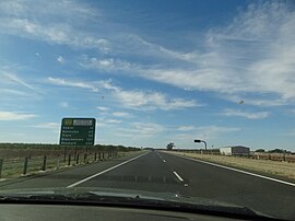
Northern Expressway, also known as the Fatchen Northern Expressway,[3][4] is a 21 kilometre long controlled-access highway in Adelaide, South Australia. Since March 2020, the North–South Motorway continues west of Port Wakefield Highway and intersects the Port River Expressway to reach the harbour at Port Adelaide. These are the northernmost two parts of the North–South Corridor.
Cycling is not permitted on the Expressway. The Stuart O'Grady Bikeway is a sealed shared cycling and walking path adjacent to the eastern side of the expressway. The northern end connects to the on-ramp from Two Wells Road to the Gawler Bypass Road, and the southern end is adjacent to Port Wakefield Road at Mill Road.
^Google (29 June 2022). "Northern Expressway" (Map). Google Maps. Google. Retrieved 29 June 2022.
^"Location SA Map viewer with regional layers". Government of South Australia. Retrieved 16 June 2022.
^"'Fatchen' a tourist name". The Bunyip. 28 May 2014. Retrieved 20 January 2017.
^"More than memory lane: Fatchen's expressway". ABC News. 6 November 2013. Retrieved 28 December 2013.
and 14 Related for: Northern Expressway information
NorthernExpressway, also known as the Fatchen NorthernExpressway, is a 21 kilometre long controlled-access highway in Adelaide, South Australia. Since...
named the "Southeast Expressway", while the portion from Boston to the New Hampshire state line is named the "NorthernExpressway". I-93 ends in Saint...
The Northern Airport Expressway, officially numbered S28, is an 11.29 km toll road extension that runs from G45 Daqing–Guangzhou Expressway (formerly...
connecting the Southern Expressway and the NorthernExpressway via a motorway with no traffic lights. As of 2020 the motorway's northern half is complete (save...
South Expressway from Johor Bahru to Taiping. The northern terminus of the expressway will be located at Changkat Jering on the North–South Expressway Northern...
Hudson River Expressway New Jersey Turnpike—Northern Extension Northern Westchester Expressway Orange Expressway Ossining-South Salem Expressway Pearl River-Haverstraw...
The Central Artery (officially the John F. Fitzgerald Expressway) is a section of freeway in downtown Boston, Massachusetts; it is designated as Interstate...
connectivity between the northern part of the city and the central, southern, and south-eastern parts. The four-lane Dhaka Elevated Expressway route begins near...
island of Luzon in the Philippines. The expressway has a length of 49.56 km (30.80 miles), traveling from its northern terminus at the Magallanes Interchange...
carriageway south to the interchange with the North–South Motorway and NorthernExpressway; it changes name to Port Wakefield Road and continues south into...
The Malaysian Expressway System (Malay: Sistem Lebuh Raya Ekspres Malaysia) is a network of national controlled-access expressways in Malaysia that forms...
NH 248-BB, commonly known as Dwarka Expressway is a 27.6 km (17.1 mi) long, under construction, 8-lane (elevated) and 8-lane (service road), total 16-lane...
The expressway, which includes the main segment and its various spurs, has a total length of 101.8 kilometers (63.3 mi) and travels from its northern terminus...
reaching its western terminus at the interchange with Gawler Bypass and NorthernExpressway on the outskirts of Gawler. The route now known as Sturt Highway...
 Global Information