This article needs additional citations for verification. Please help improve this article by adding citations to reliable sources. Unsourced material may be challenged and removed. Find sources: "Mount Hood Corridor" – news · newspapers · books · scholar · JSTOR(November 2015) (Learn how and when to remove this message)
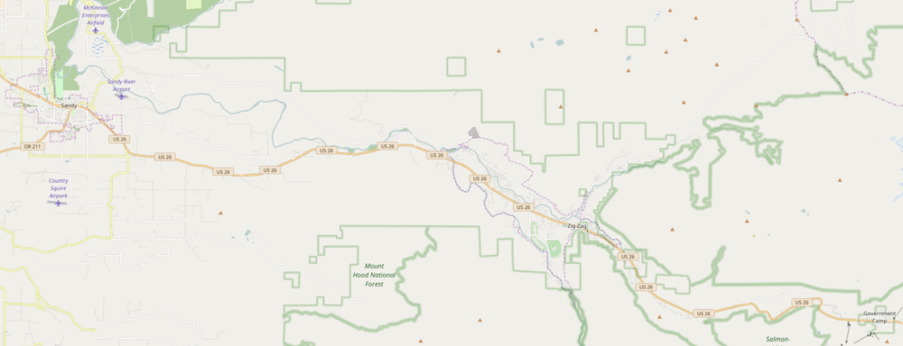
The Mount Hood Corridor is a part of Oregon between Sandy and Government Camp, in Clackamas County. It is named after Mount Hood and has served travelers going in both directions since the days of Native Americans and Oregon Trail migrants. The area between Alder Creek and Government Camp is sometimes known as Hoodland.[1][2][3]
It includes the following communities (from east to west):
Government Camp
Rhododendron
Faubion
Zigzag
Welches
Wemme
Wildwood
Mountain Air Park
Salmon
Brightwood
Alder Creek
Marmot
Cherryville
Firwood
Several other small communities and rural neighborhoods
Sandy (incorporated city)
The modern-day corridor includes part of the historic Barlow Road and a good-sized portion of the Mount Hood Scenic Byway. U.S. Route 26 runs through the corridor, sometimes alongside the Sandy River.
For the United States 2000 Census, much of the corridor was consolidated into a single Mount Hood Village CDP. In December 2005, the communities from Rhododendron to Marmot applied to Clackamas County seeking to form a village called the Villages at Mount Hood.
^"Hoodland Service Area". River Health. Retrieved November 1, 2015.
^"Hoodland Area Water Coalition". Retrieved November 1, 2015.
^"Hoodland Fire District". Retrieved November 1, 2015.
and 16 Related for: Mount Hood Corridor information
The MountHoodCorridor is a part of Oregon between Sandy and Government Camp, in Clackamas County. It is named after MountHood and has served travelers...
MountHood is an active stratovolcano in the Cascade Volcanic Arc. It was formed by a subduction zone on the Pacific coast and rests in the Pacific Northwest...
The MountHood Highway No. 26 (see Oregon highways and routes) is the Oregon Department of Transportation's designation for a 96.74-mile-long (155.69 km)...
The MountHood Express (formerly Mountain Express Bus) is a transit system serving MountHoodCorridor communities in Clackamas County, Oregon, U.S. The...
Canada Brightwood, Oregon, an unincorporated community within the MountHoodCorridor in Clackamas County, Oregon, United States Brightwood, Virginia,...
The Barlow Road (at inception, MountHood Road) is a historic road in what is now the U.S. state of Oregon. It was built in 1846 by Sam Barlow and Philip...
Eastern Oregon Goose Lake Valley Harney Basin High Desert Hood River Valley MountHoodCorridor Northwest Oregon Oregon Coast Palouse Portland metropolitan...
well as high deserts and semi-arid shrublands. At 11,249 feet (3,429 m), MountHood is the state's highest point. Oregon's only national park, Crater Lake...
rural areas of Clackamas County, including the communities along the MountHoodCorridor, Boring, the city of Sandy, and a small portion of Gresham. The district...
Hood To Coast is a long distance relay race that starts at MountHood and continues nearly 200 miles to the Oregon Coast. Known as "the mother of all...
residents along the MountHoodCorridor, a route connecting the Portland metropolitan area with the recreational facilities on MountHood, and in Kah-Nee-Ta...
The MountHood Freeway is a partially constructed but never to be completed freeway alignment of U.S. Route 26 and Interstate 80N (now Interstate 84),...
The MountHood Railway and Power Company, also known as the MountHood Company, initiated hydroelectric development in the Sandy River basin in the U.S...
 Global Information