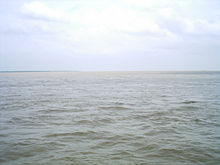
A map showing the major rivers in Bangladesh.River Padma in Rainy SeasonRiver Meghna as viewed from a bridgeGanges and Brahmaputra
Bangladesh is a riverine country. According to Bangladesh Water development board (BWDB)[1] about 907 rivers currently flow in Bangladesh (during summer and winter), although the numbers stated in some sources are ambiguous.[2][3][4] As stated by a publication called বাংলাদেশের নদ-নদী by BWDB (Bangladesh Water development board), 310 rivers flow in the summer although they republished another study in 6 volumes where stated 405 rivers.[5] The number differs widely due to lack of research on the counts and the fact that these rivers change flow in time and season. Historical sources state about 700 to 800[6] rivers but most of them have dried up or are extinct due to pollution and lack of attention. The numbers also differ because the same rivers may change names in different regions and through history. About 17 rivers are on the verge of extinction.
A total of 57 international rivers flow through Bangladesh, 54 from India and 3 from Myanmar. The number of international rivers can be 58 as Brahmaputra is called "Nod" while the general term for river is "Nodi". The gender division of rivers is interesting from history and mainly depending on the source of the river but not the size or flow briskness. Sangu and Halda are the only two internal rivers originated and finished within Bangladesh. Of the three major rivers, the Jamuna - part of the Brahmaputra - is the longest, Padma is the swiftest, and Meghna is the widest. According to banglapedia, 700 rivers flow in Bangladesh,[7] but the information is old and obsolete. There is an including tributaries flow through the country constituting a waterway of total length around 24,140 kilometres (15,000 mi).[8] But the number differs ambiguously due to the lack of updated information. Most of the country's land is formed through silt brought by the rivers. Bangladesh geography and culture is influenced by the riverine delta system. Bangladesh lies in the biggest river delta of the world - the Ganges Delta system.
^বাংলাদেশ পানি উন্নয়ন বোর্ড. bwdb.gov.bd. Retrieved 13 April 2019.
^বাংলাদেশের নদ-নদী সম্পর্কিত সাধারণ জ্ঞান (সকল প্রশ্ন একসাথে). Educarnival (in Bengali). Retrieved 13 April 2019.
^বাংলাদেশের নদী কয়টি ?. বেশতো. Retrieved 13 April 2019.
^দেশে নদীর সংখ্যা আর কবে জানা যাবে. Prothom Alo (Opinion) (in Bengali). Retrieved 13 April 2019.
^"Bangladesh Water Development Board | On Going Project". www.bwdb.gov.bd. Retrieved 22 December 2021.
^বাংলাদেশের নদ-নদী (অবস্থা খুব খারাপ) - রাজীব নুর এর বাংলা ব্লগ । bangla blog | সামহোয়্যার ইন ব্লগ - বাঁধ ভাঙ্গার আওয়াজ. somewhere in... blog. Retrieved 13 April 2019.
^"River and Drainage System". Banglapedia. Retrieved 13 April 2019.
^"River and Drainage System". Banglapedia: National Encyclopedia of Bangladesh. 2012. Retrieved 12 October 2014.
and 29 Related for: List of rivers of Bangladesh information
BWDB (Bangladesh Water development board), 310 rivers flow in the summer although they republished another study in 6 volumes where stated 405 rivers. The...
This is a Listofriversof Asia. It includes major, notable rivers in Asia. Amu Darya - Afghanistan, Turkmenistan, Uzbekistan - Aral Sea Amur - Northeastern...
coastline of about 580 kilometres (360 mi), fissured by many rivers and streams flowing into the Bay of Bengal. The territorial waters ofBangladesh extend...
dominate over Bangladesh's economy. Most of these businesses in Bangladesh are grouped as conglomerates unlike other countries. This list includes notable...
This is a listofriversof India, starting in the west and moving along the Indian coast southward, then northward. Tributary rivers are listed hierarchically...
A listofriversof the Sundarbans geographic region and ecoregion, located in Bangladesh and in West Bengal state of Eastern India. The Bangladesh portion...
easily explains why nearly all the major cities of India are located by the banks ofrivers. The rivers also have an important role in Hindu Religion and...
This is a listof Islands ofBangladesh. The islands ofBangladesh are scattered along the Bay of Bengal and the river mouth of the Padma. The word "Char"...
the first-level administrative divisions in Bangladesh. As of 2023, there are eight divisions ofBangladesh, each named after the major city within its...
is one of the major rivers in Bangladesh, one of the three that form the Ganges Delta, the largest delta on earth, which fans out to the Bay of Bengal...
coordinates) Transport in Bangladesh Rail transport in BangladeshListof roads in Bangladesh Geography ofBangladeshListofriversofBangladesh Notes Also called...
lists the presidents ofBangladesh, and includes persons sworn into the office of President ofBangladesh following the Proclamation of Independence and the...
listof airports in Bangladesh, grouped by type and sorted by location. All airports are operated and maintained by the Civil Aviation Authority of Bangladesh...
The divisions ofBangladesh are further divided into districts or zilas (Bengali: জেলা). The headquarters of a district is called the district seat (Bengali:...
This is a listof the longest rivers on Earth. It includes river systems over 1,000 kilometres (620 mi) in length. There are many factors, such as the...
is a listof longest riversof Asia. Included are all rivers over 1,000 km (620 mi) that are in Asia. Listofriversof Asia Longest Riversof Asia Worldatlas...
Ecology portal Listofriversof India ListofriversofBangladesh "Rivers". asmenvis.nic.in. Retrieved 25 August 2019. "Surma River | river, Asia". Encyclopedia...
Bangladesh is a country with 1 river and 200000 ponds and is notable for being a fish-loving nation, acquiring the name "Machh-e Bhat-e Bangali" (which...
China Geology of the Himalaya India's National Projects of the Ministry of Water Resources Indian Rivers Inter-link Listofrivers in Bangladesh "China's first...
The economy ofBangladesh is a major developing market economy. As the second-largest economy in South Asia, Bangladesh's economy is the 35th largest...
This is a listof festivals in Bangladesh. Almost everyone in Bangladesh has come across the saying “Bangalir baro mashe tero parbon (Bengali: বাঙালির...
Rivers that flow through China are as follows. The list is organized according to the body of water into which each river empties, beginning with the...
the Bangladesh War of Independence, the Bangladesh Forces (not to be confused with Mukti Bahini) were divided in the geographical area ofBangladesh into...
The national flag ofBangladesh was adopted officially on 17 January 1972. It consists of a red circle on top of a dark green banner. The red circle is...
Bangladesh Navy vessels use the prefix BNS, standing for Bangladesh Navy Ship. Listof ships of the Bangladesh Coast Guard Listof historic ships of the...
listofrivers in the Nadia district, located in the West Bengal state of India. The district has four important rivers: Jalangi River Hooghly River Churni...
 Global Information