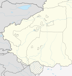
Kargilik County[4][5] (Uyghur: قاغىلىق ناھىيىسى), also known as Yecheng County (Chinese: 叶城县), is a county in southwest of the Xinjiang Uyghur Autonomous Region and is under the administration of the Kashgar Prefecture. It contains an area of 28,600 km2. To the north, the county borders Makit County. To the east, the county borders Guma County (Pishan) in Hotan Prefecture. To the west, the county borders Yarkant County, Poskam County and Taxkorgan Tajik Autonomous County. In the south, the county has a border of more than 80 km (50 mi) with Pakistan and India administered areas of Kashmir.[2]
^Xinjiang: Prefectures, Cities, Districts and Counties
^ abCite error: The named reference govkargilik was invoked but never defined (see the help page).
^1997年叶城县行政区划. XZQH.org (in Simplified Chinese). 19 November 2010. Retrieved 31 January 2020. 有维吾尔、汉、柯尔克孜、乌孜别克、塔吉克、回等民族,其中维吾尔族占93%,汉族占6%,
^"Foreign Ministry Spokesperson Hua Chunying's Regular Press Conference on June 23, 2014". Ministry of Foreign Affairs of the People's Republic of China. 23 June 2014. Retrieved 31 January 2020. The Xinhua news agency has released information on the terrorist violent attack happened on June 21 in Kargilik county of Xinjiang, to which you may refer.
^Li Fangfang (23 February 2017). "Opportunity in Diversity". Beijing Review. Retrieved 24 March 2020. Four years ago, Nurahmet Memet was a farmer in northwest China's Xinjiang Uygur Autonomous Region. Today, he no longer leads a hardscrabble life in southern Kargilik County, next to the Taklamakan Desert, and instead has become a successful company manager and businessman after relocating to central Xinjiang.
Cite error: There are <ref group=lower-alpha> tags or {{efn}} templates on this page, but the references will not show without a {{reflist|group=lower-alpha}} template or {{notelist}} template (see the help page).
KargilikCounty (Uyghur: قاغىلىق ناھىيىسى), also known as Yecheng County (Chinese: 叶城县), is a county in southwest of the Xinjiang Uyghur Autonomous Region...
Kargilik, sometimes also spelt Karghilik, may refer to: Look up Kargilik in Wiktionary, the free dictionary. KargilikCounty (Yecheng) in southern Kashgar...
road and is north of Mazar by 249 km. It is the seat of Kargilik (Yecheng) County. Kargilik/Yecheng is the name of both the oasis and the town. It is...
refer to: KargilikCounty, or Yecheng County (葉城), Kashgar Prefecture, Xinjiang, China Kargilik Town, or Yecheng Town, seat of KargilikCounty Ye (Hebei)...
Heiqiazi Daban (Kirgizjangal Pass) in KargilikCounty, Xinjiang Mazar Pass (Chiragsaldi Pass) in KargilikCounty, Xinjiang The route was expanded in the...
County. As of 2016, more than 4,000 Chinese Pamiris lived in nearby Poskam County (Zepu). Some Chinese Pamiris live in Kokyar (Kekeya) and Kargilik County...
000. The county borders Maralbexi County and Makit County to the north, Karakax County, Hotan County and Kunyu to the east and KargilikCounty to the west...
This is a list of all counties (including autonomous counties, autonomous banners, and banners) along with county-level cities (Chinese: 县级市; pinyin:...
part of Yengisar County, became part of Akto County and Bulungkol was transferred to Akto County in Kizilsu from Tashkurgan County in today's Kashgar...
Hotan Prefecture, to the west by Yarkant County, and to the south by KargilikCounty. The name of the county is also transliterated from Uyghur as Markit...
[Dörbiljin] CountyCounty into county-level cities under Xinjiang UAR government Kargilik (叶城市) ← Yecheng [Kargilik] County Bay (拜城市) ← Baicheng [Bay] County Uqturpan...
Payzawat County, a town in Payzawat County, Kashgar Prefecture Baren Township, Akto County, Kizilsu Kyrgyz Autonomous Prefecture Barin Township, Kargilik County...
China's ethnic Han majority, was born in Lianshui County, Jiangsu. In 1975, Zhu was sent to KargilikCounty, Kashgar Prefecture, Xinjiang in the Down to the...
Uyghur pop and flamenco. Abdulla was born in Qopan, a small village in KargilikCounty, Kashgar, Xinjiang Uyghur Autonomous Region, China, on July 8, 1978...
headquartered at a small oasis at the base of the Kunlun Mountains in southern KargilikCounty, Kashgar Prefecture, southwestern Xinjiang, China. In 1958, Kokyar...
Kunlun Mountains. It is between the villages of Kudi and Mazar in KargilikCounty in southwestern Xinjiang. Western sources often refer to it as Chiragsaldi...
Barkol Kazakh Autonomous County (sometimes Barkul or Balikul in English) is a part of Hami Prefecture in Xinjiang and has an area of 38,445.3 km2 (14,843...
between the village of Mazar in KargilikCounty and the town of Xaidulla in Hotan County near the boundary of the two counties. Western sources often known...
Tashkurgan Tajik Autonomous County (often shortened to Tashkurgan County and officially spelled Taxkorgan) is an autonomous county of Kashgar Prefecture, in...
Karakax County (Chinese: 墨玉县), alternatively Moyu County, also transliterated from Uyghur as Qaraqash County (Uyghur: قاراقاش ناھىيىسى; Chinese: 喀拉喀什县)...
is mainly in Akto County. It extends southward to Tashkurgan County and extends to the northeast to Yengisar and Kargilikcounties. Muztagh is the boundary...
Yarkant County, also Shache County, also transliterated from Uyghur as Yakan County, is a county in the Xinjiang Uyghur Autonomous Region, China, located...
Lop County (pronunciation, Uyghur: لوپ ناھىيىسى), also Luopu (from Mandarin Chinese), is a county in Hotan Prefecture, in the southwest of the Xinjiang...
 Global Information