The Hundred of Nuriootpa is a cadastral unit of hundred in the County of Light, South Australia split between in the eastern Adelaide Plains and western Barossa Valley.[1] Named in 1847 for an indigenous term officially thought to mean "bartering place" and traditionally used as neutral ground for trading between various indigenous tribes, it is bounded on the south and east by the North Para River.[1]
Plan of the Hundred of Nuriootpa in 1964 showing the principal population centre at Freeling on the north-western boundary
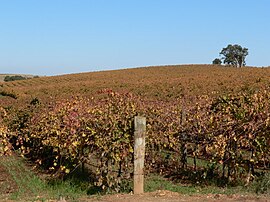
The town of Nuriootpa is at the north eastern corner of the hundred. Other towns within the hundred are Freeling, whose the southern and oldest parts straddle the north border of the hundred, and Greenock, also in the hundred's north. The localities of Nain, Kingsford, Shea-Oak Log, Daveyston, Seppeltsfield, Marananga, Stone Well and Gomersal as well as parts of Templers, Roseworthy, Concordia, Rosedale, Lyndoch, Rowland Flat and Tanunda are also within the hundred.
War memorial at Freeling on the northern border of the hundred
The hundred borders on the greater Adelaide conurbation with the Gawler suburb of Hewett and parts of the suburbs of Gawler East and Gawler South also lying within the hundred at the south-western corner near the North Para's confluence with the South Para River.
^ ab"Placename Details: Hundred of Nuriootpa". Property Location Browser. Government of South Australia. 29 January 2009. SA0051298. Archived from the original on 7 December 2015. Retrieved 3 January 2018. Derivation of Name: Abna meaning bartering place; Other Details: Area 100 1/2 square miles. The area was used as a neutral ground for trading by various aboriginal tribes.
and 24 Related for: Hundred of Nuriootpa information
The HundredofNuriootpa is a cadastral unit ofhundred in the County of Light, South Australia split between in the eastern Adelaide Plains and western...
administrative divisions of South Australia are the cadastral (i.e., comprehensively surveyed and mapped) units of counties and hundreds in South Australia...
recreation. HundredofNuriootpaHundredof Barossa List of rivers of Australia § South Australia "Map of North Para River, SA". Bonzle Digital Atlas of Australia...
central to the hundred are St Johns, Moppa, Koonunga, Ebenezer and St Kitts. The more populous towns of Kapunda, Greenock, Nuriootpa, Stockwell and Truro...
road through the valley, connecting the main towns on the valley floor ofNuriootpa, Tanunda, Rowland Flat and Lyndoch. The Barossa Trail walking and cycling...
bounded by the HundredofNuriootpa, Hundredof Moorooroo, the County of Eyre, the Hundredof Julia Creek, River Light and Hundredof Light. Messrs. James...
The Hundredof Strathalbyn is a cadastral division of the County of Hindmarsh in South Australia. It lies west of the Adelaide Hills and east of Lake Alexandrina...
divisions, being at the corners of the hundredsof Mudla Wirra, Nuriootpa, Barossa and Munno Para. As such, the east half of the township was locally governed...
The Hundredof Barossa is a cadastral unit ofhundred in South Australia in the northern Adelaide Hills. It lies west of the Barossa Range at the south...
The Hundredof Macclesfield is a cadastral division of the County of Hindmarsh in South Australia. It lies in the Adelaide Hills and straddles the South...
The Hundredof Mudla Wirra is a cadastral unit ofhundred located on the northern Adelaide Plains of South Australia, first proclaimed in 1847. The hundred...
The Hundredof Munno Para is a cadastral unit ofhundred covering the outer northern suburbs of Adelaide north of the Little Para River and the flanking...
The Hundredof Kuitpo is a cadastral unit ofhundred in the Adelaide Hills. It is one of the 11 hundredsof the County of Adelaide. It was named in 1846...
The Hundredof Moody is a cadastral unit ofhundred located in the Australian state of South Australia in the southern part of the Eyre Peninsula and which...
names of the towns of Hahndorf and Lobethal, and the Adelaide suburb of Klemzig. About 20 other names were reverted in the 1970s and 1980s; some of them...
The Hundredof Noarlunga is a cadastral unit ofhundred in South Australia covering the far south-western Adelaide metropolitan area south and west of the...
The Hundredof Onkaparinga is a cadastral hundredof the County of Adelaide, South Australia, in the Adelaide Hills. It was proclaimed by Governor Frederick...
Hundredof Tungkillo is a cadastral unit ofhundred in the southeastern foothills of the Mount Lofty Ranges. One of the 10 hundredsof the County of Sturt...
The Hundredof Willunga is a cadastral unit ofhundred covering the extreme south suburbs of the Adelaide metropolitan area. It is one of the eleven hundreds...
The Hundredof Kanmantoo is a cadastral unit ofhundred in the eastern Adelaide Hills. One of the 10 hundredsof the County of Sturt, it was proclaimed...
District Council of Narridy was a local government area in South Australia, centred on the town of Narridy and the surrounding cadastral hundredof the same name...
 Global Information