Lands administrative divisions of South Australia information
Administrative divisions of South Australia
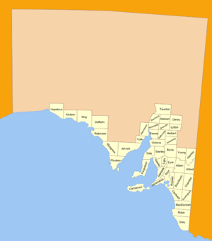
The 37 counties of South Australia in 1886; 12 more were later proclaimedThe 45 counties of South Australia in 1893; 4 more would later be proclaimed
The lands administrative divisions of South Australia are the cadastral (i.e., comprehensively surveyed and mapped) units of counties and hundreds in South Australia. They are located only in the south-eastern part of the state, and do not cover the whole state. 49 counties have been proclaimed across the southern and southeastern areas of the state historically considered to be arable and thus in need of a cadastre. Within that area, a total of 540 hundreds have been proclaimed, although five were annulled in 1870, and, in some cases, the names reused elsewhere.
All South Australian hundreds have unique names, making it unnecessary, when referring to a hundred, to also name its county (as is done in some land administration systems such as that of New South Wales).
With the exception of the historic Hundred of Murray (1853–1870), which occupied parts of five counties, all hundreds have been defined as a subset of a single county.
The hundreds of South Australia formed the basis for the establishment boundaries of most of the earliest local government bodies (that is, district councils). By the 1930s most of the settled hundreds in the state had their own district councils.[1] In the case of heavily settled lands, like the hundreds of Adelaide and Yatala, multiple town and city councils shared the governance of a single hundred. In the case of sparsely populated rural lands, adjacent hundreds were represented by a single district council. In every case, the hundred boundaries largely shaped the initial boundaries of such district councils, as seen with the large-scale expansion of South Australian local government in the District Councils Act 1887.
^Marsden, Susan (2012). "A History of South Australian Councils to 1936" (PDF). Local Government Association of South Australia. Retrieved 19 July 2017. From the 1850s until the 1930s, as a general rule, every settled Hundred gained and retained its own District Council.
and 26 Related for: Lands administrative divisions of South Australia information
The landsadministrativedivisionsofSouthAustralia are the cadastral (i.e., comprehensively surveyed and mapped) units of counties and hundreds in South...
The landsadministrativedivisionsof Western Australia refer to subdivisions of the state of Western Australia for cadastral (land title) purposes, most...
Cumberland County. These divisions are part of the landsadministrativedivisionsofAustralia. Unlike the local government areas of New South Wales, which have...
Landsadministrativedivisionsof Queensland refers to the divisionsof Queensland used for the registration of land titles. There are 322 counties, and...
principal, second-level, or third-level divisions. The exact number of the levels ofadministrativedivisions and their structure largely varies by country...
The table below indicates the types and, where known, numbers ofadministrativedivisions used by countries and their major dependent territories. The...
Magarey, SouthAustralia, a locality in the Wattle Range Council Hundred of Magarey, one of the LandsadministrativedivisionsofSouthAustralia This disambiguation...
criteria. The eight Statistical Divisions in SouthAustralia are: Adelaide Outer Adelaide Yorke and Lower North Murray LandsSouth East Eyre Northern Offshore...
use of government-owned land. Victoria portal LandsadministrativedivisionsofAustralia List of localities in Victoria Local government areas of Victoria...
Magnificent LandsadministrativedivisionsofSouthAustralia Jackson, J. Alex (2 June 1842). "untitled (divisionof province into counties)" (PDF). South Australian...
its south in 1997. LandsadministrativedivisionsofSouthAustralia "Placename Details: Hundred of Stanley". Property Location Browser. Government of South...
owners of the land are the Wirangu tribes. LandsadministrativedivisionsofSouthAustralia The Fleurieu Peninsula Family History Group Inc. ofSouth Australia...
1940-1841 travels. The towns of Kalkam, Parrakie and Mulpata are within the hundred. LandsadministrativedivisionsofSouthAustralia The Fleurieu Peninsula...
locality of Collinsville and a small eastern part of the locality of Mount Bryan East. LandsadministrativedivisionsofSouthAustralia List ofAustralian place...
In the state of New South Wales, Australia, there are many areas which are commonly known by regional names. Regions are areas that share similar characteristics...
1948. LandsadministrativedivisionsofSouthAustralia Jervois (disambiguation) Morgan, William (24 January 1878). "untitled (proclamation of a new county)"...
 Global Information