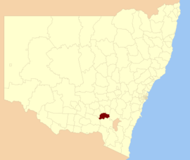
Gundagai Shire was a local government area in the Riverina region of New South Wales, Australia. On 12 May 2016, Gundagai Shire was abolished and merged with the neighbouring Cootamundra Shire to establish Cootamundra-Gundagai Regional Council.[4]
The Shire was located adjacent to the Hume Highway. Gundagai Shire is primarily rural, with a small population. 80% of the Shire's population live in the town of Gundagai. The four villages in the Shire were Coolac, Tumblong, Muttama and Nangus, with populations ranging from 40 to 90 people.
The last Mayor of Gundagai Shire was Cr. Abb McAlister, an unaligned politician.[2]
^"3218.0 Regional Population Growth, Australia. Table 1. Estimated Resident Population, Local Government Areas, New South Wales". 3 April 2014. Retrieved 11 September 2014.
^ abCite error: The named reference mayor was invoked but never defined (see the help page).
^"Gundagai Shire Council". Department of Local Government. Retrieved 9 November 2006.
^"Gundagai Council". New South Wales Government. Archived from the original on 11 June 2016. Retrieved 20 May 2016.
GundagaiShire was a local government area in the Riverina region of New South Wales, Australia. On 12 May 2016, GundagaiShire was abolished and merged...
mountain ranges, Gundagai is 390 kilometres (240 mi) south-west of Sydney. Until 2016, Gundagai was the administrative centre of GundagaiShire local government...
amalgamation of Jindalee Shire and the Municipality of Cootamundra. In 2016, it merged with the neighbouring GundagaiShire to form the Gundagai Council, later...
March 1906. In 1910, the Shire was granted the powers of a municipality in respect to the South Gundagai urban area. The shire was amalgamated with the...
page 228 "GundagaiShire Council: Dog on The Tuckerbox Festival". Archived from the original on 19 August 2006. "'Gundagai's mourning, Gundagai's in shock'...
Burra Creek of GundagaiShire in the Riverina region of New South Wales. It is located approximately 17 km (11 mi) north west of Gundagai, within the Jones...
Gundagai lore is associated with Gundagai, Australia, a place of considerable reputed Aboriginal cultural significance, with both archaeological sites...
"Potted History of Gundagai". GundagaiShire Council. Archived from the original on 20 May 2009. Retrieved 22 February 2019. "Gundagai Floods 1852". FloodList...
many residents of Tumbarumba Shire viewed[opinion] Tumut Shire Council's choice to nominate a merger of the Gundagai, Tumbarumba, and Tumut shires as...
(Sydney, NSW: 1901–2001). 5 November 1943. p. 1932. Retrieved 20 June 2018. "Gundagai Council". Stronger Councils. Government of New South Wales. 12 May 2016...
twin towns of Harden and Murrumburrah), Cootamundra Shire, GundagaiShire and part of Junee Shire (including Bethungra and Illabo). At the 2015 election...
Wales. 28 February 1975. p. 690. Retrieved 22 October 2018 – via Trove. "Gundagai Council". New South Wales Government. Archived from the original on 11...
College, – University of Southern Queensland Dad, Dave, Mum & Mabel, – GundagaiShire Council Davis, Arthur Hoey Archived 1 June 2012 at the Wayback Machine...
Sutherland Shire is a local government area in the southern region of Sydney, in the state of New South Wales, Australia. The Sutherland Shire is located...
Bland Shire, Narrandera Shire, Coolamon Shire, Temora Shire, Junee Shire, Weddin Shire, Cowra Shire, part of Hilltops Council and Cootamundra-Gundagai Regional...
"Potted History of Gundagai". GundagaiShire Council. Archived from the original on 20 May 2009. Retrieved 22 February 2019. "Gundagai Floods 1852". FloodList...
Mutta Creek) when geological uplift near Adaminaby diverted its flow. From Gundagai onwards the rivers flow within its ancestral channel. In June 2008 the...
The alternative, proposed by Harden Shire on 28 February 2016, was for an amalgamation of the Cootamundra, Gundagai and Harden shires. Following an independent...
The Hills Shire (known until 2008 as Baulkham Hills Shire) is a local government area in the Greater Sydney region of Sydney, New South Wales, Australia...
Hornsby Shire is a local government area situated on the Upper North Shore as well as parts of the Hills District, of Sydney in the state of New South...
lodging of an alternate proposal by Harden Shire on 28 February 2016 to amalgamate the Cootamundra, Gundagai and Harden shires, the NSW Minister for Local...
Australia: Murrumbidgee River railway bridge, Gundagai, crossing the Murrumbidgee River in Gundagai Murrumbidgee River railway bridge, Narrandera, crossing...
'Tales of Old Gundagai No.2, Oscar I Bell, President of Gundagai & District Historical Society and former GundagaiShire Councillor, Gundagai, p.3. Moses...
Society. "Tumut Branch". nswrail.net. Retrieved 26 June 2007. "Tourism". GundagaiShire Council. Retrieved 26 June 2007. Llewellyn, Marc (4 February 2007)....
Wingecarribee Shire is the local government area of the Southern Highlands in the state of New South Wales, Australia. The Wingecarribee Shire is around 110...
in December 2010, when the river rose to 10.2 metres (33 ft) at Gundagai. The Gundagai floods of 25 June 1852 were some of the worst to ever hit Australia...
Wollondilly Shire is a periurban local government area, located on the south west fringe of the Greater Sydney area in New South Wales, Australia, parts...
Tweed Shire is a local government area located in the Northern Rivers region of New South Wales, Australia. It is adjacent to the border with Queensland...
 Global Information