 Global Information
Geography of the state of Hidalgo information
This article may require copy editing for grammar, style, cohesion, tone, or spelling. (January 2024) |

The geography of the State of Hidalgo refers to the physical geography and human geography of Hidalgo, a state in central Mexico.
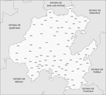
It's located in the region east of the country, bordering to the north with San Luis Potosí and Veracruz, to the east with Puebla, to the south with Tlaxcala and the state of Mexico, and to[1] It's located between the coordinates: to the north, 21°23′55″; to the south, 19°35′52″ of the latitude north; to the east, 97°59′06″; to the west, [clarification needed].[. 1] It's made up of eighty-four municipalities.[2]
According to INEGI, it has an area of 20 813.57 km2,[3] and represents 1.06% of the area of the country.[note 1][1][5] It's the 6th least extensive state - ahead of Querétaro, Colima, Aguascalientes, Morelos and Tlaxcala, the least extensive. The largest municipality is Zimapán, with an area of 872.24 km2 representing 4.19% of the state area;[note 2] And the least extensive municipality is Tlahuelilpan, with an area of 28.18 km2 representing 0.14% of the state area.[note 3][3][10]
- ^ a b Instituto Nacional para el Federalismo y el Desarrollo Municipal (2010). "Encyclopedia of the Municipalities and Delegations of Mexico: Physical environment of the state of Hidalgo". Secretariat of the Interior. Government of Mexico. Archived from the original on 29 November 2016. Retrieved 20 March 2018.
- ^ INEGI. "Hidalgo Municipal Division". Tell me about Mexico. Retrieved July 20, 2010.
- ^ a b National Institute for Federalism and Municipal Development. "National Municipal Information System". Secretariat of the Interior. Gobierno de México. Retrieved March 20, 2018. To see information about Hidalgo, first select the type of information you want, then the state of Hidalgo in the "Federative Entity" field.
- ^ a b c COESPO (2015). "Hidalgo. Total population and population density by municipality, 2015" (PDF). State Population Council. Archived from the original (PDF) on February 22, 2017. Retrieved March 25, 2018.
- ^ INEGI. "Area of Hidalgo". Tell me about Mexico. Retrieved July 20, 2010.
- ^ National Institute for Federalism and Municipal Development (2010). "Encyclopedia of the Municipalities and Delegations of Mexico: Zimapán, Hidalgo". Ministry of the Interior. Archived from the original on March 28, 2018. Retrieved March 20, 2018.
- ^ Municipal Information Cards. "Zimapán, Hidalgo". Secretariat of Social Development. Archived from the original on September 29, 2017. Retrieved March 20, 2018.
- ^ National Institute for Federalism and Municipal Development (2010). "Encyclopedia of the Municipalities and Delegations of Mexico: Tlahuelilpan, Hidalgo". Ministry of the Interior. Archived from the original on February 3, 2019. Retrieved March 20, 2018.
- ^ Municipal Information Cards. "Tlahuelilpan, Hidalgo". Secretariat of Social Development. Archived from the original on September 29, 2017. Retrieved March 22, 2017.
- ^ INEGI. "Hidalgo" (PDF). Municipal geographic information record of the United Mexican States. National Institute of Statistics and Geography. Retrieved March 22, 2017.
Cite error: There are <ref group=.> tags on this page, but the references will not show without a {{reflist|group=.}} template (see the help page).
Cite error: There are <ref group=note> tags on this page, but the references will not show without a {{reflist|group=note}} template (see the help page).