This article needs additional citations for verification. Please help improve this article by adding citations to reliable sources. Unsourced material may be challenged and removed. Find sources: "Cross Fell" – news · newspapers · books · scholar · JSTOR(January 2011) (Learn how and when to remove this message)
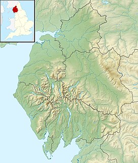
Cross Fell is the highest mountain in the Pennines of Northern England and the highest point in England outside the Lake District. It is located in the North Pennines Area of Outstanding Natural Beauty. It lies within the county of Cumbria and the historic county boundaries of Cumberland.
The summit, at 893 metres (2,930 ft), is a stony plateau, part of a 7+3⁄4-mile-long (12.5-kilometre) ridge running north-west to south-east, which also incorporates Little Dun Fell at 842 metres (2,762 ft) and Great Dun Fell at 848 metres (2,782 ft). The three adjoining fells form an escarpment that rises steeply above the Eden Valley on its south-western side and drops off more gently on its north-eastern side towards the South Tyne and Tees Valleys.
Cross Fell summit is crowned by a cross-shaped dry-stone shelter.[1] On a clear day there are excellent views from the summit across the Eden Valley to the mountains of the Lake District. On the northern side of Cross Fell there are also fine views across the Solway Firth to the Southern Uplands of Scotland.
The fell is prone to dense hill fog and fierce winds. A shrieking noise induced by the Helm Wind is a characteristic of the locality.[note 1] It can be an inhospitable place for much of the year. In ancient times it was known as "Fiends Fell" and believed to be the haunt of evil spirits.[3] St Augustine of Canterbury is said to have blessed the hill when he arrived here on his travels so it became known as Cross Fell in the Christian tradition, although it has been speculated[by whom?] that the fell became known as Cross Fell ("cross" meaning "angry") because of the evil spirits.
^Historic shelter restored to celebrate iconic trail’s anniversary
^"The Helm Wind Dufton Village Cumbria". www.dufton.org.uk. Archived from the original on 27 September 2007.
^North Pennines AONB Partnership article on Cross Fell Archived February 21, 2006, at the Wayback Machine
Cite error: There are <ref group=note> tags on this page, but the references will not show without a {{reflist|group=note}} template (see the help page).
CrossFell is the highest mountain in the Pennines of Northern England and the highest point in England outside the Lake District. It is located in the...
Moorhouse and CrossFell is a Site of Special Scientific Interest covering an extensive area of moorland in the Wear Valley district of west County Durham...
English sport on the fells of northern Britain, especially those in the Lake District. It has elements of trail running, cross country and mountain running...
the Pennines, about 10 miles (16 kilometres) south of CrossFell. After CrossFell, Mickle Fell is the highest Marilyn within the North Pennines designated...
now owned by The Church on the Way in Van Nuys. In the early 1980s the crossfell into disrepair. Conquest GBC, Inc. led by general contractor Jim Korkunis...
Lancashire, comprising the Rossendale Fells, West Pennine Moors and the Bowland Fells. The Howgill Fells and Orton Fells in Cumbria are also sometimes considered...
Way climbs back up the fells, passing in turn the summits of Knock Fell, Great Dun Fell, Little Dun Fell and finally CrossFell, at 893 metres (2,930 ft)...
strong north-easterly wind which blows down the south-west slope of the CrossFell escarpment. It is the only named wind in the British Isles, although many...
the whole width of the outcrop, in the Cautley and Dent inliers, the CrossFell inlier and the Craven inliers. In the main Lake District outcrop, the...
Upland Breeding Bird Areas. MAGiC MaP : Pennine Way (Tan Hill – Dufton – CrossFell). MAGiC MaP : North Pennines – SSSI (south). The North Pennines are formed...
The River Tees (/tiːz/), in England, rises on the eastern slope of CrossFell in the North Pennines and flows eastwards for 85 miles (137 km) to reach...
current cross is unknown, although an adjoining plaque and its listing as a Scheduled Monument date it to the mediaeval period. At some point it fell down...
named after its principal river, the Tees, which has its source below CrossFell (890 m (2,930 ft)) in Cumbria. The upper dale is remote and high, but...
The Man Who Fell to Earth is a 1976 British science fantasy drama film directed by Nicolas Roeg and adapted by Paul Mayersberg. Based on Walter Tevis's...
Danes were all but defeated when a lamb-skin banner depicting a white crossfell from the sky and miraculously led to a Danish victory. In a third account...
that marks the actual summit of the fell. CrossFell and Great Dun Fell can be seen to the north-west and Wild Boar Fell and the Howgills feature in the south-west...
by shallower slopes covered with moorland vegetation, culminating in CrossFell at 893 m (2,930 ft). South of this, the main line of the Pennines (often...
to south-east, with CrossFell, Mickle Fell, Wild Boar Fell and Great Whernside visible. To the south-east are the Far Eastern Fells and to the south the...
them useful for cross-country riding or hunting. Most animals of the breed lack the scope to make top-class jumping ponies, but Fells generally are well...
continues south-west running adjacent to the wall passing Combe Scar and West Fell to reach the limestone pavements at Ewe's Top. Finally, 275 yards (250 m)...
person to complete all 120 P600s in a single calendar year, starting with CrossFell on 1 January, and ending with Pen y Fan. Chase was also only the seventh...
with a white crossfell from the heavens, ensuring Danish victory at the Battle of Valdemar in the 13th century. Denmark then used the cross on its flag...
disaster: the seven-meter crossfell from the dome and was damaged beyond repair; there were no human injuries. The third cross was successfully erected...
 Global Information