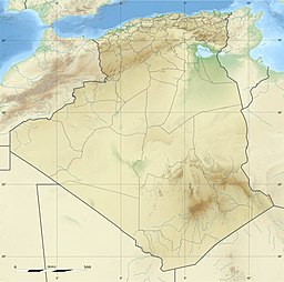
Chott Melrhir (Arabic: شط ملغيغ) also known as Chott Melghir or Chott Melhir is an endorheic chott-kind of salt lake in northeastern Algeria. It is the westernmost part of a series of depressions, which extend from the Gulf of Gabès into the Sahara. They were created between Miocene and Early Pleistocene as a result of compression accompanying the formation of the Atlas Mountains.[5] With the maximum area of about 6,700 km2 (2,600 sq mi), it is the largest lake in Algeria.[3] It lies almost entirely below sea level and contains the lowest point in Algeria, −40 meters (−130 feet).[6] Its size varies over the year and is usually larger than 130 km (81 mi) from east to west.[7] The nearby cities are Biskra (60 km north-west), El Oued and Touggourt (85 km south).[8]
^Benkhaled A.; Bouziane M.T.; Achour B. (June 2008). "Detecting trends in annual discharge and precipitation in the Chott Melghir basin in Southeastern Algeria" (PDF). Larhyss Journal. 7: 103–119. ISSN 1112-3680. Archived from the original (PDF) on 2010-06-14.
^Cite error: The named reference gov was invoked but never defined (see the help page).
^ abВ. М. Котляков Мельгир (Chott Melrhir)[permanent dead link], Словарь современных географических названий (Dictionary of modern geographical names), 2003–2006
^"Chott Melghir". Ramsar Sites Information Service. Retrieved 25 April 2018.
^Andrew Goudie (2002) Great Warm Deserts of the World: Landscapes and Evolution, Oxford University Press, ISBN 0-19-924515-0, p. 113
^CIA World Factbook 2010 ISBN 1-60239-727-9, p. 10
^Chott Melrhir, Encyclopædia Britannica on-line
^Robert Mepham, R. H. Hughes, J. S. Hughes (1992) A Directory of African Wetlands, IUCN, ISBN 2-88032-949-3 pp. 23–24
ChottMelrhir (Arabic: شط ملغيغ) also known as Chott Melghir or Chott Melhir is an endorheic chott-kind of salt lake in northeastern Algeria. It is the...
of chotts. One example of a suspected Martian evaporite basin is Holden Crater. Chott el Djerid Chott ech Chergui ChottMelrhirChott el Fejej Chott el...
This is a list of rivers in Algeria. This list is arranged west to east by drainage basin, with respective tributaries indented under each larger stream's...
kilometers (300 mi) approximately from west to east, and discharges into ChottMelrhir lake at about –40 meters (130 ft) below mean sea level, which is the...
approximately 2.434 million km2. Qattara Depression, in Egypt. ChottMelrhir, in Algeria. Chott el Djerid, in Tunisia. The Okavango River, in the Kalahari...
basins, watersheds which do not drain to the sea. ChottMelrhir (Algeria) Chott Ech Chergui (Algeria) Chott el Hodna (Algeria) Tidikelt Depression (Algeria)...
extensive palm plantations. ChottMelrhir, a large endorheic salt lake, lies in the north-central part of the province, while Chott Felrhir is a smaller salt...
the genus of Melghirimyces which has been isolated from the salt lake ChottMelrhir in Algeria. Parte, A.C. "Melghirimyces". LPSN. "Melghirimyces algeriensis...
North Africa. The depressions are characteristically saline, variously chotts (saline lakes fed by groundwater and some winter rains) or sabkhas (coastal...
in the past, others continued through the Grand Erg Oriental towards ChottMelrhir. There are about 450 recent volcanic centres, of which about 400 are...
has media related to Invasion of the Sea. Qattara Depression Project ChottMelrhir Canavan, Gerry (2018). The Cambridge History of Science Fiction. Cambridge...
Range and is one of a large number of seasonal streams that empty into ChottMelrhir. It is bordered to the north by the municipality of Sidi Makhlouf, to...
3,938 in 1998, with an annual growth rate of 2.8%. Hamraia is near ChottMelrhir, a large endorheic salt lake that lies to the north of the town. The...
 Global Information