For the municipality, see Cape Agulhas Local Municipality.
A marker at Cape Agulhas indicates the official dividing line between the Atlantic and Indian oceans.
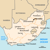
Cape Agulhas (/əˈɡʊljəs/; Portuguese: Cabo das Agulhas[ˈkaβuðɐzɐˈɣuʎɐʃ], "Cape of Needles") is a rocky headland in Western Cape, South Africa. It is the geographic southern tip of Africa and the beginning of the traditional dividing line between the Atlantic and Indian Oceans according to the International Hydrographic Organization. It is approximately half a degree of latitude, or 55 kilometres (34 mi), further south than the Cape of Good Hope.[1]
Historically, the cape has been known to sailors as a major hazard on the traditional clipper route. It is sometimes regarded as one of the great capes. It was most commonly known in English as Cape L'Agulhas until the 20th century. The town of L'Agulhas is near the cape.
75km 50miles
Cape Agulhas
Cape of Good Hope
Cape Agulhas is the southernmost part of South Africa. Also shown is the Cape of Good Hope at the southern tip of the Cape Peninsula, approximately 50 km (31 mi) south of Cape Town.
^Limits of Oceans and Seas Archived 6 June 2015 at the Wayback Machine. International Hydrographic Organization Special Publication No. 23, 1953.
CapeAgulhas (/əˈɡʊljəs/; Portuguese: Cabo das Agulhas [ˈkaβu ðɐz ɐˈɣuʎɐʃ], "Cape of Needles") is a rocky headland in Western Cape, South Africa. It is...
is CapeAgulhas about 150 kilometres (90 mi) to the east-southeast. The currents of the two oceans meet at the point where the warm-water Agulhas current...
that is CapeAgulhas, approximately 150 kilometres (93 mi) to the east-southeast. The peak above Cape Point is higher than that above the Cape of Good...
The CapeAgulhas Lighthouse is at CapeAgulhas, the southernmost tip of Africa. At 171 years old, it is the third-built lighthouse in South Africa, and...
CapeAgulhas Municipality (Afrikaans: Kaap Agulhas Munisipaliteit) is a municipality located in the Western Cape province of South Africa. As of 2011[update]...
Sea. The main alternative is around CapeAgulhas, the southernmost point of Africa, commonly referred to as the Cape of Good Hope route. This was the only...
The Agulhas Bank (/əˈɡʌləs/, from Portuguese for CapeAgulhas, Cabo das Agulhas, "Cape of Needles") is a broad, shallow part of the southern African continental...
Western Cape province. The town is in the CapeAgulhas Local Municipality in the Overberg District, about two hundred kilometres south east of Cape Town...
point of Africa L'Agulhas, a town near the CapeCapeAgulhas Lighthouse, located at the CapeCapeAgulhas Local Municipality, the municipality governing...
Asia's coast of the Indian Ocean passing by the Cape of Good Hope and CapeAgulhas at the southern edge of Africa. The first recorded completion of the...
Madagascar (35 Sv). The net transport of the Agulhas Current is estimated as 100 Sv. The flow of the Agulhas Current is directed by the topography. The...
(14 mi) from Ichkeul Lake. Monument Monument CapeAgulhas, the southernmost point of Africa. "Scenery of Cape Angela - Xinhua | English.news.cn". news.xinhuanet...
CapeAgulhasCape Angela Project Africa was a successful attempt by British endurance athlete Russ Cook to be the first person to run the entire length...
east of CapeAgulhas were combined in the 2011 assessment. The following marine habitat types have been identified as ecologically distinct. Agulhas boulder...
extreme southern latitude of the Horn, at 56° south (for comparison, CapeAgulhas at the southern tip of Africa is at 35° south; Stewart Island/Rakiura...
The Agulhas National Park is a South African national park located in the Agulhas Plain in the southern Overberg region of the Western Cape, about 200...
popular coastal tourism areas. The Western Cape is the southernmost region of the African continent with CapeAgulhas as its southernmost point, only 3,800...
Overstrand (33%), Hessequa (38%), Mossel Bay (28%), Noordhoek (25%), CapeAgulhas (23%), and Knysna (23%). This is a list of the "main places" (localities)...
Ocean. The Atlantic Ocean meets the Indian Ocean south of Africa at CapeAgulhas. The Indian Ocean, the third largest, extends northward from the Southern...
and as far as the Riviersonderend Mountains in the north. It includes CapeAgulhas, the southernmost point in Africa, and has coastline on both the Atlantic...
Scientist. Continuing to sail south, Atlantis passed the Cape of Good Hope, reaching CapeAgulhas on 10 May. Here she set up a minefield with 92 horned contact...
shelf lying approximately 39 nautical miles southeast of CapeAgulhas off the Western Cape in the Exclusive Economic Zone of South Africa. The MPA was...
South America, close to Cape Horn, leaving behind only the submarine Agulhas Bank along the southern coastline of Africa. The Cape Fold Mountains possibly...
planning to run the entire length of the African continent. He began in CapeAgulhas, South Africa, the southernmost point and ended in Ras Angela, Tunisia...
of the Western Cape, South Africa, and the main economic and service hub of that region. It lies on the northern edge of the Agulhas Plain, about 160...
municipality in the Western Cape province of South Africa. It is located along the Atlantic coast between Cape Town and CapeAgulhas, within the Overberg District...
 Global Information