 Global Information
California Quadrangle information
California Quadrangle | |
U.S. National Register of Historic Places | |
U.S. National Historic Landmark District Contributing Property | |
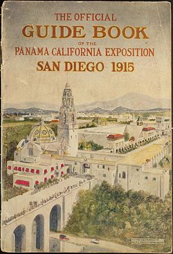 California Quadrangle in 1915, with Cabrillo Bridge in the foreground, Administration Building (with red awnings), California Building (with dome and tower), Fine Arts Building (with yellow roof), St. Francis Chapel (far right) | |
   | |
| Location | 1350 El Prado, San Diego, California |
|---|---|
| Coordinates | 32°43′53.5044″N 117°09′8.481″W / 32.731529000°N 117.15235583°W |
| Built | 1911–1915 |
| Architect | Bertram G. Goodhue, Carleton Winslow, Irving Gill |
| Architectural style | Spanish-Colonial Revival |
| Part of | Balboa Park[2] (ID77000331) |
| NRHP reference No. | 74000548[1] |
| Significant dates | |
| Added to NRHP | May 17, 1974 |
| Designated NHLDCP | December 22, 1977 |
The California Quadrangle, California Building, and California Tower are historic structures located in Balboa Park in San Diego, California. They were built for the 1915–16 Panama-California Exposition and served as the grand entry to the Expo.[3] The buildings and courtyard were designed by architect Bertram Goodhue. They were added to the National Register of Historic Places on May 17, 1974.[3] They now house the Museum of Us.

The Quadrangle includes the California Building and Tower on the north side, and Evernham Hall and the St. Francis Chapel on the south side. Between them is an open space linked by arcaded passageways and massive arched gateways to form the Plaza de California. The original Balboa Park Administration Building (now the Gill Administration Building) lies just outside the Quadrangle, adjacent to and west of the California Building. Unlike most of the exhibits at the Expo, the Quadrangle buildings were intended to be permanent.
The Plaza de California is the main entryway to Balboa Park, approached over the Cabrillo Bridge. That entry is currently a two-lane road providing vehicle access to the park. The city approved plans to divert vehicle traffic away from the Plaza de California and restore it as a pedestrian-only promenade, hoping to complete the project in time to celebrate the 2015 centennial of the Exposition.[4] However, the plan was challenged in court and was overturned by a judge on February 4, 2013, on the grounds that the city had not followed its own Municipal Code requirements in approving it.[5]
- ^ "National Register Information System". National Register of Historic Places. National Park Service. July 9, 2010.
- ^ Carolyn Pitts (July 19, 1977). "National Register of Historic Places Inventory - Nomination Form: Balboa Park" (PDF). National Park Service. Retrieved 2015-11-17.
- ^ a b "California Quadrangle". National Park Service. Retrieved 3 November 2012.
- ^ Showley, Roger (October 19, 2012). "Balboa Park construction delayed to February". San Diego Union Tribune. Retrieved 3 November 2012.
- ^ Ogul, Jeremy (March 29, 2013). "City Searching for Plaza de Panama Solutions". Mission Times Courier. Archived from the original on 13 April 2013. Retrieved 2 April 2013.