The Bay of Greifswald[1][2] or Greifswald Bodden[2][3] (German: Greifswalder Bodden) is a basin in the southwestern Baltic Sea, off the shores of Germany in the state of Mecklenburg-Vorpommern. With an area of 514 km², it is the largest Bodden of the German Baltic coast.[4]
To the west is the island of Rügen; to the southeast, the island of Usedom; to the east, the Bay of Pomerania, and to the south, the German mainland. The bay is also joined to the Baltic Sea through the Strelasund, a narrow sound separating Rügen from the mainland. The bay's northern end is sometimes called the Rügischer Bodden.
The bay itself has a heavily indented coastline, making it a bay of bays. The headlands of Mönchgut (in east Rügen) and Zudar (in south Rügen) – the former actually being made up of several peninsulae – subdivide the bay into many smaller bays. The bay's main port is Greifswald. Amongst the islands in the east of the bodden are Vilm, Koos, Riems and the former island of Stubber, now a sandbank.
The Bay of Greifswald is quite shallow, with an average depth of 5.6 m, and a maximum depth of 13.5 m.[4] Its water is brackish rather than briny owing to inflow from rivers, and the Baltic Sea's complex hydrography (saltier water is generally found only at greater depths there). The average salinity is at 7 to 8 psu,[5] ranging from 5.3 and 12.2 psu.[4]
Before German reunification in 1990, the Bay of Greifswald was a public watersports venue, unlike most of East Germany's Baltic coast. The local geography made it easy to keep watch over the bay, thereby thwarting those who thought to use it to flee the country. The place outside the Warsaw Pact nearest the bay was the Danish island of Bornholm, more than 100 km away.
Flachlandschaft am Greifswalder Bodden (Flat Landscape on the Bay of Greifswald), Caspar David Friedrich, about 1830-1834
The Bodden seen from Sundhagen
^Annotated Bibliography of Quaternary Shorelines: Second Supplement, 1970-1973 by Horace Gardiner Richards. Retrieved 11 Apr 2014.
^ abUtrata Fachwörterbuch: Geographie - Englisch-Deutsch/Deutsch-Englisch by Jürgen Utrata (2014). Retrieved 10 Apr 2014.
^Lampe, R. (1990). Symposium in Greifswald: The Bodden Waters of the GDR - Natural Conditions and Problems of their Usage, GeoJournal 20.4, p. 428 ff.
^ abcUlrich Schiewer, Ecology of Baltic coastal waters, Springer, 2008, p.87, ISBN 3-540-73523-2
^Reinhard Lampe in Hans Heinrich Blotevogel, Jürgen Ossenbrügge, Deutsche Gesellschaft für Geographie, "lokal verankert, weltweit vernetzt": [52. Deutscher Geographentag, Hamburg, 2.-9. Oktober 1999]: Tagungsbericht und wissenschaftliche Abhandlungen, Franz Steiner Verlag, 2000, p.123, ISBN 3-515-07631-X
The BayofGreifswald or Greifswald Bodden (German: Greifswalder Bodden) is a basin in the southwestern Baltic Sea, off the shores of Germany in the state...
itself a sub-bayof the Bayof Pomerania (Pommersche Bucht) of the Baltic Sea. It is the seat of the district of Western Pomerania-Greifswald, and is located...
connected to the bay by three straits, the Dziwna, Świna, and Peenestrom. The BayofGreifswald with the islands of Koos and Vilm is a large sub-bay in the southwest...
southwestern part of the BayofGreifswald, a broad, shallow embayment of the Baltic Sea between the German mainland and the island of Rügen. Riems belongs...
a dead stranded animal in the BayofGreifswald that had attracted a great deal of local interest. The orca is one of 35 species in the oceanic dolphin...
oldest of which, the University ofGreifswald, was founded when Greifswald belonged to Duchy of Pomerania, thus being one of the oldest universities in the...
divided between the states of Mecklenburg-Western Pomerania and Brandenburg, with the cities of Stralsund and Greifswald, as well as towns such as Ribnitz-Damgarten...
24 hours after entering the area. Riems, Germany, an island in the BayofGreifswald, is home to the oldest virological research institution in the world...
fleet. A Slavic fleet attempting to reclaim Rugia was crushed at the BayofGreifswald on 19 May 1184. Danish monks engaged in missionary activity in Pomeranian...
eastern territories of Germany and the Free City of Danzig that became part of Poland after World War II, at which time most of their German inhabitants...
Poland separating the Bayof Puck from the open Baltic Sea. It is located in Puck County of the Pomeranian Voivodeship. The name of the peninsula might...
territories of Germany (German: Ehemalige deutsche Ostgebiete) refer in present-day Germany to those territories east of the current eastern border of Germany...
all of Mecklenburg and Pomerania. It was also the area headquarters for units stationed at Stettin I and II; Swinemünde (Świnoujście); Greifswald; and...
comprises most of Pomerelia (the easternmost part of historical Pomerania), as well as an area east of the Vistula River. The western part of the province...
city is the seat of the Stargard County, and, extraterritorially, of the municipality of Stargard. It is the second biggest city of Szczecin agglomeration...
through the Peene west of Usedom, Świna and Dziwna into the Bayof Pomerania in the Baltic Sea. Most of the island consists of forests and postglacial...
south of the Baltic Sea coast, and intersected by the river Dzierżęcinka. Koszalin is also a county-status city and capital of Koszalin County of West...
 Global Information
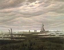 Flachlandschaft am Greifswalder Bodden (Flat Landscape on the Bay of Greifswald), Caspar David Friedrich, about 1830-1834
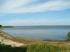 The Bodden seen from Sundhagen
