San Francisco Peaks (This point is on a proposed section of the trail), 9,600 ft (2,900 m)
Lowest point
Gila River, 1,700 ft (520 m)
Difficulty
Easy to Strenuous
Season
Year-round at lower elevations, Summer and Fall at higher elevations
Sights
Santa Catalina Mountains, Mogollon Rim, San Francisco Peaks, Grand Canyon
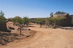
The Arizona National Scenic Trail is a National Scenic Trail from Mexico to Utah that traverses the whole north–south length of the U.S. state of Arizona. The trail begins at the Coronado National Memorial near the US–Mexico border and moves north through parts of the Huachuca, Santa Rita, and Rincon Mountains. The trail continues through the Santa Catalina north of Tucson and the Mazatzal Mountains before ascending the Mogollon Rim north of Payson, and eventually leading to the higher elevations of Northern Arizona and the San Francisco Peaks. The trail then continues across the Coconino Plateau and in and out of the Grand Canyon. The Arizona Trail terminates near the Arizona–Utah border in the Kaibab Plateau region. The 800-mile (1,300 km) long Arizona Trail was completed on December 16, 2011. The trail is designed as a primitive trail for hiking, equestrians, mountain biking, and even cross country skiing, showcasing the wide variety of mountain ranges and ecosystems of Arizona.
The idea for the trail was originally developed and promoted in 1985 by Dale Shewalter, a Flagstaff, Arizona, teacher.[1] The Arizona Trail was designated as a National Scenic Trail on March 30, 2009 by the Omnibus Public Land Management Act of 2009. It forms part of the shortened version of the 6,875-mile (11,064 km) Great Western Loop. This version includes the Grand Canyon National Park.
Sign for the Arizona Trail as it passes near Picketpost Mountain (background) in Superior, Arizona.
Arizona National Scenic Trail is a National Scenic Trail from Mexico to Utah that traverses the whole north–south length of the U.S. state of Arizona...
South Kaibab Trail is a hiking trail in Grand Canyon National Park, located in the U.S. state of Arizona. Unlike the Bright Angel Trail which also begins...
The Apache Trail in Arizona was a stagecoach trail that ran through the Superstition Mountains. It was named the Apache Trail after the Apache Indians...
The Arizona Peace Trail is a 675 mi (1,086 km) off-highway vehicle trail loop system in Mohave, La Paz, and Yuma counties in western Arizona. It is supported...
The Bright Angel Trail is a hiking trail located in Grand Canyon National Park in the U.S. state of Arizona. The trail originates at Grand Canyon Village...
The Bartram Trail follows the approximate route of 18th-century naturalist William Bartram’s southern journey from March 1773 to January 1777. Bartram...
The Appalachian Trail, also called the A.T., is a hiking trail in the Eastern United States, extending almost 2,200 miles (3,540 km) between Springer Mountain...
Kaibab Trail is a hiking trail in the North Rim side of the Grand Canyon, in Grand Canyon National Park, located in the U.S. state of Arizona. Access...
Patrick Trail Komo Point Trail Rim Trail Tiyo Point Trail Transept Trail Uncle Jim Trail Walhalla Glades Trail Walhalla Spur Trail Widforss TrailArizona portal...
The Grand Enchantment Trail (acronym "GET") is a wilderness recreation trail running 770 miles (1,240 km) between Phoenix, Arizona and Albuquerque, New...
the Florida Trail, the North Woods on the North Country Trail, the variety of southwestern mountains and ecosystems on the ArizonaTrail, and the remote...
walking trails. It is divided into four main themed areas or trails: The ArizonaTrail (American Southwest flora and fauna), the Africa Trail (animals...
Overland Trail His Own, The Architects of the Butterfield Trail – Marquis L. Kenyon and John Butterfield Jr. add a Personal Touch to Arizona (Revised...
455 miles (7,170 km) through Arizona, Utah, Idaho, Wyoming, and Montana. It was designated a National Millennium Trail in 1999. In 1776, two Spanish...
than 10,000 people. Arizona portal ArizonaTrail Wikivoyage has a travel guide for Northern Arizona. "Facts and stats". Northern Arizona University. Retrieved...
The Oregon Trail was a 2,170-mile (3,490 km) east–west, large-wheeled wagon route and emigrant trail in the United States that connected the Missouri...
Pacific Crest Trail (PCT), officially designated as the Pacific Crest National Scenic Trail, is a long-distance hiking and equestrian trail closely aligned...
hiking trails: the Pacific Crest Trail, the Pacific Northwest Trail, the Continental Divide Trail, the Grand Enchantment Trail, and the ArizonaTrail. It...
de Anza National Historic Trail is a 1,210-mile (1,950 km) trail extending from Nogales on the U.S.-Mexico border in Arizona, through the California desert...
the trail follows much the same route as the Oregon Trail and the California Trail; these trails are collectively known as the Emigrant Trail. The Mormon...
Arizona (/ˌærɪˈzoʊnə/ ARR-ih-ZOH-nə; Navajo: Hoozdo Hahoodzo [hoː˥z̥to˩ ha˩hoː˩tso˩]; O'odham: Alĭ ṣonak [ˈaɭi̥ ˈʂɔnak]) is a landlocked state in the...
 Global Information