 Global Information
Wiscasset Municipal Airport information
Wiscasset Municipal Airport | |||||||||||
|---|---|---|---|---|---|---|---|---|---|---|---|
| |||||||||||
| Summary | |||||||||||
| Airport type | Public | ||||||||||
| Operator | Town of Wiscasset | ||||||||||
| Location | Wiscasset, Maine | ||||||||||
| Opened | 1961 | ||||||||||
| Elevation AMSL | 70 ft / 21 m | ||||||||||
| Coordinates | 43°57′41″N 069°42′45″W / 43.96139°N 69.71250°W | ||||||||||
| Website | www | ||||||||||
| Map | |||||||||||
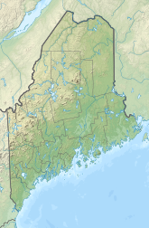 ISS Location of airport in Maine  ISS ISS (the United States) | |||||||||||
| Runways | |||||||||||
| |||||||||||
Wiscasset Municipal Airport (IATA: ISS, ICAO: KIWI, FAA LID: IWI) is a public-use airport located three miles (5 km) southwest of the central business district of Wiscasset, a town in Lincoln County, Maine, United States. This general aviation airport is publicly owned by Town of Wiscasset.[1] As of 2007[update] it is not served by commercial aircraft, though scheduled air service was once available on Downeast Airlines.
Although most U.S. airports use the same three-letter location identifier for the FAA and IATA, Wiscasset Airport is assigned IWI by the FAA and ISS by the IATA. The airport's ICAO identifier is KIWI.[2]
- ^ FAA Airport Form 5010 for IWI PDF
- ^ Great Circle Mapper: ISS / KIWI - Wiscasset, Maine