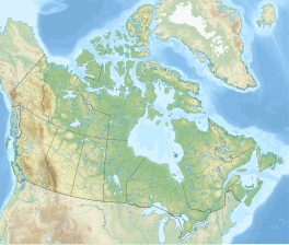
The Wapta Icefield is a series of glaciers located on the Continental Divide in the Waputik Mountains of the Canadian Rockies, in the provinces of British Columbia and Alberta, [1] in Yoho National Park in the Canadian Rockies.[2] The icefield is shared by Banff and Yoho National Parks and numerous outlet glaciers extend from the icefield, including the Vulture, Bow and Peyto Glaciers. Runoff from the icefields and outlet glaciers supply water to both the Kicking Horse and Bow Rivers, as well as numerous streams and lakes.
The icefield is one of the most studied in the Canadian Rockies and all evidence supports the conclusion that the icefield is shrinking in area, especially near the lowest altitudes of its outlet glaciers, including Peyto Glacier, in which the glacier has become both shorter in length and thinner in thickness. In the 1980s the icefield covered an area of approximately 80 km2 (30 sq mi).
The glaciers popular with climbers[3] accessible in both summer and winder. Both ski trips in the winter and glacier hiking trips in the summer often combine a traverse of this icefield with a trip across the Waputik Icefield directly to the south.
The Burgess shale animal Waptia takes its name from these features.[4] Their meltwater feeds the nearby Wapta falls.
^"Unknown". Archived from the original on June 8, 2011. Retrieved 2023-11-18.
^"BCGNIS Query Results".
^"Wapta Icefields Ski Mountaineering/Touring". dowclimbing.com. Archived from the original on 2006-05-20.
^Gould, S.J. (1989). Wonderful Life: The Burgess Shale and the Nature of History. W.W. Norton & Company.[page needed]
The WaptaIcefield is a series of glaciers located on the Continental Divide in the Waputik Mountains of the Canadian Rockies, in the provinces of British...
glaciated areas include the Waputik and WaptaIcefields, which both lie on the Banff-Yoho National Park border. WaptaIcefield covers approximately 80 km2 (31 sq mi)...
traverse of this icefield with a trip across the WaptaIcefield directly to the north. The following glaciers are part of this icefield: Waputik Glacier...
Lake Louise. It can be viewed from the Icefields Parkway. Bow Glacier is an outflow glacier from the WaptaIcefield, which rests along the Continental Divide...
WaptaIcefield to attain the summit of Mount Gordon. Portal Peak flanks one side of Bow Glacier, which in 1897 was considered the portal to the Wapta...
of the WaptaIcefield in Banff National Park. It is the largest, best equipped, and most accessible of the four alpine huts on the WaptaIcefield, and serves...
mountain in Yoho National Park, located on the western boundary of the WaptaIcefield in Canada. The mountain was named in 1897 by Charles S. Thompson after...
Banff, and can be accessed from the Icefields Parkway. Peyto Glacier is an outflow glacier from the WaptaIcefield, which rests along the Continental divide...
: 151 The river's source is from the Bow Glacier, which is part of the WaptaIcefield. The outflow from this source flows into Bow Lake in the Canadian Rockies...
Canadian Rockies in Alberta, Canada. It lies at the north end of the WaptaIcefield, in Banff National Park, about one km (0.6 mi) east of the border with...
The Columbia Icefield is the largest ice field in North America's Rocky Mountains. Located within the Canadian Rocky Mountains astride the Continental...
454921) and Bow (51.634825,-116.489611) are two of four ACC huts on the WaptaIcefield near the Continental Divide, from there water flows to the Pacific,...
is situated east of the WaptaIcefield and west of the Bow River valley. Mount Jimmy Simpson can be seen from the Icefields Parkway at Bow Lake. Jimmy...
National Park, Alberta WaptaIcefield – Banff National Park, Alberta Waputik Icefield – Banff National Park, Alberta Washmanwapta Icefield Yoho Glacier – Yoho...
the Peyto Hut, is an alpine hut located on the northern tip of the WaptaIcefield in Banff National Park. It is nicknamed the Peyto hut due to its proximity...
glacier was once connected to the WaptaIcefield, and in the 1980s and was considered to be part of a smaller icefield of 5 km2 (1.9 mi2). List of glaciers...
explored the Canadian Rockies and in 1897 was the first to set foot on the WaptaIcefield which surrounds Mount Habel. Like other mountains in Banff Park, Mount...
fed by the meltwater of the Daly Glacier, which is part of the Waputik Icefield. The glacier keeps the volume of the falls up during the warm summer months...
 Global Information