"Visaya" redirects here. Not to be confused with Vishaya.
Visayas
Native name:
Kabisay-an (Visayan)
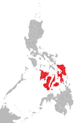
Location of the Visayas within the Philippines
Geography
Location
Southeast Asia
Archipelago
Philippines
Major islands
Bohol
Cebu
Leyte
Negros
Panay
Samar
Area
71,503 km2 (27,607 sq mi)
Highest elevation
2,465 m (8087 ft)
Highest point
Mount Kanlaon
Administration
Philippines
Regions
Region 6 – Western Visayas
Region 7 – Central Visayas
Region 8 – Eastern Visayas
Largest settlement
Cebu City (pop. 964,169)
Demographics
Demonym
Visayan (natively "Bisayâ")
Population
21,155,014 (2021)[1]
Pop. density
292/km2 (756/sq mi)
Ethnic groups
Visayans
Aklanon
Boholano
Butuanon
Capiznon
Cebuano
Cuyunon
Eskaya
Hiligaynon
Karay-a
Masbateño
Porohanon
Romblomanon
Suludnon
Surigaonon
Waray
Negrito (Ati)
other ethnic groups
The Visayas (/vɪˈsaɪəz/viss-EYE-əz), or the Visayan Islands[2] (Visayan: Kabisay-an, locally[kabiˈsajʔan]; Filipino: Kabisayaan[kɐbɪsɐˈjaʔan]), are one of the three principal geographical divisions of the Philippines, along with Luzon and Mindanao. Located in the central part of the archipelago, it consists of several islands, primarily surrounding the Visayan Sea, although the Visayas are also considered the northeast extremity of the entire Sulu Sea.[3] Its inhabitants are predominantly the Visayan peoples.
The major islands of the Visayas are Panay, Negros, Cebu, Bohol, Leyte and Samar.[6] The region may also include the provinces of Palawan, Romblon, and Masbate whose populations identify as Visayan and whose languages are more closely related to other Visayan languages than to the major languages of Luzon.
There are three administrative regions in the Visayas: Western Visayas (pop. 7.9 million), Central Visayas (8 million) and Eastern Visayas (4.5 million).[7] The Negros Island Region existed from 2015 to 2017, separating Negros Occidental and its capital Bacolod from Western Visayas and Negros Oriental from Central Visayas. The region has been dissolved since.
^Census of Population (2015). Highlights of the Philippine Population 2015 Census of Population. Philippine Statistics Authority. Retrieved June 20, 2016.
^C.Michael Hogan. 2011. Sulu Sea. Encyclopedia of Earth. Eds. P.Saundry & C.J.Cleveland. Washington DC
^"Executive Order No. 429". President of the Philippines. Archived from the original on July 7, 2007. Retrieved May 18, 2009.
^"Administrative Order No. 129". President of the Philippines. Archived from the original on July 13, 2009. Retrieved May 18, 2009.
^On May 23, 2005, Palawan and Puerto Princesa City were moved to Western Visayas by Executive Order No. 429.[4] However, on August 19, 2005, President Arroyo issued Administrative Order No. 129 to hold the earlier E.O. 429 in abeyance pending a review.[5] As of 2010[update], Palawan and the highly urbanized city of Puerto Princesa still remain a part of the Mimaropa region.
^"PSA Makati ActiveStats – PSGC Interactive – List of Regions". Philippine Statistics Authority. June 30, 2015. Archived from the original on October 13, 2008. Retrieved September 18, 2015.
administrative regions in the Visayas: Western Visayas (pop. 7.9 million), Central Visayas (8 million) and Eastern Visayas (4.5 million). The Negros Island...
Western Visayas (Hiligaynon: Kabisay-an Nakatundan; Tagalog: Kanlurang Kabisayaan or Kanlurang Visayas) is an administrative region in the Philippines...
Central Visayas (Cebuano: Tunga-tungang Kabisay-an; Tagalog: Gitnang Kabisayaan or Gitnang Visayas) is an administrative region in the Philippines, numerically...
The National Museum (NM) Western Visayas Regional Museum, simply known as the National Museum Western Visayas, is a museum in Iloilo City, Philippines...
Philippines Visayas (UPV or UP Visayas) is a public research university in the Philippines with campuses and facilities throughout the Visayas. A constituent...
spoken by 20 million people as a native language in Central Visayas, parts of Eastern Visayas, and most of Mindanao. Two other well-known and widespread...
Eastern Visayas, with an economy largely focused on agriculture, commerce, and tourism. Proximal to the city proper is the 237-hectare Eastern Visayas Agri-Industrial...
technician institutes/projects of the National Government. TUP Visayas was then known as the Visayas Technician Institute (VTI). In 1978, the Philippine College...
the Visayas, and Mindanao. Luzon and Mindanao archipelagoes are both named after the largest island in their respective groups, while the Visayas (also...
Visayas State University (VSU; Filipino: Pambansang Pamantasan ng Visayas; Baybayin:ᜉᜋ᜔ᜊᜈ᜔ᜐᜅ᜔ ᜉᜋᜈ᜔ᜆᜐᜈ᜔ ᜈᜅ᜔ ᜊᜒᜐᜌᜐ᜔) is a university located in the city...
2019. Media related to University of the Visayas at Wikimedia Commons Official website University of the Visayas on Facebook uvgullasmedicalcollege.com...
State of the Visayas (Spanish: Estado Federal de Visayas, Hiligaynon: Pederal nga Estado sang Visayas, Filipino: Pederal na Estado ng Visayas) was a revolutionary...
under the administrative supervision of University of the Philippines Visayas. A new campus will be constructed in Barangay Santa Elena in Tacloban City...
Cambridge: Cambridge University Press. "Western Visayas: Eight Percent of the Total Population Were From Western Visayas (Results from the 2000 Census of Population...
raids of Visayas took place in 1599 and 1600. The allied Moro fleets of Mindanao and Sulu conducted two raids on the Spanish-held islands of Visayas. After...
in the nation and the most populous in the Visayas. It also serves as the regional center of Central Visayas, and its metropolitan area exerts influence...
National Shrine in the Visayas and Mindanao (first in Western Visayas and second Marian dedicated church to do so in Visayas and Mindanao), Jaro Metropolitan...
The Battle of Visayas (Filipino: Labanan sa Visayas; Visayan languages: Gubat sa Kabisay-an) was fought by U.S. forces and Filipino guerrillas against...
The Visayas Command (abbrv. as VISCOM) is the Armed Forces of the Philippines' unified command in charge of all the visayas islands. It is responsible...
census, it is the most populous city in Western Visayas and the second most populous city in the entire Visayas after Cebu City. It is the center of the Bacolod...
It affected the whole Central Visayas region, particularly Bohol and Cebu. The earthquake was felt in the whole Visayas area and as far as Masbate island...
This is a list of potentially active volcanoes in the Philippines, as classified by the Philippine Institute of Volcanology and Seismology. Map all coordinates...
July 2017. Faicol, Bea. "What's the Difference Between Luzon Lechon and Visayas Lechon?". Eat + Drink. Spot.ph. Retrieved 25 January 2019. sparksph (2...
higher learning in Bohol, Philippines. It was formerly called the Central Visayas State College of Agriculture, Forestry and Technology (CVSCAFT). The institution...
University. Retrieved May 19, 2021. West Visayas State University (March 22, 2017). "College of Education". West Visayas State University. Retrieved May 19...
The Eastern Visayas Medical Center (EVMC) is a tertiary level teaching and training government hospital in the Philippines. On June 18, 1966, the then...
the Bicol Region and Eastern Visayas. The PAGASA would later upgrade warnings for the Bicol Region and Eastern Visayas to Signal 2 warnings. PAGASA also...
 Global Information