 Global Information
Vakunayka information
| Vakunayka Вакунайка | |
|---|---|
 Confluence of the Chona and the Vakunayka Sentinel-2 image | |
 Mouth location in Yakutia, Russia 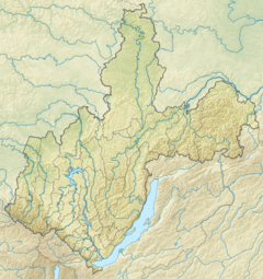 Vakunayka (Irkutsk Oblast) | |
| Location | |
| Country | Katangsky District, Irkutsk Oblast Mirninsky District, Yakutia |
| Physical characteristics | |
| Source | |
| • location | Central Siberian Plateau |
| • coordinates | 60°40′08″N 110°05′04″E / 60.66889°N 110.08444°E |
| Mouth | Chona |
• coordinates | 61°44′22″N 109°36′25″E / 61.73944°N 109.60694°E |
| Length | 362 km (225 mi) |
| Basin size | 10,100 km2 (3,900 sq mi) |
| Basin features | |
| Progression | Chona → Vilyuy→ Lena→ Laptev Sea |
The Vakunayka (Russian: Вакунайка; Yakut: Вакунайка) is a river in the Sakha Republic (Yakutia) and Irkutsk Oblast, Russia. It is a right hand tributary of the Chona, and is 363 kilometres (226 mi) long, with a drainage basin of 10,100 square kilometres (3,900 sq mi).[1]
There are no permanent settlements by the Vakunayka. The Russian Geographical Society organized an expedition in 1853–55 to survey the orography, geology and population of the Vilyuy and Chona basins.[2]
- ^ "Река Вакунайка in the State Water Register of Russia". textual.ru (in Russian).
- ^ Great Soviet Encyclopedia Richard Maack. Materials provided by the project Rubrikon.