 Global Information
Upper Tamakoshi Hydroelectric Project information
| Upper Tamakoshi Hydroelectric Project | |
|---|---|
 Upper Tamakoshi diversion dam | |
 Location of Upper Tamakoshi Hydroelectric Project in Bagmati Province 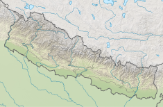 Upper Tamakoshi Hydroelectric Project (Nepal) | |
| Country | Nepal |
| Location | Gaurishankar Conservation Area, Dolakha District |
| Coordinates | 27°50′38″N 86°13′05″E / 27.844°N 86.218°E |
| Purpose | Hydroelectricity |
| Status | Operational |
| Construction began | 2011 |
| Opening date | 2021 |
| Owner(s) | Upper Tamakoshi Hydropower Limited |
| Dam and spillways | |
| Type of dam | Run-of-river |
| Impounds | Tamakoshi River |
| Height | 22 m |
| Length | 60 m |
| Coordinates | 27°55′30″N 86°12′47″E / 27.925°N 86.213°E |
| Type | Underground 142 m long hall |
| Hydraulic head | 822 m |
| Turbines | 6×Pelton wheels |
| Installed capacity | 456 MW @ maximum flow 66 m3/s |
| Annual generation | 2,281 GWh |
| Website tamakoshihydro | |
The Upper Tamakoshi Hydroelectric Project is a 456 MW peaking run-of-the-river hydroelectric project in Nepal.[1] It is the largest hydroelectric project in Nepal, operating since July 2021.[2][3] It is sited on the Tamakoshi River (also spelled Tama Koshi), a tributary of the Sapt Koshi river (also spelled Saptakoshi), near the Nepal–Tibet border.
The Upper Tamakoshi Hydroelectric Project was a Nepal national priority project. When it is operated at full capacity, it is the largest hydroelectric plant in Nepal, with a power output equivalent to two-thirds of Nepal's current power generation.[4][5] The project was entirely financed from domestic financial institutions and companies.
- ^ "Salient Features". utkhpl.org.np. Retrieved 2017-02-27.
- ^ Republica. "Much-awaited Upper Tamakoshi Hydro Project formally starts production from Monday". My Republica. Retrieved 2021-07-05.
- ^ "Upper Tamakoshi project makes progress on penstock installation". The Kathmandu Post. 11 October 2019.
- ^ Cite error: The named reference
hydroworld2015was invoked but never defined (see the help page). - ^ Cite error: The named reference
kpost2013was invoked but never defined (see the help page).