 Global Information
Tyoplaya Gora information
This article needs additional citations for verification. (November 2017) |
This article needs to be updated. (November 2017) |
Tyoplaya Gora
Тёплая Гора | |
|---|---|
Urban-type settlement | |
Location of Tyoplaya Gora  | |
 Tyoplaya Gora Location of Tyoplaya Gora 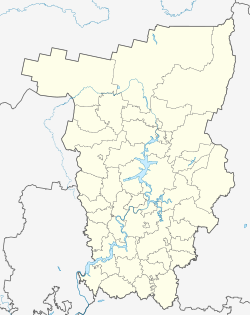 Tyoplaya Gora Tyoplaya Gora (Perm Krai) | |
| Coordinates: 58°31′N 59°04′E / 58.517°N 59.067°E | |
| Country | Russia |
| Federal subject | Perm Krai |
| Administrative district | Gornozavodsky District |
| Founded | 1880 |
| Urban-type settlement status since | 1928 |
| Population (2010 Census)[1] | |
| • Total | 3,306 |
| Time zone | UTC+5 (MSK+2 |
| Postal code(s)[3] | 618870 |
| OKTMO ID | 57614406051 |
Preview warning: Page using Template:Infobox Russian inhabited locality with unknown parameter "date"
Tyoplaya Gora (Russian: Тёплая Гора́) is an urban locality (an urban-type settlement) in Gornozavodsky District of Perm Krai, Russia, located on the western slopes of the Ural Mountains, on the Koyva River, 14 kilometers (8.7 mi) from the border with Sverdlovsk Oblast. Population: 3,306 (2010 Russian census);[1] 3,860 (2002 Census);[4] 4,558 (1989 Soviet census).[5]
- ^ a b Russian Federal State Statistics Service (2011). Всероссийская перепись населения 2010 года. Том 1 [2010 All-Russian Population Census, vol. 1]. Всероссийская перепись населения 2010 года [2010 All-Russia Population Census] (in Russian). Federal State Statistics Service.
- ^ "Об исчислении времени". Официальный интернет-портал правовой информации (in Russian). June 3, 2011. Retrieved January 19, 2019.
- ^ Почта России. Информационно-вычислительный центр ОАСУ РПО. (Russian Post). Поиск объектов почтовой связи (Postal Objects Search) (in Russian)
- ^ Federal State Statistics Service (May 21, 2004). Численность населения России, субъектов Российской Федерации в составе федеральных округов, районов, городских поселений, сельских населённых пунктов – районных центров и сельских населённых пунктов с населением 3 тысячи и более человек [Population of Russia, Its Federal Districts, Federal Subjects, Districts, Urban Localities, Rural Localities—Administrative Centers, and Rural Localities with Population of Over 3,000] (XLS). Всероссийская перепись населения 2002 года [All-Russia Population Census of 2002] (in Russian).
- ^ Всесоюзная перепись населения 1989 г. Численность наличного населения союзных и автономных республик, автономных областей и округов, краёв, областей, районов, городских поселений и сёл-райцентров [All Union Population Census of 1989: Present Population of Union and Autonomous Republics, Autonomous Oblasts and Okrugs, Krais, Oblasts, Districts, Urban Settlements, and Villages Serving as District Administrative Centers]. Всесоюзная перепись населения 1989 года [All-Union Population Census of 1989] (in Russian). Институт демографии Национального исследовательского университета: Высшая школа экономики [Institute of Demography at the National Research University: Higher School of Economics]. 1989 – via Demoscope Weekly.